
Oruro or Uru Uru is a city in Bolivia with a population of 264,683, about halfway between La Paz and Sucre in the Altiplano, approximately 3,709 meters (12,169 ft) above sea level.

Tapacarí is a province in the Cochabamba Department, Bolivia. Its capital is Tapacarí. The province is located at a turnoff from the major highway that links Cochabamba and Oruro. It has traditionally been amongst the poorest in the department. Tapacarí Province and neighboring Arque Province are the two poorest of the 16 provinces that make up the department of Cochabamba.

Omasuyos or Uma Suyu is a province in the La Paz Department in Bolivia. Its capital is Achacachi.

Cercado is a province in the northeastern parts of the Bolivian department of Oruro. Its capital is Oruro. The hamlet of Paria, established in 1535, was the first Spanish settlement in Bolivia and previously had been a regional capital of the Inca Empire. Paria is located in Soracachi municipality.

Calacoto or Qalaqutu is a neighborhood in La Paz Municipality, Bolivia. It is located in the southern part of the city and is considered one of the largest residential zones due to the cost of the houses and the services available. The population in this neighborhood has a medium to high income level. The zone is located about 15 kilometers from downtown. Calacoto is located in the central zone of the Zona Sur which is considered the biggest residential area in the country along with Santa Cruz De La Sierra’s Equipetrol and Cochabamba’s Cala Cala.

Jach'a Waracha is a mountain in the Apolobamba mountain range in Bolivia, at 5,540 metres (18,176 ft) high. It is situated in the La Paz Department, Franz Tamayo Province, Pelechuco Municipality. Jach'a Waracha lies west of the mountain Waracha and north-west of the mountain Qala Phusa.

Calamarca or Qala Marka is the fourth municipal section of Aroma Province in the La Paz Department of Bolivia. It is located on the Altiplano and its seat is the town of Calamarca.
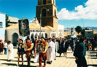
Calamarca or Qala Marka is a town in the La Paz Department in Bolivia. It is the seat of Calamarca Municipality, the fourth municipal section of Aroma Province. It lies on the Altiplano on the east side of the main road between La Paz and Patacamaya, about 60 km south of La Paz.
Cala Cala or Qala Qala is a small town in Bolivia. In 2010 it had an estimated population of 2,073. it is known for the historic rock paintings.
Machacamarca is a small town in the Pantaléon Dalence Province in the Oruro Department in Bolivia. It is the seat of the Machacamarca Municipality and of the Machacamarca Canton. At the time of census 2001 it had a population of 2,206. The town is situated south of Oruro near the south-eastern shore of Lake Uru Uru at the road and railway that lead to Poopó.
Villa Rosario de Wilacala is a village in the La Paz Department in Bolivia. It is the seat of the Villa Rosario de Wila Khala Canton, one of the five cantons of the Mocomoco Municipality which is the second municipal section of the Eliodoro Camacho Province. The village is situated 4,264 m high at the north-western edge of the Muñecas Mountain Range (Cordillera Muñecas) near the border to Peru. At the time of census 2001 it had a population of 303.

K'isi K'isini is a 5,536-metre-high (18,163 ft) mountain in the Cordillera Occidental in the Andes of Bolivia. It is located in the Oruro Department, Sajama Province, Curahuara de Carangas Municipality, Sajama Canton. K'isi K'isini is situated inside the boundaries of the Sajama National Park, south-east of the Parina Quta and Pomerape volcanoes and north of the Bolivian route 4 that leads to the Chungara–Tambo Quemado mountain pass on the border with Chile.

Machu Such'i Qhuchi or Machu Such'i Q'uchi is a mountain in the Apolobamba mountain range in the Bolivian Andes, about 5,679 metres (18,632 ft) high. It is situated near the Peruvian border in the La Paz Department, Franz Tamayo Province, Pelechuco Municipality, east of Such'i Lake.
Kimsa Chata is a 5,245-metre-high (17,208 ft) mountain in the Andes of Bolivia. It is located in the Oruro Department, Sabaya Province, Sabaya Municipality, Negrillos Canton. It lies south-east of the mountain Qillwiri, east of Lliscaya, north-east of Taypi Qullu and north-west of the Laram Pukara, near the border with Chile.
Jach'a Ch'ankha is a 4,345-metre-high (14,255 ft) mountain in the Andes in Bolivia. It is located in the Oruro Department, Cercado Province, Paria Municipality, 16 km east of Oruro. Jach'a Ch'ankha lies near the villages of Paya Payani in the northeast, Qala Qala in the south and Irsuma in the southwest.
Chullpa Chullpani is a 4,878-metre-high (16,004 ft) mountain in the Andes of Bolivia. It is located in the Oruro Department, Challapata Province, Challapata Municipality, east of Challapata. Chullpa Chullpani lies southwest of Wila Willk'i. It is situated at the Qala Jawira, an affluent of the Crucero River.
Wila Willk'i is a 4,818-metre-high (15,807 ft) mountain in the Andes of Bolivia. It is located in the Oruro Department, Challapata Province, Challapata Municipality. Wila Willk'i lies northeast of Chullpa Chullpani. It is north of the Qala Jawira, an affluent of the Crucero River.
Chachakumani is a 4,712-metre-high (15,459 ft) mountain in the Cordillera Occidental in the Andes of Bolivia. It is situated in the Oruro Department, Sajama Province, in the west of the Turco Municipality. Chachakumani lies south of Muru Qullu, northeast of Umurata and Kuntur Ikiña and southeast of Uqi Uqini. The Jaruma River flows between Muru Qullu and Chachakumani. It is a tributary of the Sajama River.
Qala P'axrani is a 4,262-metre-high (13,983 ft) mountain in the Chilla-Kimsa Chata mountain range in the Andes of Bolivia. It lies in the La Paz Department, Los Andes Province, Laja Municipality. Qala P'axrani is situated south-west of Pukara (Pucara), north-west of the mountain Kunkani. The river Ch'amaka Jawira originates near the mountain. It flows to the north as a left tributary of Wakira River.
