
Coroico is a town in Nor Yungas Province, in the La Paz Department of western Bolivia.
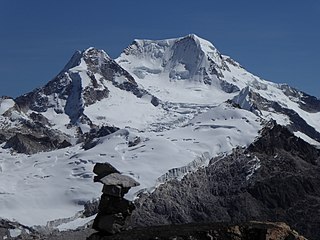
Chachacomani is a mountain in the Cordillera Real of the Andes Mountains, east of Lake Titicaca in Bolivia.

Chearoco, Chiaraco or Chiaroco is a mountain in the Cordillera Real in the Andes of Bolivia. It has a height of about 6,127 m (20,102 ft). It is situated in the La Paz Department, Larecaja Province, Guanay Municipality, southeast of the peak of Aman Pata. Chearoco lies between Qalsata in the northwest and Chachakumani in the southeast.

Yanacachi Municipality is the third municipal section of the Sud Yungas Province in the La Paz Department, Bolivia. Its seat is Yanacachi.

Sirk'i Qullu is a mountain in the Cordillera Real in the Andes of Bolivia, about 5,546 m (18,196 ft) high. It is located in the La Paz Department, at the border of the Pedro Domingo Murillo Province, La Paz Municipality, and the Sud Yungas Province, Yanacachi Municipality. Sirk'i Qullu lies north-east of the city of La Paz, north of the mountain Jathi Qullu and south of the mountains Wak'ani and Mik'aya.
Q'asiri is a mountain in the Cordillera Real in the Andes of Bolivia, about 5,828 m (19,121 ft) high. It is located in the La Paz Department, Larecaja Province, Sorata Municipality. It is situated south-east of the mountain Janq'u Uma, north-west of the mountains Qalsata and Ch'iyar Juqhu and north-east of San Francisco Lake.
Sura Qullu is a 4,752-metre-high (15,591 ft) mountain in the Cordillera Real in the Bolivian Andes. It is situated in the La Paz Department, Sud Yungas Province, Yanacachi Municipality, north-east of the city of La Paz. Sura Qullu lies between the mountain Jathi Qullu in the north-west and the lake Warawarani in the south-east.
Wanakuni is a 4,944-metre-high (16,220 ft) mountain in the Cordillera Real in the Bolivian Andes. It is situated in the La Paz Department, Sud Yungas Province, Yanacachi Municipality, northeast of the city of La Paz. Wanakuni lies at a lake named Warawarani, southeast of Sura Qullu.
Jathi Qullu is a mountain in the Cordillera Real in the Bolivian Andes, about 5,421 metres (17,785 ft) high. It is situated in the Yanacachi Municipality, north-east of the city of La Paz. Jathi Qullu lies south of the mountain Sirk'i Qullu, north-west of Sura Qullu, east of Qutapata and north of Q'asiri.
Pirqata is a mountain in the Cordillera Real in the Bolivian Andes. It is situated in the La Paz Department, Sud Yungas Province, Yanacachi Municipality. Pirqata lies north-east of the mountains Jathi Qullu and Sura Qullu and east of Sirk'i Qullu.
Pirqa Pata is a mountain in the Bolivian Andes which reaches a height of approxilamtely 4,060 m (13,320 ft). It is situated in the La Paz Department, Sud Yungas Province, Yanacachi Municipality. Pirqa Pata lies east of the main range of the Cordillera Real, north of Mururata and southeast of Sirk'i Qullu and Pirqata.
Wak'ani is a mountain in the Cordillera Real in the Andes of Bolivia, 5,321 metres (17,457 ft) high. It is located in the La Paz Department at the border of the Pedro Domingo Murillo Province, La Paz Municipality, and the Sud Yungas Province, Yanacachi Municipality. Wak'ani lies north-east of the city of La Paz, north to north-west of the mountains Jathi Qullu, Sirk'i Qullu and Mik'aya.
Mik'aya is a 5,342-metre-high (17,526 ft) mountain in the Cordillera Real in the Andes of Bolivia. It is located in the La Paz Department at the border of the Pedro Domingo Murillo Province, La Paz Municipality, and the Sud Yungas Province, Yanacachi Municipality. Mik'aya lies north-east of the city of La Paz, south-east of the mountains Ch'uñawi and Wak'ani and north of the mountains Jathi Qullu and Sirk'i Qullu.
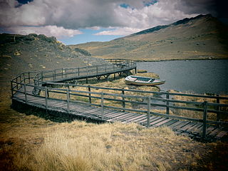
Laram Quta is a lake in the Cordillera Real in the Andes of Bolivia. It is situated in the La Paz Department, Pedro Domingo Murillo Province, La Paz Municipality, La Paz Canton. It lies south-west of the lake Pata Larama. The wetlands of this area are also known as Pampa Larama (Pampalarama, Pamparalama). This is where the Qaluyu River (Kaluyo) originates which downstream is called Achachi Qala and Choqueyapu River.
Qutapata is a 5,288-metre-high (17,349 ft) mountain in the Cordillera Real in the Bolivian Andes. It is situated in the La Paz Department, Murillo Province, La Paz Municipality, near the border with the Sud Yungas Province, Yanacachi Municipality. Qutapata lies south-west of the mountain Sirk'i Qullu, west of the mountain Jathi Qullu and south of the lake Sirk'i Quta.
Ch'uxña Quta is a lake in the La Paz Department in Bolivia. It is situated in the Murillo Province, Palca Municipality. Ch'uxña Quta lies northeast of the mountain Tata Ch'iyar Qullu.
Jach'a Quta is a lake in Bolivia located in the La Paz Department, Sud Yungas Province, Yanacachi Municipality, north-west of the mountain Mururata. It lies south-east of the mountain Wanakuni and the lakes Warawarani and Jisk'a Warawarani at the mountain Thakis Uma. One of the smaller lakes near Jach'a Quta is named Jisk'a Quta. It is situated north-east of Jach'a Quta.
The Llallawa Jawira which upstream successively is named Patu Uma, Ch'alla Jawira, Jach'a Qura, Lupipi and Chuqi Phuju is a river in the La Paz Department in Bolivia. It is a left tributary of the Desaguadero River.
Sura Surani is a mountain in the Bolivian Andes which reaches a height of approximately 4,840 m (15,880 ft). It is situated in the La Paz Department, Sud Yungas Province, Yanacachi Municipality. Sura Surani lies northeast of Mik'aya.
Turini is a mountain in the Bolivian Andes which reaches a height of approxilamtely 3,800 m (12,500 ft). It is situated in the La Paz Department, Sud Yungas Province, Yanacachi Municipality, south of Unduavi.
