Andijan is a city in Uzbekistan. It is the administrative, economic, and cultural center of Andijan Region. Andijan is a district-level city with an area of 74 km2 (29 sq mi) and it had 458,400 inhabitants in 2022. Andijan is located in the south-eastern edge of the Fergana Valley near Uzbekistan's border with Kyrgyzstan.

Osh is the second-largest city in Kyrgyzstan, located in the Fergana Valley in the south of the country and often referred to as the "capital of the south". It is the oldest city in the country and has served as the administrative center of Osh Region since 1939. The city has an ethnically mixed population of 322,164 in 2021, comprising Uzbeks, Kyrgyz, Russians, Tajiks, and other smaller ethnic groups. It is about 5 km from the Uzbekistan border.

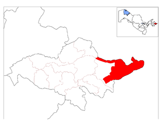
Osh Region is a region (oblast) of Kyrgyzstan. Its capital is Osh, which is not part of the region. It is bounded by (clockwise) Jalal-Abad Region, Naryn Region, China (Xinjiang), Tajikistan, Batken Region, and Uzbekistan. Its total area is 28,934 km2 (11,171 sq mi). The resident population of the region was 1,391,649 as of January 2021. The region has a sizeable Uzbek minority.

Qorasuv is a city in Qoʻrgʻontepa District of Andijan Region in eastern Uzbekistan, about 50 km from the district capital of Andijan. The town's name means "black water" in Uzbek. It lies in the politically volatile and religiously conservative Fergana Valley, along the border with Kyrgyzstan. In 1989 it had a population of 19,500.

Andijan Region is a region of Uzbekistan, located in the eastern part of the Fergana Valley in far eastern Uzbekistan. It borders with Kyrgyzstan, Fergana Region and Namangan Region. It covers an area of 4,300 km2. The population is estimated to be around 3,253,528 (2022) thus making Andijan Region the most densely populated region of Uzbekistan.
Namangan is a city in eastern Uzbekistan. It is the administrative, economic, and cultural center of Namangan Region. Administratively, it is a district-level city. Namangan is located in the northern edge of the Fergana Valley, less than 30 km from the Kyrgyzstan border. The city is served by Namangan Airport.
Asaka is a city and the administrative center of Asaka District in eastern Uzbekistan, located in the southeastern edge of the Fergana Valley near Uzbekistan's border with Kyrgyzstan.
Chust is a city in eastern Uzbekistan. It is the administrative center of Chust District. The City of Chust is located in the northern corner of the Fergana Valley along the river Chustsoy.
Gurlan is a town and seat of Gurlan District in Xorazm Region in Uzbekistan. It is located near the border with Turkmenistan in western Uzbekistan, 42 kilometres (26 mi) north-west of Urgench, north of Shovot, and south of the Amu Darya river. Gurlen is a major centre for cotton production, and rice and yams are also significant other crops.
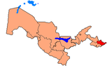
Qoʻrgʻontepa District is a district of Andijan Region, Uzbekistan. The capital of the district is the city Qoʻrgʻontepa. The district was established on September 29, 1926. It has an area of 460 km2 (180 sq mi) and it had 222,100 inhabitants in 2022.

Oltinkoʻl District is a district of Andijan Region, Uzbekistan. The seat of the district is the village Oltinkoʻl. The district was established on June 26, 1939. It has an area of 210 km2 (81 sq mi) and it had 184,700 inhabitants in 2022.
Uchqoʻrgʻon is a city and seat of Uchqoʻrgʻon District in Namangan Region in eastern Uzbekistan. In 1989 it had a population of 23,772.

Shahrixon District is a tuman (district) of Andijan Region in Uzbekistan. The capital lies at the city Shahrixon. It has an area of 290 km2 (110 sq mi) and it had 310,000 inhabitants in 2022.
Paxtakor is a city in Jizzakh Region, Uzbekistan. It is the capital of Paxtakor District. In 1989, it had a population of 15,366, and had an estimated population of 21,384 in 2011. In 1974 Paxtakor was granted city status. The city has a cotton-cleaning factory.
Kuyganyor is an urban-type settlement in Andijan Region, Uzbekistan. It is the administrative center of Andijan District. The town population in 1989 was 8,426 people.
Poytugʻ or Paytug is a city in Andijan Region, Uzbekistan. It is the administrative center of Izboskan District. The town population in 1989 was 19,389 people.
Jalaquduq is a city in Andijan Region, Uzbekistan. It is the administrative center of Jalaquduq District. The town population in 1989 was 11043.
Paxtaobod is a city in Andijan Region, Uzbekistan. It is the administrative center of Paxtaobod District. The town population in 1989 was 18,991 people.
Dardoq is a village and a rural community in Qoʻrgʻontepa District, in Andijan Region in eastern Uzbekistan. It is situated near the confluence of the rivers Kögart and Kara Darya, 6 km south of Dostuk (Kyrgyzstan), 12 km west of Xonobod and 32 km north of Osh (Kyrgyzstan). In 2015 it had a population of 26,055.
Sultonobod is an urban-type settlement in Andijan Region, Uzbekistan. It is part of Qoʻrgʻontepa District. The town population in 2015 was 16,450 people.