
State College Regional Airport, is a public airport in Benner Township, Centre County, Pennsylvania, serving State College and Bellefonte. The airport covers 1,105 acres and has one active runway.
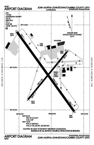
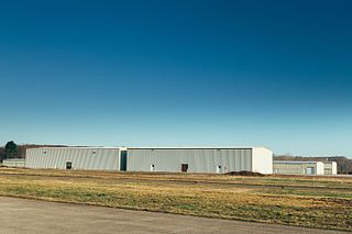
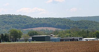
John Murtha Johnstown–Cambria County Airport is a civil-military airport three miles (5 km) northeast of Johnstown, in Cambria County, Pennsylvania. It is owned by Johnstown–Cambria County Airport Authority and is named after the late Congressman John Murtha. It sees one airline, subsidized by the Essential Air Service.
Rostraver Airport is a public use airport in Westmoreland County, Pennsylvania, United States.

Central Jersey Regional Airport is a privately owned, public use airport in Somerset County, New Jersey, United States. The airport is one nautical mile (2 km) south of the central business district of Manville. It is located in Hillsborough Township and was formerly known as Kupper Airport. This facility is included in the National Plan of Integrated Airport Systems for 2011–2015, which categorized it as a general aviation reliever airport.
Anoka County–Blaine Airport, also known as Janes Field, is a public use airport in Anoka County, Minnesota, United States. Owned by Metropolitan Airports Commission, it is 10 nautical miles (19 km) north of the central business district of Minneapolis. The airport is located in the city of Blaine.

York Airport (York Aviation) (IATA: THV, ICAO: KTHV, FAA LID: THV) is a privately owned, public use airport that is located seven nautical miles (8 mi, 13 km) southwest of the central business district of York in the Thomasville section of Jackson Township, York County, Pennsylvania, United States.
Danielson Airport is a state-owned public-use airport located two nautical miles (4 km) northwest of the central business district of Danielson, a borough in the town of Killingly in Windham County, Connecticut, United States. The smallest airport in the state, it is included in the Federal Aviation Administration (FAA) National Plan of Integrated Airport Systems for 2017–2021, in which it is categorized as a local general aviation facility.

Stanly County Airport is a county-owned, joint civil-military, public-use airport in Stanly County, North Carolina, United States. It is located four nautical miles northeast of the central business district of Albemarle, North Carolina. This airport is included in the National Plan of Integrated Airport Systems for 2011–2015, which categorized it as a general aviation facility.

Mifflin County Airport is a public airport in Mifflin County, Pennsylvania. It is in Reedsville, five miles northwest of Lewistown. It is owned by the Mifflin County Airport Authority. The FAA's National Plan of Integrated Airport Systems for 2009-2013 called it a general aviation airport.
Oswego County Airport is a county-owned, public-use airport three nautical miles (6 km) northeast of the central business district of Fulton, in Oswego County, New York, United States. The airport is located in Volney, New York. It has been designated by the Federal Aviation Administration as a general aviation reliever airport for Syracuse Hancock International Airport, located 25 miles (40 km) to the southeast.

Doylestown Airport is a public airport in Bucks County, Pennsylvania, owned by the Bucks County Airport Authority (BCAA). It is two nautical miles north of Doylestown, Pennsylvania and has a single fixed-base operator, Leading Edge Aviation, Civil Air Patrol squadron 907, flight training, and aircraft rentals.
Perkiomen Valley Airport is formerly a privately owned, public use airport located two nautical miles (4 km) northeast of the central business district of Collegeville, a borough in Montgomery County, Pennsylvania, United States. The airport was built by Wells MacCormack and opened on March 1, 1938. It closed in March of 2021. It was included in the National Plan of Integrated Airport Systems for 2009–2013, which categorized it as a general aviation facility.
Heritage Field is a public use airport in Montgomery County, Pennsylvania, United States. It is located three nautical miles (6 km) east of Pottstown, in Limerick Township. The airport is privately owned by Limerick Aviation LP.

Indianapolis Executive Airport is a public airport at 11329 E. State Road 32, five miles north of Zionsville, in Boone County, Indiana, United States. The airport is owned by the Hamilton County Airport Authority. It is 14 miles (23 km) northwest of downtown Indianapolis and is a reliever airport for Indianapolis International Airport. In 2020, the airport was categorized as a "National" airport in the National Plan of Integrated Airport Systems.
Pittsburgh Northeast Airport is a privately owned, public use airport in Allegheny County, Pennsylvania, United States. The airport is located 12 nautical miles north-northeast of the central business district of Pittsburgh, in West Deer Township. The airport is located a few miles north of Pittsburgh Mills shopping mall.
Zelienople Municipal Airport is a public airport in Beaver County, Pennsylvania, a mile west of Zelienople, a borough in Butler County, Pennsylvania, in the Pittsburgh metropolitan area. The airport is owned by the Borough of Zelienople and operated by the Zelienople Municipal Authority. The National Plan of Integrated Airport Systems for 2011–2015 categorized it as a general aviation facility.
New Castle Municipal Airport is a small municipal airport located in Union Township, Lawrence County, Pennsylvania serving Lawrence County, Pennsylvania, part of the Pittsburgh metropolitan area. Union Township is an outskirt of New Castle, Pennsylvania hence the name. The airport is located four nautical miles northwest of the central business district of New Castle. The airport is a public-owned airport and is controlled by the Lawrence County Airport Authority.

Richard B. Russell Airport is a county-owned public-use airport in Floyd County, Georgia, United States. The airport is located six nautical miles (11 km) north of the central business district of Rome, Georgia. It is also known as Richard B. Russell Regional Airport.

Pocono Mountains Regional Airport is a public airport two miles northwest of Mount Pocono, in Coolbaugh Township, Monroe County, Pennsylvania. It is owned by the Pocono Mountains Regional Airport Authority. The National Plan of Integrated Airport Systems for 2011–2015 categorized it as a general aviation facility.
Penn Valley Airport is a public airport a mile north of Selinsgrove, a borough in Snyder County, Pennsylvania. It is owned by the Penn Valley Airport Authority. The National Plan of Integrated Airport Systems for 2011–2015 categorized it as a general aviation facility.

