Garhwa is a town and a municipality in, and headquarters of, Garhwa district in the state of Jharkhand, India. Uttar Pradesh, Chhattisgarh and Bihar are nearby states. Garhwa Road (Rehla) is a major Railway Junction where thousands of passengers find this station most convenient to catch their train for Delhi and Kolkata. You can find bus services for Ranchi, Ambikapur, Gaya etc.
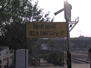
Delhi Cantonment is a Class I Cantonment Board established in 1914. The area of the Cantonment is 10,452 acres (42.30 km2) and the population of the Cantonment as per the 2011 census is 110,351.

Malkajgiri also known as Mallikarjuna Giri is a suburb of Hyderabad, Telangana, India. It is located in Medchal–Malkajgiri district and also Sub-District in Medchal District is the headquarters of Malkajgiri mandal in Malkajgiri revenue division. Erstwhile Malkajgiri Major Grampanchayat was upgraded to a municipality in 1965 and became a municipal corporation in 1985. It was merged into the Greater Hyderabad Municipal Corporation in 2007. It was a part of Ranga Reddy district before the re-organisation of districts in 2016.

Bahadurgarh is a city and municipal council, nearby Jhajjar City, is located in Jhajjar district in the Indian state of Haryana. The city comprises 31 wards and is approximately 21 km from National Capital Territory (NCT) of Delhi and 31 km from Jhajjar, the district headquarter. It is one of the major cities of Haryana and is surrounded by the major NCR cities of Faridabad, Gurugram and Sonipat.

Dadri is a town and a municipal board in Gautam Buddha Nagar District in the state of Uttar Pradesh, India. Dadri Railway Station is a complex yard in North Central Railway spread over six kilometers on busiest route of Delhi–Kanpur–Patna–Howrah section of Indian Railways and also having connectivity with National Thermal Power Corporation and Container Depot.
Nautanwa is a town and Nagar Palika in Maharajganj district in the state of Uttar Pradesh, India. It is about 87 km from Gorakhpur, NH24 and 68 km NH730 from Maharajganj and 7 km from Sonauli Indo-Nepal Border.
Pharenda, or Anandnagar, is a city in the Maharajganj district of the province of Uttar Pradesh in northern India. It is located approximately 44 kilometres north of Gorakhpur near the border with Nepal. District of Pharenda is Maharajganj. This is situated on the Buddhist Circuit which is built from Sarnath to Lumbini. It lies on NH-24 and near NH 29. It is about 45 km from Gorakhpur, 40 km from Siddharthnagar, 30 km from Maharajganj and 55 km from Sonauli Indo-Nepal Border. This place is named after Seth Anandram Jaypuriya. There is closed sugar Mill which was started in about 1935 and closed in 1995. Near Anand Nagar there is a temple is Durga devi mandir, popularly known as Lehara Devi mandir.
Kot Fatta is a city and a municipal council in Bathinda district in the Indian state of Punjab.
Laksar is a small town, near Haridwar city and Nagar Palika in Haridwar district of the Indian state of Uttarakhand, situated along National Highway 334A. It is an important sugar manufacturing destination in the state and also known for the Laksar Junction railway station (LRJ), the largest railway junction in the state, which was built in 1866.
Mundka is a census town and village in the West Delhi district of Delhi. It is the birthplace and village of former Chief Minister of Delhi, the late Dr. Sahib Singh Verma. Its neighbouring villages are Bakkarwala and Nangloi. The current MLA of the Mundka constituency is Dharampal Lakra, a member of the Aam Aadmi Party (AAP).
Nangloi Jat or popularly known as "Nangloi" is a locality in West district in the Union Territory of Delhi in India, surrounded by Paschim Vihar, Delhi Outer Ring road, Najafgarh
Narasimhanaickenpalayam is a part of Coimbatore city. It is about 14 km from Coimbatore city junction in the northern direction. Narasimhanaickenpalayam is on the stretch of National Highway NH 67 Extn (NH-181) Mettupalayam Road, one of the arterial roads of Coimbatore city. Neighbouring places are Thudiyalur, NGGO Colony, and Periyanaickenpalayam
Noorpur is a City and a Municipal Board in Bijnor District in the Indian State of Uttar Pradesh.
Pul Pehladpur is a census town in South East Delhi district of Delhi, India.
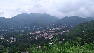
Sundar Nagar is a town and a municipal council in Mandi district in the Indian state of Himachal Pradesh. Formerly it was a princely state, known as Suket.
Islampur is a city and Notified area in Nalanda district in the Indian state of Bihar. it is a city council and no of ward is 26 here.

West Delhi is one of the 11 administrative districts of the National Capital Territory of Delhi in India. Administratively, the district is divided into three subdivisions, Patel Nagar, Rajouri Garden and Punjabi Bagh.
Banga is a town and Municipal council in the Shahid Bhagat Singh Nagar district of Punjab, India. Banga is also one of the sub-division (tehsil) headquarters of the district. Banga located on Phagwara-Rupnagar section of National Highway 344A. It is currently estimated to have a population of about 23,000 and is classified as a class 2 Municipality. The town also incorporates the former village of Jindowal apart from Banga town.
Lonipronunciation (help·info) is a town, near Ghaziabad city in Ghaziabad district in the state of Uttar Pradesh, India and Loni town is governed by Loni Municipal Council which comes under Ghaziabad Metropolitan Region.

Kartarpur is a town, near the city of Jalandhar in Jalandhar district in the Indian state of Punjab and is located in the Doaba region of the state. It was founded by the fifth Guru of the Sikhs, Guru Arjan.
