Quesada, San Carlos

Last updated
Quesada
Pavilion of Ciudad Quesada, Costa Rica park.jpg
Central park of Ciudad Quesada
Quesada, San Carlos
Quesada district
Costa Rica location map.svg
Red pog.svg
Quesada
Quesada district location in Costa Rica
Coordinates: 10°20′39″N84°25′12″W / 10.3440686°N 84.4198985°W / 10.3440686; -84.4198985
CountryFlag of Costa Rica.svg  Costa Rica
Province Alajuela
Canton San Carlos
Government
  SyndicAdolfo Enrique Vargas Aragonés (CUSC)
Area
  Total144 km2 (56 sq mi)
Elevation
656 m (2,152 ft)
Population
 (2011)
  Total42,060
  Density290/km2 (760/sq mi)
Time zone UTC−06:00
Postal code
21001
Climate Af

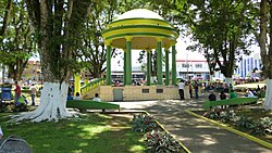
Quesada is a district of the San Carlos canton, in the Alajuela province of Costa Rica. [1] [2] It is the head city of the canton of San Carlos. Although Ciudad Quesada is the official name, it is commonly referred to by the area name of San Carlos. Ciudad Quesada is also the most populous city in the canton of San Carlos.

Contents

The city is the economic and political center of the region, especially for the agricultural and dairy industries. The Quesada district and its surrounding areas produce about 65% of all milk in Costa Rica.

Geography

Quesada has an area of 144 km2 [3] and an elevation of 656 metres. [1] It is located at the foot of the Cordillera Central (Central Mountain Range) on the southern edge of the San Carlos Plain, an expansive lowland that forms a major part of the Caribbean slope in northern Costa Rica. It is 79 km northwest of the provincial capital city of Alajuela and 90.9 km from the national capital city of San José. [4]

History

The city was first called La Unión, which was later changed to Villa Quesada.[ citation needed ] Villa Quesada was granted the title of "Ciudad" (City) by law on July 8, 1953.

Demographics

Historical population
CensusPop.
1883 303
1927 1,749
1950 5,054189.0%
1963 11,689131.3%
1973 17,02745.7%
1984 21,69627.4%
2000 36,36567.6%
2011 42,06015.7%

Instituto Nacional de Estadística y Censos [5]
Centro Centroamericano de Población [6]

For the 2011 census, Quesada had a population of 42,060 inhabitants. [7]

Transportation

Road transportation

The district is covered by the following road routes:

Economy

The city is a major commercial center for ranching and agricultural enterprises in the surrounding area. It is known for its leather goods, as well as for its dairy production. The city harbours some important manufacturing plants related to the agribusiness sector.

This city harbors facilities of Costa Rica's largest dairy cooperative in order to produce cheese and powder milk. It also has a R&D center operating in the same facilities Dos Pinos.

Tourism

There are several hot springs in the area, some of which have developed into resorts, attracting Costa Ricans and foreign tourists.

Nearby places of interest

Zoológico La Marina is a private nonprofit zoo operated by the Alfaro family on five hectares of their cattle ranch. There are more than 450 species of animals and birds on display, most of which were confiscated by the government from illegal private ownership. The facility also maintains a successful breeding program of tapirs, an increasingly endangered species. It is 11 kilometers northeast of Ciudad Quesada on the road to Aguas Zarcas.

Sports

The town's football club is A.D. San Carlos, who have spent over 25 years in the Costa Rican Primera División. They play their home games at the Estadio Carlos Ugalde Álvarez.

See also

Related Research Articles

<span class="mw-page-title-main">Zarcero</span> District in Zarcero canton, Alajuela province, Costa Rica

Zarcero is a district of the Zarcero canton, in the Alajuela province of Costa Rica.

<span class="mw-page-title-main">San Carlos (canton)</span> Canton in Alajuela province, Costa Rica

San Carlos is a canton in the Alajuela province of Costa Rica. The capital city of the canton is Ciudad Quesada.

San Rafael is a district of the Guatuso canton, in the Alajuela province of Costa Rica.

Los Chiles is a district of the Los Chiles canton, in the Alajuela province of Costa Rica.

Naranjo is a district of the Naranjo canton, in the Alajuela province of Costa Rica.

San Pedro is a district of the Poás canton, in the Alajuela province of Costa Rica.

<span class="mw-page-title-main">San Mateo de Alajuela</span> District in San Mateo canton, Alajuela province, Costa Rica

San Mateo is a district of the San Mateo canton, in the Alajuela province of Costa Rica.

Upala is a district of the Upala canton, in the Alajuela province of Costa Rica.

Florencia is a district of the San Carlos canton, in the Alajuela province of Costa Rica.

Buenavista is a district of the San Carlos canton, in the Alajuela province of Costa Rica.

Aguas Zarcas is a district of the San Carlos canton, in the Alajuela province of Costa Rica.

Venecia is a district of the San Carlos canton, in the Alajuela province of Costa Rica.

Pital is a district of the San Carlos canton, in the Alajuela province of Costa Rica.

La Tigra is a district of the San Carlos canton, in the Alajuela province of Costa Rica.

La Palmera is a district of the San Carlos canton, in the Alajuela province of Costa Rica.

Cutris is a district of the San Carlos canton, in the Alajuela province of Costa Rica.

Monterrey is a district of the San Carlos canton, in the Alajuela province of Costa Rica.

Pocosol is a district of the San Carlos canton, in the Alajuela province of Costa Rica.

Venado is a district of the San Carlos canton, in the Alajuela province of Costa Rica.

San Antonio is a district of the Alajuela canton, in the Alajuela province of Costa Rica.

References

  1. 1 2 "Declara oficial para efectos administrativos, la aprobación de la División Territorial Administrativa de la República N°41548-MGP". Sistema Costarricense de Información Jurídica (in Spanish). 19 March 2019. Retrieved 26 September 2020.
  2. División Territorial Administrativa de la República de Costa Rica (PDF) (in Spanish). Editorial Digital de la Imprenta Nacional. 8 March 2017. ISBN   978-9977-58-477-5.
  3. "Área en kilómetros cuadrados, según provincia, cantón y distrito administrativo". Instituto Nacional de Estadística y Censos (in Spanish). Retrieved 26 September 2020.
  4. "Costa Rica|Ciudad Quesada|Pause in a typical Costarican village".
  5. "Instituto Nacional de Estadística y Censos" (in Spanish).
  6. "Sistema de Consulta de a Bases de Datos Estadísticas". Centro Centroamericano de Población (in Spanish).
  7. "Censo. 2011. Población total por zona y sexo, según provincia, cantón y distrito". Instituto Nacional de Estadística y Censos (in Spanish). Retrieved 26 September 2020.