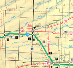
Quickville, Kansas

Last updated
Quickville, Kansas
Map of Thomas Co, Ks, USA.png
USA Kansas location map.svg
Red pog.svg
Quickville
Usa edcp location map.svg
Red pog.svg
Quickville
Coordinates: 39°31′41.4″N101°16′49.3″W / 39.528167°N 101.280361°W / 39.528167; -101.280361
Country United States
State Kansas
County Thomas
Elevation
3,307 ft (1,008 m)
Population
  Total0
Time zone UTC-6 (CST)
  Summer (DST) UTC-5 (CDT)
Area code 785
GNIS ID 482662 [1]

Quickville is a ghost town in Thomas County, Kansas, United States. It is farm ground with no remaining structures.

Contents

History

Quickville was platted on June 27, 1887, by the Thomas County Land and Townsite Co. [2] [3]

It was issued a post office in 1880. The post office was discontinued in 1909. [4]

Related Research Articles

<span class="mw-page-title-main">Tecumseh, Kansas</span> Unincorporated community in Shawnee County, Kansas

Tecumseh is an unincorporated community in Shawnee County, Kansas, United States, and situated along the Kansas River. As of the 2020 census, the population of the community and nearby areas was 696. The community and township are both named for the Shawnee chief.

<span class="mw-page-title-main">Bloom, Kansas</span> Unincorporated community in Ford County, Kansas

Bloom is an unincorporated community in Ford County, Kansas, United States. Its post office closed in 1992. At a 2018 estimate, the community had a population of 94. It is located along U.S. Route 54 highway.

<span class="mw-page-title-main">Joseph L. Bristow</span> American politician (1861–1944)

Joseph Little Bristow was a Republican politician from the American state of Kansas. Elected in 1908, Bristow served a single term in the United States Senate where he gained recognition for his support of several political causes of the Progressive era. In retirement, Bristow was a farmer in Annandale, Virginia.

<span class="mw-page-title-main">Montrose, Kansas</span> Unincorporated community in Jewell County, Kansas

Montrose is an unincorporated community in Jewell County, Kansas, United States.

Brazilton is an unincorporated community in Crawford County, Kansas, United States. It located along highway K-3.

<span class="mw-page-title-main">Lanham, Kansas and Nebraska</span> Unincorporated community in Kansas and Nebraska, US

Lanham is an unincorporated community in both Washington County, Kansas, and Gage County, Nebraska, United States. The Kansas–Nebraska state line runs down its main street. It is located along State Line Road, about 0.6 miles west of K-148/Nebraska Highway 112. Also, it is 7 miles north of Hanover, Kansas, and 6.5 miles from Odell, Nebraska.

<span class="mw-page-title-main">Hyattville, Kansas</span> Ghost town in Anderson County, Kansas

Hyattville is a ghost town in Anderson County, Kansas, United States.

Cedar Bluffs is an unincorporated community in Decatur County, Kansas, United States.

Sherman is an unincorporated community in Cherokee County, Kansas, United States.

Midway is an unincorporated community in Crawford County, Kansas, United States.

Halford is an unincorporated community in Thomas County, Kansas, United States. It is located approximately 9 miles (14 km) east of Colby.

Mingo is an unincorporated community in Thomas County, Kansas, United States It is located approximately 6 miles (9.7 km) southeast of Colby, then west of I-70 exit 62 via a rural road. It is primarily the site of a large granary operation; there is also a church, two large farms and, near the highway, a free-standing self-service gasoline pump row; and no other businesses or services. There are also a dozen or so homes.

Laton is a ghost town in Corning Township, Rooks County, Kansas, United States.

<span class="mw-page-title-main">Stockrange, Kansas</span> Ghost town in Ellis County, Kansas

Stockrange is a ghost town in Lookout Township, Ellis County, Kansas, United States.

<span class="mw-page-title-main">Walnut Grove, Kansas</span> Ghost town in Mitchell County, Kansas

Walnut Grove is a ghost town in Mitchell County, Kansas, United States.

<span class="mw-page-title-main">Pleasant Valley, Lincoln County, Kansas</span> Ghost town in Kansas, United States

Pleasant Valley is a ghost town in Lincoln County, Kansas, United States.

<span class="mw-page-title-main">Copeland, Thomas County, Kansas</span> Ghost town in Thomas County, Kansas

Copeland is a ghost town in Thomas County, Kansas, United States.

<span class="mw-page-title-main">Cumberland, Kansas</span> Ghost town in Thomas County, Kansas

Cumberland is a ghost town in Thomas County, Kansas, United States.

<span class="mw-page-title-main">Kuka, Kansas</span> Ghost town in Thomas County, Kansas

Kuka is a ghost town in Thomas County, Kansas, United States.

<span class="mw-page-title-main">Otterbourne, Kansas</span> Ghost town in Thomas County, Kansas

Otterbourne is a ghost town in Thomas County, Kansas, United States.

References

  1. "Quickville, Kansas", Geographic Names Information System , United States Geological Survey, United States Department of the Interior
  2. The National Gazetteer of the United States of America--Kansas, 1984. U.S. Government Printing Office. 1985.
  3. "Thomas County Schools". Kansas Historical Society. Retrieved 2022-03-14.
  4. "Kansas Post Offices, 1828-1961". Kansas Historical Society. Retrieved 2018-01-05.

Further reading