This page is based on this
Wikipedia article Text is available under the
CC BY-SA 4.0 license; additional terms may apply.
Images, videos and audio are available under their respective licenses.

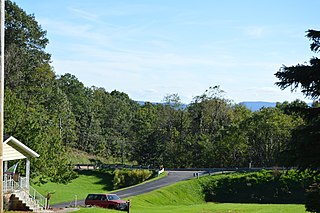
Southampton Township is a township in Somerset County, Pennsylvania, United States. The population was 655 at the 2000 census. It is part of the Johnstown, Pennsylvania Metropolitan Statistical Area.

Mosquito Lagoon is a body of water located on the east coast of Florida in Brevard and Volusia counties. It is part of the Indian River Lagoon system and the Atlantic Intracoastal Waterway. It extends from the Ponce de Leon Inlet to a point north of Cape Canaveral, and connects to the Indian River via the Haulover Canal. The Mosquito Lagoon Aquatic Preserve includes 4,740 acres (1,920 ha) in the northern end of the lagoon. The preserve originally extended to the southern end of the lagoon, but close to two-thirds of the preserve in the central and southern lagoon were transfered to the Federal government, and is now part of the Canaveral National Seashore. The cities of New Smyrna Beach and Edgewater, the Merritt Island National Wildlife Refuge and the Kennedy Space Center adjoin the lagoon.

Zilker is a neighborhood in south central Austin, Texas. It extends south of Lady Bird Lake, approximately bounded by the Union Pacific Railway to the southeast/south, Barton Skyway to the south, Rabb Road and Robert E Lee Road to the west and Lady Bird Lake to the north.
Capps Corner is an unincorporated community in Montague County, Texas, United States.

Chenoa Township is located in McLean County, Illinois. As of the 2010 census, its population was 2,074 and it contained 928 housing units.

Empire Township is located in McLean County, Illinois. As of the 2010 census, its population was 4,093 and it contained 1,719 housing units. Empire Township changed its name from Le Roy Township on May 17, 1858.
Banquete is a census-designated place (CDP) in Nueces County, Texas, United States.
Banquete is located at the intersection of State Highway 44 and FM 666, 23 miles west of Corpus Christi. Banquete should not be confused with Rancho Banquete, a census-designated place situated several miles west of the community.

Meiks is an unincorporated community in Addison Township, Shelby County, in the U.S. state of Indiana.
Rabbs Prairie is an unincorporated community in Fayette County, Texas, United States.
Westwood Place is an unincorporated community in Alleghany County, Virginia, United States.

Wierzbin is a village in the administrative district of Gmina Stare Babice, within Warsaw West County, Masovian Voivodeship, in east-central Poland. It lies approximately 7 kilometres (4 mi) west of Stare Babice, 6 km (4 mi) north-west of Ożarów Mazowiecki, and 18 km (11 mi) west of Warsaw.

Dickerson is a former settlement in Fresno County, California. It lay at an elevation of 266 feet. Dickerson still appeared on maps as of 1923.

Elk is an unincorporated community in Fresno County, California. It is located on the Atchison, Topeka and Santa Fe Railroad 7.25 miles (12 km) southwest of Piedra, at an elevation of 413 feet.

Raco is an unincorporated community in Fresno County, California. It is located on the Southern Pacific Railroad 4.25 miles (6.8 km) southwest of Herndon, at an elevation of 269 feet.

Elmore Desert Ranch is an unincorporated community in Imperial County, California. It lies at an elevation of 177 feet below sea level.
Sublime is an unincorporated community in Lavaca County, Texas, United States. Although it is unincorporated, Sublime has a post office, with the ZIP code of 77986.
National Highway 5 (NR5) is a highway of southern-central Burma. It connects Taungoo to Hopong, east of Taunggyi.
Grandy is an unincorporated community located in Brunswick County, in the U.S. state of Virginia.
Twelvemile Creek is a stream in the U.S. state of South Dakota.


