San Patricio, Texas

Last updated

San Patricio, Texas
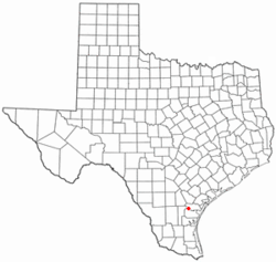
TXMap-doton-SanPatricio.PNG
Location of San Patricio, Texas
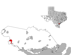
SanPatricio County SanPatricio.svg
Coordinates: 27°57′33″N97°46′23″W / 27.95917°N 97.77306°W / 27.95917; -97.77306
Country United States
State Texas
Counties San Patricio
Area
[1]
  Total3.89 sq mi (10.07 km2)
  Land3.85 sq mi (9.97 km2)
  Water0.04 sq mi (0.10 km2)
Elevation
43 ft (13 m)
Population
 (2020)
  Total384
  Density97.45/sq mi (37.63/km2)
Time zone UTC-6 (Central (CST))
  Summer (DST) UTC-5 (CDT)
ZIP code
78368
Area code 361
FIPS code 48-65612 [2]
GNIS feature ID1346436 [3]

San Patricio is a city in San Patricio counties in the U.S. state of Texas. The population was 384 at the 2020 census.

Contents

In the 2000 U.S. Census, a portion of San Patricio was indicated as being in Nueces County. [4] As of the 1990 U.S. Census, the 2010 U.S. Census, and the 2020 U.S. Census, that particular area is indicated as being in San Patricio County. [5] [6] [7]

Geography

According to the United States Census Bureau, San Patricio, located at 27°57′33″N97°46′23″W / 27.95917°N 97.77306°W / 27.95917; -97.77306 (27.959196, -97.773134), [8] has a total area of 3.9 square miles (10.0 km2), of which 3.8 square miles (9.9 km2) is land and 0.04 square mile (0.1 km2) (1.03%) is water.

History

The town was founded in 1829 by empresarios James McGloin and John McMullen. They had received approval from the Mexican government to settle 200 Irish Catholic families on the land [9] —the name meaning Saint Patrick, the patron saint of Ireland. Empresario James Power was involved as well.

The Battle of San Patricio was fought near the town in 1836 during the Texas Revolution.

With the approval of the General Council, Texas revolutionaries James Grant, Frank W. Johnson and Robert C. Morris collaborated on plans to lead an assault on the Mexican town of Matamoros. Recruiting some 300 men, several of whom were native to San Antonio, they gathered provisions from the Alamo and Presidio La Bahia for their expedition. [10] The men needed mounts for their long journey and divided into groups as they traveled toward the coast to capture wild horses.

On February 27, 1836, Mexican General José de Urrea's advanced reconnaissance patrol discovered Frank W. Johnson and about 34 Texians camped at the abandoned Irish settlement of San Patricio. In a surprise attack at 3:30am, Mexican troops fired on the Texian Army and killed about 10 (7 of them Hispanics) and captured 18. [11] Johnson and four others who were captured managed to escape and rejoin James Fannin's command at Goliad. One man, Daniel J. Toler, escaped capture. [12] The men killed were buried in the Old Cemetery on the Hill in San Patricio. [9]

Grant and Morris's party was also surprised by Urrea's army as they camped at Agua Dulce Creek. On March 2, the Mexicans surprised them, killing both Grant and Morris and twelve others. The survivors were taken captured and imprisoned at Matamoros.

In 1846, San Patricio became the second county seat of San Patricio County after Nueces County was partitioned from San Patricio County. In 1893, the county seat was moved to Sinton. [13]

Demographics

Historical population
CensusPop.Note
1880 238
1890 31532.4%
1980 210
1990 36975.7%
2000 318−13.8%
2010 39524.2%
2020 384−2.8%
U.S. Decennial Census [14] 2020 [15]

2020 census

San Patricio racial composition [16]
(NH = Non-Hispanic) [lower-alpha 1]
RaceNumberPercentage
White (NH)19149.74%
Asian (NH)10.26%
Some Other Race (NH)20.52%
Mixed/Multi-Racial (NH)133.39%
Hispanic or Latino 17746.09%
Total384

As of the 2020 United States census, there were 384 people, 155 households, and 116 families residing in the city.

2000 census

As of the census [2] of 2000, there were 318 people, 113 households, and 89 families residing in the city. The population density was 82.7 inhabitants per square mile (31.9/km2). There were 124 housing units at an average density of 32.3 per square mile (12.5/km2). The racial makeup of the city was 81.45% White, 0.94% African American, 0.63% Native American, 14.47% from other races, and 2.52% from two or more races. Hispanic or Latino of any race were 39.94% of the population.

There were 113 households, out of which 42.5% had children under the age of 18 living with them, 64.6% were married couples living together, 8.8% had a female householder with no husband present, and 21.2% were non-families. 18.6% of all households were made up of individuals, and 8.8% had someone living alone who was 65 years of age or older. The average household size was 2.81 and the average family size was 3.22.

The population in the city was spread out, with 33.0% under the age of 18, 4.4% from 18 to 24, 33.3% from 25 to 44, 19.8% from 45 to 64, and 9.4% who were 65 years of age or older; the median age was 36 years. For every 100 females, there were 102.5 males. For every 100 females age 18 and over, there were 91.9 males.

The median income for a household in the city was $32,386, and the median income for a family was $40,313. Males had a median income of $31,250 versus $19,063 for females. The per capita income for the city was $13,531. About 12.6% of families and 14.9% of the population were below the poverty line, including 17.9% of those under age 18 and 14.7% of those age 65 or over.

Education

The City of San Patricio is served by the Mathis Independent School District. [19]


Related Research Articles

<span class="mw-page-title-main">Zavala County, Texas</span> County in Texas, United States

Zavala County is a county located in the U.S. state of Texas. As of the 2020 census, the population was 11,677. Its county seat is Crystal City. The county was created in 1858 and later organized in 1884. Zavala is named for Lorenzo de Zavala, Mexican politician, signer of the Texas Declaration of Independence, and first vice president of the Republic of Texas.

<span class="mw-page-title-main">San Patricio County, Texas</span> County in Texas, United States

San Patricio County is located in the U.S. state of Texas. As of the 2020 census, its population was 68,755. Its county seat is Sinton. San Patricio County is part of the Corpus Christi metropolitan statistical area.

<span class="mw-page-title-main">Real County, Texas</span> County in Texas, United States

Real County is a county located on the Edwards Plateau in the U.S. state of Texas. As of the 2020 census, its population was 2,758. The county seat is Leakey. The county is named for Julius Real (1860–1944), a former member of the Texas State Senate. The Alto Frio Baptist Encampment is located in an isolated area of Real County southeast of Leakey.

<span class="mw-page-title-main">Nueces County, Texas</span> County in Texas, United States

Nueces County is located in the U.S. state of Texas. As of the 2020 census, the population was 353,178, making it the 16th-most populous county in the state. The county seat is Corpus Christi. The county was formed in 1846 from portions of San Patricio County and organized the following year. It is named for the Nueces River, which marks the county's northwestern boundary with San Patricio County before emptying into its mouth at Nueces Bay north of the port of Corpus Christi. Nueces County is part of the Corpus Christi metropolitan statistical area.

<span class="mw-page-title-main">Live Oak County, Texas</span> County in Texas, United States

Live Oak County is a county in the U.S. state of Texas. It was named for its native groves of live oak. George West is its county seat. Its population was 11,335 in the 2020 census.

<span class="mw-page-title-main">La Salle County, Texas</span> County in Texas, United States

La Salle County is a county in Texas. As of the 2020 census, its population was 6,664. Its county seat is Cotulla. The county was created in 1858 and later organized in 1880. It is named for René-Robert Cavelier, Sieur de La Salle, a 17th-century French explorer.

<span class="mw-page-title-main">Jim Wells County, Texas</span> County in Texas, United States

Jim Wells County is a county in the U.S. state of Texas. As of the 2020 census, its population was 38,891. The county was founded in 1911 and is named for James B. Wells Jr. (1850–1923), for three decades a judge and Democratic Party political boss in South Texas.

<span class="mw-page-title-main">Edwards County, Texas</span> County in Texas, United States

Edwards County is a county located on the Edwards Plateau in the U.S. state of Texas. As of the 2020 census its population was 1,422. The county seat is Rocksprings. The county was created in 1858 and organized in 1883. It is named for Haden Edwards, an early settler of Nacogdoches, Texas. The Edwards Aquifer and Edwards Plateau are named after the county by reason of their locations.

<span class="mw-page-title-main">Aransas County, Texas</span> County in Texas, United States

Aransas County is a county located in the U.S. state of Texas. It is in South Texas and its county seat is Rockport.

<span class="mw-page-title-main">Jourdanton, Texas</span> City in Texas, United States

Jourdanton is a city in and the county seat of Atascosa County, Texas, United States. The population is 4,094. It is part of the San Antonio metropolitan statistical area. The mayor is Robert "Doc" Williams. The city manager is Bobby J. Martinez. The police chief is Eric Kaiser. The fire chief is Jay Fojtik.

<span class="mw-page-title-main">Asherton, Texas</span> City in Texas, United States

Asherton is a city in Dimmit County, Texas, United States. The population was 1,084 at the 2010 census, down from 1,342 at the 2000 census. The estimated population in 2018 was 1,064. U.S. Highway 83 passes through Asherton.

<span class="mw-page-title-main">Three Rivers, Texas</span> City in Texas, United States

Three Rivers is a city in Live Oak County, Texas, United States. The population was 1,848 at the 2010 census.

<span class="mw-page-title-main">Bishop, Texas</span> City in Texas, United States

Bishop is a city in Nueces County, Texas, United States. The population was 3,134 in the 2010 census, down from 3305 at the 2000 census.

<span class="mw-page-title-main">Robstown, Texas</span> City in Texas, United States

Robstown is a city in Nueces County, Texas, United States, and a western suburb of Corpus Christi. It was founded circa 1906, and was named for Robert Driscoll. The population was 10,143 as of the 2020 census.

<span class="mw-page-title-main">Mathis, Texas</span> City in Texas, United States

Mathis is a city in San Patricio County, Texas, United States. The population was 4,942 at the 2010 census.

<span class="mw-page-title-main">Odem, Texas</span> City in Texas, United States

Odem is a city in San Patricio County, Texas, United States. Its population was 2,389 at the 2010 census.

<span class="mw-page-title-main">Sinton, Texas</span> City in Texas, United States

Sinton is a city in and the county seat of San Patricio County, Texas, United States. The population was 5,504 at the 2020 census. It was founded in 1886 and was named in honor of David Sinton, a influential business owner and rancher.

<span class="mw-page-title-main">Aransas Pass, Texas</span> City in Texas, United States

Aransas Pass is a city in Aransas, Nueces, and San Patricio Counties in the U.S. state of Texas. The population was 8,011 at the 2021 Census.

<span class="mw-page-title-main">Ingleside, Texas</span> City in Texas, United States

Ingleside is a city primarily in San Patricio County, with small parts in Nueces County, in the U.S. state of Texas. Its population was 9,519 at the 2020 census.

<span class="mw-page-title-main">Portland, Texas</span> City in Texas, United States

Portland is a city primarily located in San Patricio County with some water bodies extending into Nueces County in the U.S. state of Texas. Its population was 20,383 as of the 2020 United States census. Current population calculated by the City of Portland is 22,620. Portland is a suburb of Corpus Christi, located on the north shore of Nueces and Corpus Christi Bays.

References

  1. "2019 U.S. Gazetteer Files". United States Census Bureau. Retrieved August 7, 2020.
  2. 1 2 "U.S. Census website". United States Census Bureau . Retrieved January 31, 2008.
  3. "US Board on Geographic Names". United States Geological Survey. October 25, 2007. Retrieved January 31, 2008.
  4. "CENSUS 2000 BLOCK MAP: NUECES County (Page 2)" (PDF). 2000 U.S. Census . U.S. Census Bureau . Retrieved February 16, 2024.
  5. "1990 COUNTY BLOCK MAP (RECREATED): NUECES County (Page 2)" (PDF). U.S. Census Bureau . Retrieved February 16, 2024.
  6. "2010 CENSUS - CENSUS BLOCK MAP: Nueces County, TX (Page 2)" (PDF). 2010 U.S. Census . U.S. Census Bureau . Retrieved February 16, 2024.
  7. "2020 CENSUS - CENSUS BLOCK MAP: Nueces County, TX" (PDF). U.S. Census Bureau . Retrieved February 16, 2024.
  8. "US Gazetteer files: 2010, 2000, and 1990". United States Census Bureau. February 12, 2011. Retrieved April 23, 2011.
  9. 1 2 Handbook of Texas Online - San Patricio
  10. Todish et al. (1998), p. 29.
  11. Keith Guthrie, "SAN PATRICIO, BATTLE OF," Handbook of Texas Online (https://tshaonline.org/handbook/online/articles/qfs03), accessed June 09, 2011. Published by the Texas State Historical Association.
  12. Thomas W. Cutrer, "TOLER, DANIEL J.," Handbook of Texas Online (https://tshaonline.org/handbook/online/articles/fto11), accessed June 09, 2011. Published by the Texas State Historical Association.
  13. Guthrie, Keith (February 17, 2016). "San Patricio County". Handbook of Texas . Texas State Historical Association. Retrieved March 29, 2020.
  14. "Census of Population and Housing". Census.gov. Retrieved June 4, 2015.
  15. "2020 Census Data". data.census.gov.
  16. "Explore Census Data". data.census.gov. Retrieved May 21, 2022.
  17. https://www.census.gov/ [ not specific enough to verify ]
  18. "About the Hispanic Population and its Origin". www.census.gov. Retrieved May 18, 2022.
  19. "2020 CENSUS - SCHOOL DISTRICT REFERENCE MAP: San Patricio County, TX" (PDF). U.S. Census Bureau . Retrieved February 15, 2024. - Text list - 2010 map and 2010 list
  1. Note: the US Census treats Hispanic/Latino as an ethnic category. This table excludes Latinos from the racial categories and assigns them to a separate category. Hispanics/Latinos can be of any race. [17] [18]