Powell County is a county in the U.S. state of Montana. As of the 2020 census, the population was 6,946. Its county seat is Deer Lodge.
Missoula County is a county located in the State of Montana. As of the 2020 census, the population was 117,922, making it Montana's third most populous county. Its county seat and most populous city is Missoula. The county was founded in 1860. Missoula County comprises the Missoula, MT Metropolitan Statistical Area, and is not a consolidated city-county.

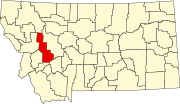
Deer Lodge County is a county in the U.S. state of Montana. As of the 2020 census, the population was 9,421. It forms a consolidated city-county government with its county seat of Anaconda. The county was established in 1865. It has had a city-county consolidated government since 1977.

Willow Creek is a census-designated place (CDP) in Gallatin County, Montana, United States. The population was 210 at the 2010 census. It is part of the Bozeman, MT Micropolitan Statistical Area.

Augusta is an unincorporated community and census-designated place (CDP) in Lewis and Clark County, Montana, United States. The population was 309 at the 2010 census and rose to 316 in the 2020 census. The most accepted version in the naming of this town is after Augusta Hogan, thought to be the first child born in this town, the daughter of J. D. Hogan, an early rancher.

De Borgia is an unincorporated community and census-designated place (CDP) in Mineral County, Montana, United States. The population was 91 at the 2020 census.

St. Regis or Saint Regis is an unincorporated community and census-designated place (CDP) in Mineral County, Montana. The population was 313 at the time of the 2020 census.

Bonner-West Riverside is a census-designated place (CDP) in Missoula County, Montana, United States, including the unincorporated communities of Bonner, Milltown, West Riverside, and Pinegrove. It is part of the Missoula metropolitan area. The population was 1,690 at the 2020 census.

Clinton is an unincorporated community and census-designated place (CDP) in Missoula County, Montana, United States. It is part of the Missoula metropolitan area. The population was 1,018 at the 2020 census.
Frenchtown is an unincorporated community and census-designated place (CDP) in Missoula County, Montana, United States. It is part of the Missoula metropolitan area. The population was 1,958 as of the 2020 census.

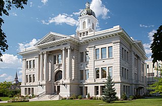
Deer Lodge is a city in and the county seat of Powell County, Montana, United States. The population was 2,938 at the 2020 census.

Big Sky is an unincorporated community and census-designated place (CDP) in Gallatin and Madison counties in southwestern Montana, United States. As of the 2020 census, it had a population of 3,591, up from 2,308 in 2010. It is 44 miles (71 km) by road southwest of Bozeman. The primary industry of the area is tourism.

The Clark Fork, or the Clark Fork of the Columbia River, is a river in the U.S. states of Montana and Idaho, approximately 310 miles (500 km) long. It is named after William Clark of the 1806 Lewis and Clark Expedition. The largest river by volume in Montana, it drains an extensive region of the Rocky Mountains in western Montana and northern Idaho in the watershed of the Columbia River. The river flows northwest through a long valley at the base of the Cabinet Mountains and empties into Lake Pend Oreille in the Idaho Panhandle. The Pend Oreille River in Idaho, Washington, and British Columbia, Canada which drains the lake to the Columbia in Washington, is sometimes included as part of the Clark Fork, giving it a total length of 479 miles (771 km), with a drainage area of 25,820 square miles (66,900 km2). In its upper 20 miles (32 km) in Montana near Butte, it is known as Silver Bow Creek. Interstate 90 follows much of the upper course of the river from Butte to Saint Regis. The highest point within the river's watershed is Mount Evans at 10,641 feet (3,243 m) in Deer Lodge County, Montana along the Continental Divide.

Interstate 90 (I-90) is an east–west transcontinental Interstate Highway across the northern United States, linking Seattle to Boston. The portion in the state of Montana is 552.54 miles (889.23 km) in length, passing through 14 counties in central and southern Montana. It is the longest segment of I-90 within a single state.

Saltese is an unincorporated community and census-designated place in Mineral County, Montana, United States. It lies in the valley of the St. Regis River along Interstate 90 at exit 10. As of the 2020 census, the population was 10.
Turah is an unincorporated community and census-designated place (CDP) in Missoula County, Montana, United States, along Interstate 90. It had a population of 364 as of the 2020 census, up from 306 in 2010.
Montaqua is a census-designated place (CDP) in Carbon County, Montana, United States. It is in the northern part of the county, along U.S. Route 212, which leads northeast 15 miles (24 km) to Laurel and southwest 30 miles (48 km) to Red Lodge. Montaqua is on the north side of Rock Creek, a northeast-flowing tributary of the Clarks Fork Yellowstone River. The community is bordered to the northeast by Rockvale.

Gilman is an unincorporated community and census-designated place (CDP) in Lewis and Clark County, Montana, United States. It is near the northern border of the county, on the east side of U.S. Route 287. Augusta is less than 2 miles (3 km) to the southwest. US-287 leads northeast from Gilman 24 miles (39 km) to Choteau and south through Augusta 40 miles (64 km) to Interstate 15 near Wolf Creek. Montana Highway 21 forms the southern edge of Gilman and leads east 21 miles (34 km) to Simms.
Potomac is an unincorporated community and census-designated place (CDP) in Missoula County, Montana, United States. It was first listed as a CDP prior to the 2020 census, at which time it had a population of 26.
Goldcreek is an unincorporated community and census-designated place (CDP) in Powell County, Montana, United States. It is in the southwestern part of the county, 0.4 miles (0.6 km) south of Interstate 90's Exit 166. Via I-90, Garrison is 8 miles (13 km) to the southeast and Drummond is 12 miles (19 km) to the northwest.