Avon, Montana | |
---|---|
| |
![]() Location of Avon, Montana | |
Coordinates: 46°36′50″N112°35′56″W / 46.61389°N 112.59889°W | |
Country | United States |
State | Montana |
County | Powell |
Area | |
• Total | 13.37 sq mi (34.62 km2) |
• Land | 13.36 sq mi (34.61 km2) |
• Water | 0.00 sq mi (0.01 km2) |
Elevation | 5,240 ft (1,600 m) |
Population (2020) | |
• Total | 114 |
• Density | 8.53/sq mi (3.29/km2) |
Time zone | UTC-7 (Mountain (MST)) |
• Summer (DST) | UTC-6 (MDT) |
ZIP code | 59713 |
Area code | 406 |
FIPS code | 30-03175 |
GNIS feature ID | 2407787 [2] |
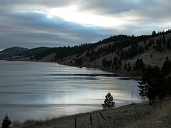
Avon is a census-designated place (CDP) in Powell County, Montana, United States. The population was 124 at the 2000 census. The town sits along the Little Blackfoot River, and serves as a gateway to the Beaverhead-Deerlodge National Forest.
The post office was opened in 1884 by Bill Cramer. [3] The town was named Avon after the Welsh word for river. [4] The town served as a supply point for nearby ranchers, prospectors, and miners.
The town includes the Fitzpatrick Ranch Historic District, a designated location on the National Register of Historic Places.
According to the United States Census Bureau, the CDP has a total area of 13.4 square miles (35 km2), all land.
Census | Pop. | Note | %± |
---|---|---|---|
2000 | 124 | — | |
2010 | 111 | −10.5% | |
2020 | 114 | 2.7% | |
U.S. Decennial Census [5] |
As of the census [6] of 2000, there were 124 people, 48 households, and 28 families residing in the CDP. The population density was 9.3 inhabitants per square mile (3.6/km2). There were 62 housing units at an average density of 4.6 per square mile (1.8/km2). The racial makeup of the CDP was 100.00% White.
There were 48 households, out of which 29.2% had children under the age of 18 living with them, 56.3% were married couples living together, and 39.6% were non-families. 35.4% of all households were made up of individuals, and 18.8% had someone living alone who was 65 years of age or older. The average household size was 2.58 and the average family size was 3.52.
In the CDP, the population was spread out, with 33.9% under the age of 18, 4.0% from 18 to 24, 25.0% from 25 to 44, 25.0% from 45 to 64, and 12.1% who were 65 years of age or older. The median age was 39 years. For every 100 females there were 79.7 males. For every 100 females age 18 and over, there were 90.7 males.
The median income for a household in the CDP was $25,208, and the median income for a family was $25,625. Males had a median income of $31,750 versus $22,969 for females. The per capita income for the CDP was $12,777. There were 30.8% of families and 41.2% of the population living below the poverty line, including 63.2% of under eighteens and 16.7% of those over 64.
Summit is a census-designated place (CDP) in Pima County, Arizona, United States. The population was 3,702 at the 2000 census.
St. Xavier or Saint Xavior is an unincorporated community and census-designated place (CDP) in Big Horn County, Montana, United States. The CDP population was 83 at the 2010 census.
Black Eagle is a census-designated place (CDP) in Cascade County, Montana, United States. The population was 904 at the 2010 census. It is a suburb of Great Falls.
Sun Prairie is a census-designated place (CDP) in Cascade County, Montana, United States. The population was 1,630 at the 2010 census. It is part of the Great Falls Metropolitan Statistical Area.
South Browning is a census-designated place (CDP) in Glacier County, Montana, United States. The population was 1,785 at the 2010 census. South Browning is a rural village on the Blackfeet Indian Reservation. It is bordered to the north by the town of Browning.
Inverness is a census-designated place (CDP) in Hill County, Montana, United States. The population was 55 at the 2010 census. It was named after a city in Scotland.
West Havre is a census-designated place (CDP) in Hill County, Montana, United States. The population was 316 at the 2010 census, up from 284 in 2000.
Big Arm is a census-designated place (CDP) in Lake County, Montana, United States. The population was 177 at the 2010 census, up from 131 in 2000.
Evaro is a census-designated place (CDP) in Missoula County, Montana, United States, and part of the Missoula metropolitan area. It is located on the southernmost part of the Flathead Indian Reservation, approximately 20 miles (32 km) north of downtown Missoula via US Highway 93. As of the 2020 census, the population of the CDP was 373, up from 322 in 2010.
Orchard Homes is a census-designated place (CDP) in Missoula County, Montana, United States. It is part of the Missoula metropolitan area. The population was 5,377 at the 2020 census.
Musselshell is an unincorporated community and census-designated place (CDP) in Musselshell County, Montana, United States. The population of the CDP was 59 at the 2020 census. The village is located near the Musselshell River.
Cooke City-Silver Gate was a census-designated place (CDP) in Park County, Montana, United States, corresponding to the unincorporated communities of Cooke City and Silver Gate. The population was 140 at the 2000 census. Starting with the 2010 census, the two communities were listed as separate CDPs. The communities sit toward the northeast of Yellowstone National Park on the Beartooth Highway.
Ovando is a census-designated place (CDP) in Powell County, Montana, United States. It is approximately fifty-four miles ENE of Missoula, Montana. The population was 71 at the 2000 census.
Simsbury Center is a census-designated place (CDP) that consists of the central settlement, and the neighborhoods immediately surrounding it, in the town of Simsbury, Connecticut, United States. As of the 2010 census, the CDP had a population of 5,836. The core area of the CDP is listed as the Simsbury Center Historic District on the National Register of Historic Places.
Jette is a census-designated place (CDP) in Lake County, Montana, United States. The population was 253 at the 2010 census.
Turpin Hills is a census-designated place (CDP) in Anderson Township, Hamilton County, Ohio, United States. The population was 5,162 at the 2020 census.
Avon is a census-designated place (CDP) in Cache County, Utah, United States. The population was 390 at the 2020 census. It is included in the Logan, Utah-Idaho (partial) Metropolitan Statistical Area.
Niarada is a census-designated place (CDP) in Flathead and Sanders counties in Montana, United States. The population was 27 at the 2010 census, down from 50 in 2000.
Kennebunkport is a census-designated place (CDP) consisting of the central village in the town of Kennebunkport in York County, Maine, United States. The population was 1,238 at the 2010 census, out of a total town population of 3,474. It is part of the Portland–South Portland–Biddeford, Maine Metropolitan Statistical Area.
Canton Valley is a village and census-designated place (CDP) in the town of Canton in Hartford County, Connecticut, United States. The population was 1,580 at the 2010 census. As of the 2017 census the population was 1,489.