Elliston, Montana | |
---|---|
Coordinates: 46°34′2″N112°26′42″W / 46.56722°N 112.44500°W | |
Country | United States |
State | Montana |
County | Powell |
Area | |
• Total | 8.10 sq mi (20.98 km2) |
• Land | 8.10 sq mi (20.98 km2) |
• Water | 0.00 sq mi (0.00 km2) |
Elevation | 5,059 ft (1,542 m) |
Population (2020) | |
• Total | 227 |
• Density | 28.03/sq mi (10.82/km2) |
Time zone | UTC-7 (Mountain (MST)) |
• Summer (DST) | UTC-6 (MDT) |
ZIP code | 59728 |
Area code | 406 |
FIPS code | 30-23950 |
GNIS feature ID | 0783161 [2] |
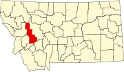
Elliston is a census-designated place (CDP) in Powell County, Montana, United States. The population was 225 at the 2000 census.
The town is most likely named after Northern Pacific Railroad director John W. Ellis. [3] By the mid-1880s, Elliston was flourishing as a center for gold and quartz mining. [3]
Elliston is located at 46°34′02″N112°26′42″W / 46.567089°N 112.444965°W (46.567089, -112.444965). [4]
According to the United States Census Bureau, the CDP has a total area of 8.8 square miles (23 km2), all land.
This climatic region is typified by large seasonal temperature differences, with warm to hot (and often humid) summers and cold (sometimes severely cold) winters. According to the Köppen Climate Classification system, Elliston has a humid continental climate, abbreviated "Dfb" on climate maps. [5]
Climate data for Elliston, Montana, 1991–2020 normals, 1920-2020 extremes: 5080ft (1548m) | |||||||||||||
---|---|---|---|---|---|---|---|---|---|---|---|---|---|
Month | Jan | Feb | Mar | Apr | May | Jun | Jul | Aug | Sep | Oct | Nov | Dec | Year |
Record high °F (°C) | 57 (14) | 58 (14) | 73 (23) | 81 (27) | 89 (32) | 96 (36) | 100 (38) | 100 (38) | 94 (34) | 82 (28) | 70 (21) | 56 (13) | 100 (38) |
Mean maximum °F (°C) | 49.5 (9.7) | 51.2 (10.7) | 60.5 (15.8) | 71.6 (22.0) | 79.9 (26.6) | 87.7 (30.9) | 94.0 (34.4) | 92.3 (33.5) | 88.0 (31.1) | 74.5 (23.6) | 60.4 (15.8) | 48.1 (8.9) | 92.9 (33.8) |
Average high °F (°C) | 32.6 (0.3) | 33.1 (0.6) | 43.2 (6.2) | 50.8 (10.4) | 60.4 (15.8) | 68.6 (20.3) | 80.9 (27.2) | 80.4 (26.9) | 68.9 (20.5) | 53.3 (11.8) | 39.3 (4.1) | 31.2 (−0.4) | 53.6 (12.0) |
Daily mean °F (°C) | 21.7 (−5.7) | 22.5 (−5.3) | 31.2 (−0.4) | 38.3 (3.5) | 47.7 (8.7) | 54.8 (12.7) | 63.5 (17.5) | 62.3 (16.8) | 52.7 (11.5) | 40.1 (4.5) | 28.3 (−2.1) | 20.8 (−6.2) | 40.3 (4.6) |
Average low °F (°C) | 10.7 (−11.8) | 11.9 (−11.2) | 19.2 (−7.1) | 25.8 (−3.4) | 35.0 (1.7) | 41.0 (5.0) | 46.0 (7.8) | 44.1 (6.7) | 36.4 (2.4) | 27.0 (−2.8) | 17.3 (−8.2) | 10.4 (−12.0) | 27.1 (−2.7) |
Mean minimum °F (°C) | −15.8 (−26.6) | −14.6 (−25.9) | −2.7 (−19.3) | 9.5 (−12.5) | 21.6 (−5.8) | 30.2 (−1.0) | 36.6 (2.6) | 34.0 (1.1) | 25.5 (−3.6) | 7.7 (−13.5) | −3.4 (−19.7) | −14.0 (−25.6) | −23.9 (−31.1) |
Record low °F (°C) | −41 (−41) | −41 (−41) | −30 (−34) | −3 (−19) | 9 (−13) | 24 (−4) | 24 (−4) | 24 (−4) | 5 (−15) | −12 (−24) | −40 (−40) | −43 (−42) | −43 (−42) |
Average precipitation inches (mm) | 1.12 (28) | 1.04 (26) | 1.37 (35) | 1.77 (45) | 2.49 (63) | 2.79 (71) | 1.45 (37) | 1.39 (35) | 1.40 (36) | 1.76 (45) | 1.48 (38) | 1.05 (27) | 19.11 (486) |
Average snowfall inches (cm) | 11.2 (28) | 13.7 (35) | 10.5 (27) | 8.0 (20) | 2.1 (5.3) | 0.2 (0.51) | 0.0 (0.0) | 0.2 (0.51) | 0.8 (2.0) | 5.2 (13) | 8.3 (21) | 15.4 (39) | 75.6 (191.32) |
Source 1: NOAA [6] | |||||||||||||
Source 2: XMACIS2 (2004-2020 snowfall, records & monthly max/mins) [7] |
Census | Pop. | Note | %± |
---|---|---|---|
2000 | 225 | — | |
2010 | 219 | −2.7% | |
2020 | 227 | 3.7% | |
U.S. Decennial Census [8] |
As of the census [9] of 2000, there were 225 people, 89 households, and 64 families residing in the CDP. The population density was 25.6 inhabitants per square mile (9.9/km2). There were 104 housing units at an average density of 11.8 per square mile (4.6/km2). The racial makeup of the CDP was 98.22% White, 0.89% Native American, 0.44% Asian, and 0.44% from two or more races.
There were 89 households, out of which 41.6% had children under the age of 18 living with them, 57.3% were married couples living together, 11.2% had a female householder with no husband present, and 27.0% were non-families. 22.5% of all households were made up of individuals, and 12.4% had someone living alone who was 65 years of age or older. The average household size was 2.53 and the average family size was 2.94.
In the CDP, the population was spread out, with 32.0% under the age of 18, 2.7% from 18 to 24, 28.0% from 25 to 44, 23.6% from 45 to 64, and 13.8% who were 65 years of age or older. The median age was 36 years. For every 100 females, there were 94.0 males. For every 100 females age 18 and over, there were 96.2 males.
The median income for a household in the CDP was $31,964, and the median income for a family was $38,333. Males had a median income of $33,750 versus $21,875 for females. The per capita income for the CDP was $16,501. About 7.6% of families and 10.4% of the population were below the poverty line, including 13.0% of those under the age of eighteen and 6.5% of those 65 or over.
Fort Smith is a census-designated place (CDP) in Big Horn County, Montana, United States. The population was 161 at the 2010 census. The town is named for the former Fort C.F. Smith. The North District of Bighorn Canyon National Recreation Area is accessed at Fort Smith.
Winston is a census-designated place (CDP) in Broadwater County, Montana, United States. The population was 147 at the 2010 census.
Big Arm is a census-designated place (CDP) in Lake County, Montana, United States. The population was 177 at the 2010 census, up from 131 in 2000.
Elmo is a census-designated place (CDP) in Lake County, Montana, United States. The population was 180 at the 2010 census, up from 143 in 2000.
Augusta is an unincorporated community and census-designated place (CDP) in Lewis and Clark County, Montana, United States. The population was 309 at the 2010 census and rose to 316 in the 2020 census. The most accepted version in the naming of this town is after Augusta Hogan, thought to be the first child born in this town, the daughter of J. D. Hogan, an early rancher.
Helena Valley West Central is a census-designated place (CDP) in Lewis and Clark County, Montana, United States. The population was 7,883 at the 2010 census. It is part of the Helena Micropolitan Statistical Area.
Lincoln is an unincorporated community and census-designated place (CDP) in Lewis and Clark County, Montana, United States. As of the 2010 census, the population was 1,013.
Alder is a census-designated place (CDP) in Madison County, Montana, United States. The population was 86 at the 2020 census. The community takes its name from Alder Creek, the site of the second major gold discovery in Montana.
East Missoula is a census-designated place (CDP) in Missoula County, Montana, United States. It is part of the 'Missoula, Montana Metropolitan Statistical Area'. The population was 2,157 at the 2010 census, an increase from its population of 2,070 in 2000.
Lolo is a census-designated place (CDP) in Missoula County, Montana, United States. It is part of the Missoula Metropolitan Statistical Area. The population was 4,399 at the 2020 census, an increase from its population of 3,892 in 2010. It is home to Travelers' Rest State Park, a site where Lewis and Clark camped in 1805 and again in 1806.
Seeley Lake is a census-designated place (CDP) in Missoula County, Montana, United States. It is part of the 'Missoula, Montana Metropolitan Statistical Area'. The town sits beside the 1,031.5 acres lake Seeley Lake. The population was 1,659 at the 2010 census, an increase from its population of 1,436 in 2000.
Wilsall is a census-designated place (CDP) in Park County, Montana, United States. The population was 237 at the 2000 census.
Avon is a census-designated place (CDP) in Powell County, Montana, United States. The population was 124 at the 2000 census. The town sits along the Little Blackfoot River, and serves as a gateway to the Beaverhead-Deerlodge National Forest.
Ovando is a census-designated place (CDP) in Powell County, Montana, United States. It is approximately fifty-four miles ENE of Missoula, Montana. The population was 71 at the 2000 census.
Corvallis is a census-designated place (CDP) in Ravalli County, Montana, United States. The population was 1,125 at the 2020 census.
Lonepine is a census-designated place (CDP) in Sanders County, Montana, United States. The population was 137 at the 2000 census.
Noxon is a census-designated place (CDP) in Sanders County, Montana, United States. The population of the whole CDP was 255 at the 2020 census.
Greycliff is a census-designated place (CDP) in Sweet Grass County, Montana, United States. The population was 56 at the 2000 census.
Custer is a village in Yellowstone County, Montana, United States. The population was 145 at the 2000 census.
Shark River Hills is an unincorporated community and census-designated place (CDP) within Neptune Township, in Monmouth County, in the U.S. state of New Jersey. As of the 2010 United States Census, the CDP's population was 3,697.