
Bathinda is a city and municipal corporation in Punjab, India. The city is the administrative headquarters of Bathinda district. It is located in northwestern India in the Malwa Region, 227 km (141 mi) west of the capital city of Chandigarh and is the fifth largest city of Punjab. It is the second cleanest city in Punjab after Mohali.

Faridkot is a city in the South-western part of state of Punjab, India. It serves as the headquarters for both, the Faridkot district. as well as the Faridkot Division. The division was established in 1995 at Faridkot which includes Faridkot, Bathinda, and Mansa districts.
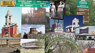
Hoshiarpur is a city and a municipal corporation in Hoshiarpur district in the Doaba region of the Indian state of Punjab. It was founded, according to tradition, during the early part of the fourteenth century. In 1809, it was occupied by the forces of Maharaja Karanvir Singh and was united into the greater state of Punjab in 1849.

Mansa is a city of Punjab. It is the administrative headquarters of Mansa district and is situated on the Bathinda-Jind-Delhi railway line and also on the Barnala-Sardulgarh-Sirsa state highway.

Mansa district is a district in the state of Punjab, India. The district headquarters is Mansa city. Mansa district was formed on 13 April 1992 from the erst while district of Bathinda. The district has three tehsils: Mansa, Budhlada and Sardulgarh; and five development blocks: Mansa, Budhlada, Sardulgarh, Bhikhi and Jhunir.

Jamnagar District is a district of Gujarat in Western India. Its headquarters are located in the eponymous city of Jamnagar. It hosts the production facilities of large Indian companies such as Reliance. Among its attractions are several palaces, a Marine National Park and a Bird Sanctuary, known as Khijadiya Bird Sanctuary. In 2013, Devbhoomi Dwarka district was carved out of the western part of the district.

Budhlada is a municipal council located in the Mansa district of the state of Punjab, India. The area's main industry is agriculture, which provides the majority of employment opportunities in the region. The municipal council of Budhlada is divided into 19 wards, and regular elections are held every five years. It has held the status of a Class II Municipal Council since the 1950s.

Fazilka, also known as Bangla, is a city and a municipal council in Fazilka district of Punjab, India. In 2011, it was made the headquarter of the newly created Fazilka district. The Trans-Afghanistan Pipeline (TAPI) project originating in Turkmenistan will have its last station in Fazilka.
Kalanwali is a town and a municipal committee, nearby Sirsa in Sirsa district in the Indian state of Haryana. Being very near the Punjab border, most of the people in this area have Haryanvi & Punjabi as their mother tongue.
Kot Fatta is a city and a municipal council in Bathinda district in the Indian state of Punjab.
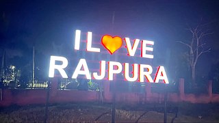
Rajpura is a city in Patiala district in the Indian state of Punjab, India, situated along the border of the Indian state of Haryana. It is located 26 KM Patiala city, towards East from District Head Quarter. It is Tehsil Head Quarter. Rajpura is the largest tehsil of the district.
Sangat is a Suburb town of Bathinda City and a municipal council in Bathinda district in the Indian state of Punjab. Sangat Mandi is situated 20 km (12 mi) away from Bathinda District headquarter in south. Sangat is Small commercial hub of area.
Sujanpur is a city and municipal council in the Pathankot district of the Indian state of Punjab. It is 06 km from Pathankot towards Jammu on Jalandhar-Jammu-Amritsar National Highway (NH-1A). It is situated near the banks of Ravi River and surrounded by two canals: UBDC and Bias Link. Sujanpur Municipal Council area is divided into 15 wards.
Tapa is a small town or city and a municipal council and administrative area in Barnala district in the Indian state of Punjab. Tapa is mainly known as Tapa-Mandi because Mandi word can be translated as grain market. As Tapa has been very famous for its grain market, many people from near villages come here to sell their crops and grains. This has been the main source of income and job opportunities for many people around this area. Tapa is well known for its historic Deras and Guruduwaras and for best economy in its district. A famous holy place named as Baba Math -, is the main attraction of this town. Tapa is situated at Barnala-Bathinda Main Road between Barnala and Bathinda, Moga and Mansa. It is 24 km towards Bathinda from Barnala and 42 km towards Barnala from Bathinda. Moga Road also passes through it towards Pakho-Kenchian.
Tohana is a city and a municipal council, just 56 km from Fatehabad City in Fatehabad district in the Indian state of Haryana. Its name comes from the Sanskrit 'Taushayana'. It is known as the City of Canals.
Zirakpur is a planned satellite city, in Mohali District, Punjab, neighboring Mohali, Chandigarh in India. It is set on the foothills of Shivalik hills. It is part of the tehsil Dera Bassi. It is the gateway to Chandigarh from Delhi. It comprises mainly the following areas near Chandigarh Airport including VIP Road, Dhakoli, Lohgarh, Bhabat, Bishanpura, Kishanpura, Nabha, Gazipur, Baltana, Singhpura, Peer Muchalla and Dyalpura. This town is situated on the junction of national highways Himalayan Expressway, National Highway 5 (India) towards Shimla, Ambala Chandigarh Expressway towards Ambala and National Highway 7 (India) towards Patiala.
Giddarbaha is a town and a municipal council in Muktsar district, in the Indian state of Punjab. It is 19 kilometres (12 mi) from the city of Malout, 30 kilometres (19 mi) from the city of Bathinda and 40 kilometres (25 mi) from the city of Muktsar. It lies on NH-7, which connects Fazilka (Punjab) to Mana (Uttarakhand) in India.
Banga is a town and Municipal council in the Shaheed Bhagat Singh Nagar district of Punjab, India. Banga is also one of the sub-division (tehsil) headquarters of the district. Banga located on Phagwara-Rupnagar section of National Highway 344A. It is currently estimated to have a population of about 23,000 and is classified as a class 2 Municipality. The town also incorporates the former village of Jindowal apart from Banga town.
Maur is a suburb town of Bathinda City and a municipal council in Bathinda district in the Indian state of Punjab.It has a class II Municipal committee, located on the Bathinda- Delhi railway line, and the Bathinda-Mohali (Ajitgarh) state highway. This State Highway has now been upgraded to National Highway NH 148B. Maur Mandi is about 35 km from Bathinda city.
Bareta is a city and municipal council in the Mansa district in Southern Punjab, India. It is a small town that lies on the NH-148B.

