
Amalapuram is a town in the Indian state of Andhra Pradesh. It is the district headquarters and the third largest town of Dr. B. R. Ambedkar Konaseema district. It is the mandal and divisional headquarters of Amalapuram mandal and Amalapuram revenue division respectively. The town is situated in the delta of konaseema.
Peddapuram is a town in the Kakinada district of Andhra Pradesh in South India. The town also forms a part of Godavari Urban Development Authority.
Chintalavalasa is a census town in Vizianagaram district of the Indian state of Andhra Pradesh. It is located in Denkada mandal of Vizianagaram revenue division.

Gajapathinagaram is a census town in Vizianagaram district of the Indian state of Andhra Pradesh. It is located in Gajapathinagaram mandal of Vizianagaram revenue division. It is located on National Highway 26 between Vizianagaram and Ramabhadrapuram.
Jarajapupeta is a census town in Vizianagaram district of the Indian state of Andhra Pradesh. It is located in Nellimarla mandal of Vizianagaram revenue division.
Kanapaka is a census town in Vizianagaram district in the Indian state of Andhra Pradesh.
Kantabamsuguda is a census town in Anakapalli district of the Indian state of Andhra Pradesh.

Kothavalasa is a town in Vizianagaram district of the Indian state of Andhra Pradesh. It is located in Kothavalasa mandal of Vizianagaram revenue division. It is located 30 km from the city of Visakhapatanam
Moragudi is a census town in Kadapa district in the Indian state of Andhra Pradesh.

Narsipatnam is a census town in Anakapalle district of the Indian state of Andhra Pradesh. It was upgraded from a gram panchayat into municipality in 2012. The town is spread over an area of 42 km2 (16 sq mi) The resting place of the revolutionary Indian freedom fighter Alluri Sitarama Raju is located in Krishna Devi Peta village of From Narsipatnam to labasingi Village 30 km only.. labasingi most popular winter tourism place..so many Tourists enjoy -2 degree's temparature there.. Narsipatnam town is 43 km away from Tuni. And it is 72 km away from Visakhapatnam.
Papampeta is a census town in Anantapur district of the Indian state of Andhra Pradesh. It is located in Anantapur mandal of Anantapur revenue division. The town is a constituent of Anantapur urban agglomeration.

Samarlakota is a town in Kakinada district of the Indian state of Andhra Pradesh. The town forms a part of Godavari Urban Development Authority. It was previously known as Chamarlakota, which dates back to a local kaifiyat that was written in the mid-eighteenth century.
Sriramnagar is a census town in Vizianagaram district of the Indian state of Andhra Pradesh. It is located in Garividi mandal of Vizianagaram revenue division.
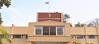
Suryaraopet is a locality in Vijayawada of the India state of Andhra Pradesh. It is the Health district of Vijayawada.The area consist of Many super Speciality hospitals. Andhra Pradesh Raj Bhavan also located in this area.

Tuni is a City in Kakinada district of the Indian state of Andhra Pradesh. It is a second biggest city in Kakinada district. Freedom fighter Alluri Sitaramaraju studied here. It is a major commercial marketing centre for more than 200+ surrounding villages in the district. Tuni is a border point for the district of Kakinada. It is known for mango production, with nearly 250 varieties being exported from the area. Tuni City is also known as "Mango City". Tuni is also famous for the production of betel leaves and jute bags. A variety of cashew nuts are also produced in Tuni.
Vetapalem is a census town in Bapatla district of the Indian state of Andhra Pradesh. It is the mandal headquarters of Vetapalem mandal in Ongole revenue division.

Nagari is a town in Chittoor district of the Indian state of Andhra Pradesh. It is the mandal headquarters of Nagari mandal in Nagari revenue division.
Rameswaram is a census town in Cuddapah district inside Proddatur in the Indian state of Andhra Pradesh.
Ramachandrapuram is a town in Dr. B.R. Ambedkar Konaseema district of the Indian state of Andhra Pradesh. The town is a Municipality which serves as the headquarters of Ramachandrapuram mandal and Ramachandrapuram revenue division.

Narasannapeta is a census town in Srikakulam district of the Indian state of Andhra Pradesh. It is the mandal headquarters of Narasannapeta mandal in Srikakulam revenue division. 43 villages are there under the administrative division of Narasannapeta.

