
Jharkhand is a state in eastern India. The state shares its border with the states of West Bengal to the east, Chhattisgarh to the west, Uttar Pradesh to the northwest, Bihar to the north and Odisha to the south. It is the 15th largest state by area, and the 14th largest by population. Hindi is the official language of the state. The city of Ranchi is its capital and Dumka its sub-capital. The state is known for its waterfalls, hills and holy places; Baidyanath Dham, Parasnath, Dewri and Rajrappa are major religious sites. Jharkhand is primarily rural, with about 24% of its population living in cities.

Bokaro, officially known as Bokaro Steel City, is a large and planned city in Jharkhand, India. It is the fourth most populous city in the state and one of the first planned cities of India. Bokaro is the administrative headquarters of Bokaro district. The city is located on the banks of Garga River and on the fringes of Bokaro river and is surrounded by hill ranges at Giridih and Ramgarh districts. It is one of the most peaceful cities in India. As per 2011 census, the city's population was 563,417 and 1,100,000 of its metropolitan area. The city span across 183 km in geographic area.
Barhi is a census town and headquarters of a subdivision in the Barhi CD block in the Barhi subdivision of the Hazaribagh district in the state of Jharkhand, India. It stands at the crossing of NH 19 / Grand Trunk Road and NH 20.. All major buses on the Ranchi-Patna, Ranchi-Gaya,Barhi-Ranchi, Dhanbad-Patna and Dhanbad-Gaya routes pass through Barhi. Both Tilaiya Dam of DVC and Hazaribagh Wildlife Sanctuary are near Barhi.

Ramgarh Cantonment, usually referred to as Ramgarh Cantt or just Ramgarh is a cantonment town, belonging to the Ramgarh district of the Indian state of Jharkhand. Historically, a subdivision of the larger Hazaribag district, Ramgarh was finally elevated to a district status on 12 September 2007 largely to ease administrative hardships.
National Highway 6 & Economic Corridor 1 (EC1), was a National Highway in India that has been separately designated under the new national highway numbering system. It was officially listed as running over 1,949 km (1,211 mi) from Surat to Kolkata. The route was also known as Asian Highway 46 (AH46) & Mumbai - Kolkata Highway and Great Eastern Highway.
The Chennai Bypass Road is a full-access controlled expressway that interconnects four radial Indian National Highways around Chennai, India covering a distance of 32 km (20 mi) from Perungalathur on NH-32 to puzhal on NH-16 via Maduravoyal at a cost of ₹ 4.05 billion. Constructed as part of the National Highway Development Project to decongest the city of transiting vehicles, the expressway interconnects NH-32, NH-48, NH-716 and NH-16. This expressway now forms a part of the circular transportation corridor.
Delhi, a major metropolitan region of India, is connected to various parts of country through several national highways and expressways. All the highways and expressways from Delhi lead to Haryana or Uttar Pradesh and continue from there.

Old National Highway 2 or Old NH 2, was a major National Highway in India, that connected the states of Delhi, Haryana, Uttar Pradesh, Bihar, Jharkhand and West Bengal. It constitutes a major portion of the historical Grand Trunk Road along with old NH 91 and old NH 1 in India. The highway connects national capital Delhi with Kolkata as well as important cities such as Faridabad, Mathura, Agra, Kanpur, Allahabad, Varanasi, Dhanbad, Asansol, Durgapur and Bardhaman.

Expressways are the highest class of roads in India. In July 2023, the total length of expressways in India was 5,930 km (3,680 mi), with 11,127.69 km (6,914.43 mi) under construction. These are controlled-access highways where entrance and exits are controlled by the use of cloverleaf, three-way, trumpet or grade separated interchanges that are incorporated into the design of the expressway and designed for maximum speed of 120 km/h, whereas National highways are flyover access or tolled, where entrance and exit is through the side of the flyover, at each intersection of highway with road, flyovers are provided to bypass the city/town/village traffic and these highways are designed for speed of 100 km/h. Some roads are not access-controlled expressways but are still named expressways, such as the Bagodara–Tarapur Expressway, Biju Expressway, these are actually state highways that are not declared by the central government as an Expressway, hence not an Expressway or National Highway.
Ramgarh district is one of the 24 districts in the Indian state of Jharkhand. It was also a military district during the British Regime, referred to then as Ramgarh district. It is the part of State Capital Region (SCR).
Chauparan is a census town in the Chauparan CD block in the Barhi subdivision of the Hazaribagh district in the Indian state of Jharkhand.
National Highway 66, commonly referred to as NH 66, is a mostly 4 lane 1640 km long busy National Highway that runs roughly north–south along the western coast of India, parallel to the Western Ghats. It connects Panvel, a city east of Mumbai (Bombay) to Cape Comorin (Kanyakumari) via Cochin (Kochi), passing through the states of Maharashtra, Goa, Karnataka, Kerala and Tamil Nadu.
Barhi is a community development block that forms an administrative division in the Barhi subdivision of the Hazaribagh district in the Indian state of Jharkhand.

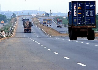
National Highway 19 is a national highway in India. It was previously referred to as Delhi–Kolkata Road and is one of the busiest national highways in India. After renumbering of national highways, Delhi to Agra route is now national highway 44 and Agra to Kolkata route is numbered national highway 19. It constitutes a major portion of the historical Grand Trunk Road. It is also part of AH1 of Asian Highway Network, that traverses from Japan to Turkey.
Singhrawan is a village in the Chauparan sub-district in the Hazaribagh district of Jharkhand state in India.
Charhi is a census town in the Churchu CD block in the Hazaribagh Sadar subdivision of the Hazaribagh district in the Indian state of Jharkhand.
The Trans-Haryana Expressway or the Ambala–Narnaul Expressway (NH-152D) is a 227-km long, 6-lane wide greenfield access-controlled expressway, connecting the cities of Ambala and Narnaul in the state of Haryana. The expressway connects Gangheri village in Kurukshetra district with Surana village on Narnaul Bypass (NH-148B) in Mahendragarh district. It passes via Kaul, Pundri, Assandh, Dhatrath, Kalanaur, Charkhi Dadri and Kanina. It will reduce the distance from Chandigarh to Delhi, Narnaul, and Jaipur, thus decongesting NH-44 and NH-48.
Varanasi–Kolkata Expressway, also known as Varanasi–Ranchi–Kolkata Expressway, and NH-319B, is an approved 610 km (380 mi) long, six-lane, greenfield access-controlled expressway, which will connect the spiritual city of Varanasi in Uttar Pradesh with the capital of West Bengal, Kolkata, through the capital of Jharkhand, Ranchi. It will run almost parallel to the Grand Trunk Road or the Asian Highway 1, and will pass through four states–Uttar Pradesh, Bihar, Jharkhand and West Bengal. The expressway is a part of Bharatmala Pariyojana, and it will reduce both travel time and distance, from 12-14 hours to only 6-7 hours, and from 690 km (430 mi) to 610 km (380 mi). It will start from Chandauli district in Uttar Pradesh, and will terminate near Uluberia, Howrah district, West Bengal.
