
The geography of Egypt relates to two regions: North Africa and West Asia.

The Sinai Peninsula, or simply Sinai, is a peninsula in Egypt, and the only part of the country located in Asia. It is between the Mediterranean Sea to the north and the Red Sea to the south, and is a land bridge between Asia and Africa. Sinai has a land area of about 60,000 km2 (23,000 sq mi) and a population of approximately 600,000 people. Administratively, the vast majority of the area of the Sinai Peninsula is divided into two governorates: the South Sinai Governorate and the North Sinai Governorate. Three other governorates span the Suez Canal, crossing into African Egypt: Suez Governorate on the southern end of the Suez Canal, Ismailia Governorate in the center, and Port Said Governorate in the north.
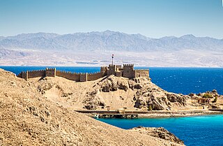
Taba is an Egyptian town near the northern tip of the Gulf of Aqaba. Taba is the location of Egypt's busiest border crossing with neighboring Eilat, Israel. It is the northernmost resort of Egypt's Red Sea Riviera.

The Gulf of Aqaba or Gulf of Eilat is a large gulf at the northern tip of the Red Sea, east of the Sinai Peninsula and west of the Arabian Peninsula. Its coastline is divided among four countries: Egypt, Israel, Jordan, and Saudi Arabia. The northernmost coral reef in the world is situated near the Eilat shore.

Sharm El Sheikh, alternatively rendered Sharm el-Sheikh, Sharm el Sheikh, or Sharm El-Sheikh, is an Egyptian city on the southern tip of the Sinai Peninsula, in South Sinai Governorate, on the coastal strip along the Red Sea. Its population is approximately 13,000 as of 2023. Sharm El Sheikh is the administrative hub of Egypt's South Sinai Governorate, which includes the smaller coastal towns of Dahab and Nuweiba as well as the mountainous interior, St. Catherine and Mount Sinai. It was historically a fishing town and military base, and was developed into a commercial and tourist-centric city in 1968 by Israel. Today, the city and holiday resort is a significant centre for tourism in Egypt, while also attracting many international conferences and diplomatic meetings.

South Sinai Governorate is the least populated governorate of Egypt. It is located in the east of the country, encompassing the southern half of the Sinai Peninsula. Saint Catherine's Monastery, an Eastern Orthodox Church monastery and UNESCO World Heritage Site of world renown, is located in the central part of the governorate.

Dahab is a small Egyptian town on the southeast coast of the Sinai Peninsula in Egypt, approximately 80 km (50 mi) northeast of Sharm el-Sheikh.
The 2005 Sharm El Sheikh bombings were committed by Islamist group Abdullah Azzam Brigades on 23 July 2005 in the Egyptian resort city of Sharm El Sheikh, at the southern tip of the Sinai Peninsula. Eighty-eight people were killed by the three bombings, the majority of them Egyptians, and over 200 were injured, making the attack the deadliest terrorist action in the history of Egypt, until it was surpassed by the 2017 Sinai mosque attack.

Marsa Alam is a tourist town in south-eastern Egypt, located on the western shore of the Red Sea. It is currently seeing fast increasing popularity as a tourist destination and development following the opening of Marsa Alam International Airport in 2003. Marsa Alam is considered one of the newly established towns, as its development began in 1995 through the investments of Kuwaiti Al-Kharafi Group, which Established the town with all its facilities, resorts and infrastructure, to make Marsa Alam one of the most attractive places in Egypt for tourism. The town is located on an area of 38,433 km2, 274 km south of Hurghada, and 134 km south of Qusayr, and its 60 meters above sea level. It is inhabited by about 11,497 residents.

Ras Muhammad is a national park in Egypt at the southern extreme of the Sinai Peninsula, overlooking the Gulf of Suez on the west and the Gulf of Aqaba to the east. The park is becoming a center of eco-tourism in the region.

The Red Sea Riviera, Egypt's eastern coastline along the Red Sea, consists of resort cities on the western shore of the Gulf of Aqaba and along the eastern coast of mainland Egypt, south of the Gulf of Suez. The combination of a favorable climate, warm sea, thousands of kilometers of shoreline, and abundant natural and archaeological points of interest makes this stretch of Egypt's coastline a popular national and international tourist destination. There are numerous National Parks along the Red Sea Riviera, both underwater and on land. Desert and marine life are protected by several laws, and visitors may be subject to heavy fines for not abiding.

Nuweiba is a coastal town in the eastern part of Sinai Peninsula, Egypt, located on the coast of the Gulf of Aqaba.

El Qoseir is a city in eastern Egypt, located on the Red Sea west coast. Populated for approximately 5,000 years, its ancient Egyptian name was Tjau, while its ancient Greek name during the Ptolemaic era was Myos Hormos. Historically, it was the endpoint of the Wadi Hammamat trail, an important route connecting Egypt and the Red Sea. El Qoseir is located 138 kilometers south of Hurghada, 130 km north of Marsa Alam and 68 km north of the Marsa Alam International Airport. In 1986, its population was approximately 20,000. Today, the population of El Qoseir is around 50,000.

Al-'Ain al-Sokhna is a town in the Suez Governorate, lying on the western shore of the Red Sea's Gulf of Suez. It is situated 55 kilometres (34 mi) south of Suez and approximately 120 kilometres (75 mi) east of Cairo.
Tourism is one of the leading sources of income, crucial to Egypt's economy. At its peak in 2010, the sector employed about 12% of workforce of Egypt, serving approximately 14.7 million visitors to Egypt, and providing revenues of nearly $12.5 billion as well as contributing more than 11% of GDP and 14.4% of foreign currency revenues.

Egypt essentially has a hot desert climate. The climate is generally extremely dry all over the country except on the northern Mediterranean coast which receives rainfall in winter. In addition to rarity of rain, extreme heat during summer months is also a general climate feature of Egypt although daytime temperatures are more moderated along the northern coast.
King Salman International University is a national (Ahleya), non-profit Egyptian university located in Sinai across three campuses in Ras Sedr, El Tor and Sharm El Sheikh. The university includes 13 faculties in different fields of study. It was established in August 2020 by a decision of Abdel Fattah El-Sisi, President of Egypt, and was named after Salman of Saudi Arabia.


