Red House Cone

Last updated • 1 min readFrom Wikipedia, The Free Encyclopedia
Red House Cone
Redhouseglasscone.jpg
Red House Cone
Red House Cone
Location Wordsley, Stourbridge, West Midlands, England
DesignerRichard Bradley and George Ensell
Height90 feet (27 m)
Completion date1794

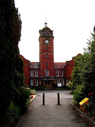
The Red House Cone as seen from the gates Redhouseglasscone.jpg
The Red House Cone as seen from the gates
Top of the cone, seen in 2021 Red House Glass Cone Cherry Picker - View from top of Cone (51102898536).jpg
Top of the cone, seen in 2021

The Red House Cone is a glass cone located in Wordsley in the West Midlands, adjacent to the Stourbridge Canal bridge on the A491 High Street. It is a 90-foot (27 m) high conical brick structure with a diameter of 60 feet (18 m), used for the production of glass. [1] It was used by the Stuart Crystal firm till 1936, [2] when the company moved to a new facility at Vine Street. [3] It is one of only four complete cones remaining in the United Kingdom. [4]

Contents

It is one of four such structures in the UK and is currently maintained as a museum by Dudley Council. (The other three cones are at Lemington, Catcliffe and Alloa). [5] At the site are 10 businesses including glass artists, pottery, jewellers, textiles fine art and demonstrations of glass blowing along with a Coffee House and gift shop. [6]

A 1-acre (4,000 m2) site, on which the cone stands, was sold by John and Ann Southwell and Rebecca Stokes to Richard Bradley, a wealthy glass-manufacturer, on 21 June 1788. The cone was built by Bradley in partnership with his brother-in-law, George Ensell, for the manufacture of window glass. [7] Ensell installed a moving lehr in the cone, which remains today and is the only surviving one in the world. [1]

The cone received Grade II* listed building status on 23 September 1966. [8] [9]

In April 2022, the Cone received a pledge of £1.5m from Dudley Council in order to restore the structure. [10] The restored cone was opened to the public in August 2024.

Representation in the media

The Red House Cone was featured in an episode of BBC Two's Great British Railway Journeys, in the episode Sarah Cordingley taught Michael Portillo how to make a lampwork bead. [11] [12]

Related Research Articles

<span class="mw-page-title-main">Stourbridge</span> Town in the West Midlands, England

Stourbridge is a market town in the Metropolitan Borough of Dudley in the West Midlands, England. Situated on the River Stour, the town lies around 10 miles west of Birmingham. Historically in Worcestershire, it was the centre of British glass making during the Industrial Revolution. The 2011 UK census recorded the town's population as 63,298.

<span class="mw-page-title-main">Metropolitan Borough of Dudley</span> Metropolitan borough in England

The Metropolitan Borough of Dudley is a metropolitan borough of West Midlands, England. It was created in 1974 following the Local Government Act 1972, through a merger of the existing Dudley County Borough with the municipal boroughs of Stourbridge and Halesowen.

<span class="mw-page-title-main">Brierley Hill</span> Town in the West Midlands, England

Brierley Hill is a town and electoral ward in the Metropolitan Borough of Dudley, West Midlands, England, 3 miles (4.8 km) south of Dudley and 1 mile (1.6 km) north of Stourbridge. Part of the Black Country and in a heavily industrialised area, it has a population of 13,935 at the 2011 census. It is best known for glass and steel manufacturing, although the industry has declined considerably since the 1970s. One of the largest factories in the area was the Round Oak Steelworks, which closed down and was redeveloped in the 1980s to become the Merry Hill Shopping Centre. Brierley Hill was originally in Staffordshire.

<span class="mw-page-title-main">Kingswinford</span> Human settlement in England

Kingswinford is a town of the Metropolitan Borough of Dudley in the English West Midlands, situated 5 miles (8 km) west-southwest of central Dudley. In 2011 the area had a population of 25,191, down from 25,808 at the 2001 Census.

<span class="mw-page-title-main">Amblecote</span> Village in the West Midlands, England

Amblecote is a village in the Metropolitan Borough of Dudley in the West Midlands, England. It lies immediately north of the historic town of Stourbridge on the southwestern edge of the West Midlands conurbation. Historically, Amblecote was in the parish of Oldswinford, but unlike the rest of the parish it was in Staffordshire, and as such was administered separately. It borders Audnam, Quarry Bank and Wollaston.

<span class="mw-page-title-main">Dudley South (UK Parliament constituency)</span> Parliamentary constituency in the United Kingdom, 1997–2024

Dudley South was a United Kingdom House of Commons constituency from 1997 until 2024.

<span class="mw-page-title-main">Wollaston, West Midlands</span> Village on the outskirts of Stourbridge in the English West Midlands

Wollaston is a village on the outskirts of Stourbridge, in the south of the Dudley district, in the county of the West Midlands, England. It is located one mile west of Stourbridge town centre.

Wordsley is a suburban village near Stourbridge in the West Midlands, England. It is part of the Metropolitan Borough of Dudley and is north of the River Stour. Wordsley is part of the Kingswinford and South Staffordshire Parliamentary constituency as of 2024. It is bordered by open Staffordshire countryside to the west, Kingswinford to the north, Brierley Hill to the east and Stourbridge to the south.

<span class="mw-page-title-main">Stourbridge Canal</span> Canal in England

The Stourbridge Canal is a canal in the West Midlands of England. It links the Staffordshire and Worcestershire Canal with the Dudley Canal, and hence, via the Birmingham Canal Navigations, to Birmingham and the Black Country.

Wall Heath is a suburban village in the Dudley Metropolitan Borough in the West Midlands of England. It is located on the A449 road, approximately 1.5 miles northwest of Kingswinford, 5 miles west of Dudley Town Centre and 9 miles north of Kidderminster. It forms part of the West Midlands-South Staffordshire border.

<span class="mw-page-title-main">Russells Hall Hospital</span> Hospital in England

Russells Hall Hospital is an NHS general hospital located in Dudley, West Midlands, England, managed by the Dudley Group NHS Foundation Trust. The hospital is south-west of the town centre on the A4101 road, which connects to the Kingswinford area of the borough.
<span class="mw-page-title-main">Wordsley Hospital</span> Hospital in West Midlands, England

Wordsley Hospital was an NHS hospital located in Wordsley, near Stourbridge, West Midlands, England.

<span class="mw-page-title-main">A491 road</span> Road in UK

The A491 is an A road in Zone 4 of the Great Britain numbering scheme.

<span class="mw-page-title-main">Delph Locks</span>

Delph Locks or the Delph Nine are a series of eight narrow canal locks on the Dudley No. 1 Canal in Brierley Hill, in the West Midlands, England. They were opened in 1779, and reopened in 1967 following restoration of the Dudley Canal and the Stourbridge Canal in a joint venture between the Staffordshire and Worcestershire Canal Society and the British Waterways Board.

<span class="mw-page-title-main">Catcliffe Glass Cone</span> Grade I listed building in the United Kingdom

The Catcliffe Glass Cone is a glass cone in the village of Catcliffe in South Yorkshire, England. It is the oldest surviving structure of its type in Western Europe, and it is a Grade I listed building and Scheduled Ancient Monument. Only three other glass cones survive in the United Kingdom; at Lemington, Wordsley and Alloa.

<span class="mw-page-title-main">Broadfield House Glass Museum</span> Art, craft and social history museum in Kingswinford, West Midlands

Broadfield House, a Grade II listed building, was home to a glass museum and hot glass studio, owned and operated by Dudley Council museum service and was located in Kingswinford, West Midlands, England. The museum closed on 30 September 2015.

<span class="mw-page-title-main">2016 Dudley Metropolitan Borough Council election</span> 2016 local election in England, UK

The 2016 Dudley Metropolitan Borough Council election took place on 5 May 2016 to elect a third of the members of Dudley Metropolitan Borough Council in England. This was on the same day as other local elections.

A glass cone is a glass production structure historically unique to the United Kingdom. A glass cone had a large central furnace, a circular platform where the glassblowers worked, and smaller furnaces around its wall to ensure the glass did not cool too quickly.

<span class="mw-page-title-main">Dudley Council House</span> Municipal building in Dudley, West Midlands, England

Dudley Council House is a municipal building in Priory Road, Dudley, West Midlands, England. The Council House, which is the meeting place of Dudley Metropolitan Borough Council is a Grade II listed building.

References

  1. 1 2 Jason Ellis (2003). Glassmakers of Stourbridge and Dudley 1612-2002: A Biographical History of a Once Great Industry. Xlibris Corporation. ISBN   1-4010-6798-0.
  2. John Butt; Ian L. Donnachie (1979). Industrial Archaeology in the British Isles. Paul Elek Incorporated. ISBN   0-236-40157-2.
  3. BBC Legacies: Red House Cone, Chris Upton (page 4)
  4. Dudley Metropolitan Borough Council: Red House Glass Cone
  5. Trinder, Barrie. Industrial Heritage of Britain (1992 ed.). AA. p. 12.
  6. Red House Glass Cone entry on Culture24 Retrieved 9 December 2009
  7. Trafford, John (15 May 2019). "The history of the Cones: Wordsley". Black Country Bugle. Retrieved 16 April 2023.
  8. Historic England. "Details from listed building database (1076007)". National Heritage List for England . Retrieved 30 March 2008.
  9. Historic England. "Glass Cone At Stuart And Sons Red House Glassworks (Grade II*) (1076007)". National Heritage List for England . Retrieved 8 October 2013.
  10. "£1.5m pledged to restore Red House Glass Cone at Wordsley". Stourbridge News. Retrieved 7 May 2022.
  11. "Dudley borough features on Michael Portillo's TV train show". Dudley News. Retrieved 13 June 2017.
  12. Auraunul (12 January 2013), Stourbridge - Great British Railway Journeys, archived from the original on 13 January 2013, retrieved 13 June 2017

52°28′34″N2°09′26″W / 52.476168°N 2.157235°W / 52.476168; -2.157235