
Los Lagos Region is one of Chile's 16 regions, which are first order administrative divisions, and comprises four provinces: Chiloé, Llanquihue, Osorno and Palena. The region contains the country's second-largest island, Chiloé, and the second-largest lake, Llanquihue. Its capital is Puerto Montt; other important cities include Osorno, Castro, Ancud, and Puerto Varas. Los Lagos Region is considered part of Patagonia.

Puyehue Lake, is an Andean piedmont lake on the border of Los Lagos Region with Los Ríos Region of Chile.
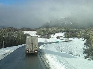
Cardenal Antonio Samoré Pass is one of the main mountain passes through the southern Andes along the border between Argentina and Chile.
Entre Lagos is the main town of Puyehue commune in Osorno Province of Los Lagos Region, Chile. It is 46 km (29 mi) east of Osorno, next to the entrance of the Pilmaiquén River at the western end of Puyehue Lake. It is the only town of any size on the lake.

The Puyehue Hot Springs is a series of hot springs located 76 kilometers along Route 215-CH east of Osorno, a city 20 kilometers from Puerto Montt in the Los Lagos Region of southern Chile.

The 2011–2012 Puyehue-Cordón Caulle eruption was a volcanic eruption that began in the Puyehue-Cordón Caulle volcanic complex in Chile on 4 June 2011. The eruption, which occurred from the Cordón Caulle fissure after 51 years of the volcano being inactive, is one of the largest volcanic eruptions of the 21st century thus far. At least 3,500 people were evacuated from nearby areas, while the ash cloud was blown across cities all around the Southern hemisphere, including Bariloche, Buenos Aires, Montevideo, Stanley, Porto Alegre, Cape Town, Hobart, Perth, Adelaide, Sydney, Melbourne, Wellington, Auckland and Port Moresby, forcing airlines to cancel hundreds of international and domestic flights and causing travel chaos.

Concón Airport is an airport serving Greater Valparaíso, Chile. The airport is in the hills 4 kilometres (2.5 mi) east of the coastal commune of Concón. It mainly serves as a military air base for the Chilean Navy aviation, but also has a small civilian passenger terminal; this is however only rarely used.
Gamboa Airport is an airport serving Castro, a city on Chiloé Island in the Los Lagos Region of Chile.

Mocopulli Airport is an airport serving Dalcahue, a port city on Chiloé Island in the Los Lagos Region of Chile, as well as the city of Castro. The airport is 6 kilometres (3.7 mi) northwest of Dalcahue.
Tolhuin Lago Fagnano Airport is a public use airport located 2 kilometres (1 mi) northeast of Tolhuin, a lakeside village in the Tierra del Fuego Province of Argentina.
Alto Palena Airport is an airport serving Palena, a small town in the mountains of the Los Lagos Region of Chile. Palena is 5 kilometres (3.1 mi) from the Argentina border. The airport is just north of the town, and south of a bend in the Palena River.
Pupelde Airport is an airport serving Ancud, a Pacific port city in the Los Lagos Region of Chile. Ancud is on the northern shore of Chiloé Island.
Chaitén Airfield was an airport serving Chaitén, a town in the Los Lagos Region of Chile. The airport was damaged and closed after the 2008 eruption of Chaitén Volcano.
Frutillar Airport is an airport serving Frutillar, a town at the western end of Llanquihue Lake in the Los Lagos Region of Chile.
Futaleufú Airfield is an airport serving Futaleufú, a town in the Los Lagos Region of Chile.
Lago Brown Airport is an airstrip at the western end of Lago Brown (es), a mountain lake in the Aysén Region of Chile that runs along the border with Argentina.
Juan Kemp Airport, is an airstrip on the southern shore of Rupanco Lake in the Los Lagos Region of Chile. The nearest town is Entre Lagos, 30 kilometres (19 mi) northwest on neighboring Puyehue Lake.
El Mirador Airport, is an airport just southeast of Puerto Varas, a city in the Los Lagos Region of Chile. Puerto Varas is on the southwest shore of Llanquihue Lake.
Licán Airport is an airstrip 17 kilometres (11 mi) east-northeast of Entre Lagos, a town in the Los Lagos Region of Chile. The airstrip is on the small delta of the Licán River on the north shore of Lake Puyehue.

The Aguas Calientes Hot Springs is a series of hot springs located 76 kilometers near Route 215-CH east of Osorno in Los Lagos Region of southern Chile.

