Reinforced-Concrete Highway Bridges in Minnesota MPS

Last updated

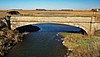
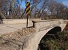
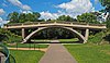
Reinforced-Concrete Highway Bridges in Minnesota MPS is a Multiple Property Submission of bridges listed on the National Register of Historic Places in Minnesota. The submission includes 20 individual bridges. It also includes the Chicago, Milwaukee and St. Paul Railroad Grade Separation, which comprises 30 bridges built over the Milwaukee Road tracks one block north of Lake Street in Minneapolis. [1] The submission traces the historical context of reinforced concrete bridge building in Minnesota and cites examples of early and historic bridges. [2]

The submission establishes criteria for bridges to be listed on the National Register. The National Register contains four primary criteria:

The MPS also documents several eras that were important in reinforced-concrete bridge construction:

The Franklin Avenue Bridge and the Mendota Bridge are listed in the MPS as examples of monumental concrete arch bridge construction, but these bridges were listed on the National Register before the MPS was submitted.

Landmark nameImageDate listedLocationCity or TownSummary
1 Bridge No. 3355-Kathio Township Bridge 3355.jpg June 29, 1998US-169 over Whitefish Cr.
46°12′56″N93°47′33″W / 46.21556°N 93.79250°W / 46.21556; -93.79250 (Bridge No. 3355--Kathio Township)
Kathio Township
2 Bridge No. 3589-Silver Creek Township Stewart Bridge 001.JPG June 29, 1998US-61 over Stewart R.
47°2′59″N91°37′50″W / 47.04972°N 91.63056°W / 47.04972; -91.63056 (Bridge No. 3589--Silver Creek Township)
Silver Creek Township
3 Bridge No. 5083-Marshall Bridge No. 5083.jpg June 29, 1998MN 19 over Redwood R.
44°26′58″N95°47′6″W / 44.44944°N 95.78500°W / 44.44944; -95.78500 (Bridge No. 5083--Marshall)
Marshall
4 Bridge No. 5151-Marshall BridgeNo5151Marshall.jpg June 29, 1998MN 19 over Redwood R.
44°26′35″N95°47′58″W / 44.44306°N 95.79944°W / 44.44306; -95.79944 (Bridge No. 5151--Marshall)
Marshall
5 Bridge No. 8096 Bridge 8096.jpg June 26, 1998MN 19 over Spring Cr.
44°27′51″N93°9′13″W / 44.46417°N 93.15361°W / 44.46417; -93.15361 (Bridge No. 8096)
Northfield
6 Bridge No. L-2162 Bridge No. L-2162.jpg November 6, 1989Co. Rd. 51 over Split Rock Creek
43°46′46″N96°25′54″W / 43.77944°N 96.43167°W / 43.77944; -96.43167 (Bridge No. L-2162)
Jasper
7 Bridge No. L-2315 November 6, 1989Twp. Rd. 89 over Rock River
43°33′21″N96°9′9″W / 43.55583°N 96.15250°W / 43.55583; -96.15250 (Bridge No. L-2315)
Luverne
8 Bridge No. L-2316 November 6, 1989Twp. Rd. 89 over Rock River
43°33′31″N96°9′9″W / 43.55861°N 96.15250°W / 43.55861; -96.15250 (Bridge No. L-2316)
Luverne
9 Bridge No. L-4646 Bridge No. L-4646.jpg November 6, 1989Sixth St. over Spring Brook
43°36′55″N96°21′34″W / 43.61528°N 96.35944°W / 43.61528; -96.35944 (Bridge No. L-4646)
Beaver Creek
10 Bridges No. L-5853 and 92247 Bridge L-5853 restored.jpg
Bridge 92247 2020.jpg
November 6, 1989Lexington Ave. in Como Park
44°58′42″N93°8′47″W / 44.97833°N 93.14639°W / 44.97833; -93.14639 (Bridges No. L-5853 and 92247)
St. Paul Early reinforced-concrete bridges built using the Melan system for reinforcement [2]
11 Broadway Bridge 2009-0805-MN-StPeter-BroadwayBridge.jpg August 5, 1999MN 99 over Minnesota River, Oshawa Twp.
44°19′29″N93°57′10″W / 44.32472°N 93.95278°W / 44.32472; -93.95278 (Broadway Bridge)
Saint Peter
12 Cedar Avenue Bridge Cedar Avenue Bridge Minneapolis.jpg November 6, 1989Tenth Ave. over Mississippi River
44°58′31″N93°14′45″W / 44.97528°N 93.24583°W / 44.97528; -93.24583 (Cedar Avenue Bridge)
Minneapolis
13 Chicago, Milwaukee and St. Paul Railroad Grade Separation MidtownGreenwayTrail6.jpg June 1, 2005Parallel to 29th St. between Humboldt & 20th Aves. S.
44°57′3″N93°16′18″W / 44.95083°N 93.27167°W / 44.95083; -93.27167 (Chicago, Milwaukee and St. Paul Railroad Grade Separation)
Minneapolis
14 Faribault Viaduct Faribault Viaduct.jpg November 6, 1989Division St. over Straight River
44°17′27″N93°16′0″W / 44.29083°N 93.26667°W / 44.29083; -93.26667 (Faribault Viaduct)
Faribault
15 Intercity Bridge Ford Parkway.jpg November 6, 1989Ford Pkwy. over Mississippi River
44°55′4″N93°12′14″W / 44.91778°N 93.20389°W / 44.91778; -93.20389 (Intercity Bridge)
St. Paul
16 Interlachen Bridge Interlachen Bridge 1.jpg November 6, 1989William Berry Dr. over Minnesota Transportation Museum street railway track in William Berry Park
44°55′53″N93°18′31″W / 44.93139°N 93.30861°W / 44.93139; -93.30861 (Interlachen Bridge)
Minneapolis
17 Lester River Bridge-Bridge No. 5772 Lester River bridge.jpg September 6, 2002London Rd. over the Lester R.
46°50′12″N92°0′22″W / 46.83667°N 92.00611°W / 46.83667; -92.00611 (Lester River Bridge--Bridge No. 5772)
Duluth
18 Nymore Bridge Nymore Bridge.jpg November 6, 1989First St. over Mississippi River
47°28′1″N94°52′42″W / 47.46694°N 94.87833°W / 47.46694; -94.87833 (Nymore Bridge)
Bemidji
19 Queen Avenue Bridge Queen Ave Bridge.jpg November 6, 1989W. Lake Harriet Blvd. over Minnesota Transportation Museum street railway track
44°55′28″N93°18′40″W / 44.92444°N 93.31111°W / 44.92444; -93.31111 (Queen Avenue Bridge)
Minneapolis
20 Robert Street Bridge Robert Street Bridge.jpg November 6, 1989Robert St. over Mississippi River
44°56′41″N93°5′17″W / 44.94472°N 93.08806°W / 44.94472; -93.08806 (Robert Street Bridge)
St. Paul

References

  1. "National Register Information System". National Register of Historic Places . National Park Service. April 15, 2008.
  2. 1 2 3 4 5 6 "Reinforced-Concrete Highway Bridges in Minnesota". Minnesota Historical Society. September 22, 1989. Retrieved January 20, 2009.