Retzow

Last updated
Retzow
Location of Retzow within Havelland district
Retzow in HVL.png
Germany adm location map.svg
Red pog.svg
Retzow
Brandenburg location map.svg
Red pog.svg
Retzow
Coordinates: 52°38′N12°42′E / 52.633°N 12.700°E / 52.633; 12.700 Coordinates: 52°38′N12°42′E / 52.633°N 12.700°E / 52.633; 12.700
Country Germany
State Brandenburg
District Havelland
Municipal assoc. Friesack
Government
   Mayor (201924) Heinrich Stumpp [1]
Area
  Total14.73 km2 (5.69 sq mi)
Elevation
39 m (128 ft)
Population
 (2021-12-31) [2]
  Total521
  Density35/km2 (92/sq mi)
Time zone UTC+01:00 (CET)
  Summer (DST) UTC+02:00 (CEST)
Postal codes
14641
Dialling codes 033237
Vehicle registration HVL
Website www.amt-friesack.de

Retzow is a municipality in the Havelland district, in Brandenburg, Germany.

Demography

Development of population since 1875 within the current boundaries (Blue line: Population; Dotted line: Comparison to population development of Brandenburg state; Grey background: Time of Nazi rule; Red background: Time of communist rule) Bevolkerungsentwicklung Retzow.pdf
Development of population since 1875 within the current boundaries (Blue line: Population; Dotted line: Comparison to population development of Brandenburg state; Grey background: Time of Nazi rule; Red background: Time of communist rule)
Retzow: Population development
within the current boundaries (2013) [3]
YearPop.±% p.a.
1875 537    
1890 540+0.04%
1910 562+0.20%
1925 642+0.89%
1933 573−1.41%
1939 503−2.15%
1946 1,000+10.31%
1950 966−0.86%
1964 696−2.31%
1971 675−0.44%
1981 554−1.96%
1985 573+0.85%
1989 569−0.17%
1990 563−1.05%
1991 584+3.73%
1992 569−2.57%
1993 577+1.41%
1994 582+0.87%
1995 588+1.03%
1996 603+2.55%
YearPop.±% p.a.
1997 600−0.50%
1998 587−2.17%
1999 586−0.17%
2000 586+0.00%
2001 600+2.39%
2002 606+1.00%
2003 602−0.66%
2004 591−1.83%
2005 585−1.02%
2006 580−0.85%
2007 573−1.21%
2008 571−0.35%
2009 562−1.58%
2010 568+1.07%
2011 552−2.82%
2012 527−4.53%
2013 529+0.38%
2014 518−2.08%
2015 518+0.00%
2016 511−1.35%

Related Research Articles

<span class="mw-page-title-main">Havelland (district)</span> District in Brandenburg, Germany

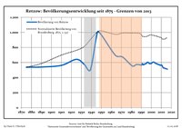
Havelland is a district or county in Brandenburg, Germany. It is bounded by the districts of Ostprignitz-Ruppin and Oberhavel, the city-state of Berlin, the district of Potsdam-Mittelmark, the city of Brandenburg and the state of Saxony-Anhalt.

<span class="mw-page-title-main">Nauen</span> Town in Brandenburg, Germany

Nauen is a small town in the Havelland district, in Brandenburg, Germany. It is chiefly known for Nauen Transmitter Station, the world's oldest preserved radio transmitting installation.

<span class="mw-page-title-main">Friesack</span> Town in Brandenburg, Germany

Friesack is a town in the Havelland district, in Brandenburg, Germany. It is situated 22 km (14 mi) northeast of Rathenow, and 25 km (16 mi) southwest of Neuruppin. It is known for its Mesolithic archaeological site.

<span class="mw-page-title-main">Ketzin</span> Town in Brandenburg, Germany

Ketzin is a town in the Havelland district, in Brandenburg, Germany. It is situated on the river Havel, 17 km northwest of Potsdam, and 40 km west of Berlin.

<span class="mw-page-title-main">Brieselang</span> Municipality in Brandenburg, Germany

Brieselang is a municipality in the Havelland district, in Brandenburg, Germany.

<span class="mw-page-title-main">Dallgow-Döberitz</span> Municipality in Brandenburg, Germany

Dallgow-Döberitz is a municipality in the Havelland district, in Brandenburg, Germany.

<span class="mw-page-title-main">Großderschau</span> Municipality in Brandenburg, Germany

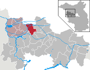
Großderschau is a municipality in the Havelland district, in Brandenburg, Germany. The Dosse river runs past the town.

<span class="mw-page-title-main">Havelaue</span> Municipality in Brandenburg, Germany

Havelaue is a municipality in the Havelland district, in Brandenburg, Germany.

<span class="mw-page-title-main">Kleßen-Görne</span> Municipality in Brandenburg, Germany

Kleßen-Görne is a municipality in the Havelland district, in Brandenburg, Germany.

<span class="mw-page-title-main">Kotzen</span> Municipality in Brandenburg, Germany

Kotzen is a municipality in the Havelland district, in Brandenburg, Germany.

<span class="mw-page-title-main">Märkisch Luch</span> Municipality in Brandenburg, Germany

Märkisch Luch is a municipality in the Havelland district, in Brandenburg, Germany.

<span class="mw-page-title-main">Milower Land</span> Municipality in Brandenburg, Germany

Milower Land is a municipality in the Havelland district, in Brandenburg, Germany.

<span class="mw-page-title-main">Mühlenberge</span> Municipality in Brandenburg, Germany

Mühlenberge is a municipality in the Havelland district, in Brandenburg, Germany.

<span class="mw-page-title-main">Nennhausen</span> Municipality in Brandenburg, Germany

Nennhausen is a municipality in the Havelland district, in Brandenburg, Germany. It consists of the Ortsteile (villages) Bamme, Buckow, Damme, Gräningen, Liepe and Mützlitz.

<span class="mw-page-title-main">Paulinenaue</span> Municipality in Brandenburg, Germany

Paulinenaue is a municipality in the Havelland district, in Brandenburg, Germany.

<span class="mw-page-title-main">Pessin</span> Municipality in Brandenburg, Germany

Pessin is a municipality in the Havelland district, in Brandenburg, Germany.

<span class="mw-page-title-main">Seeblick</span> Municipality in Brandenburg, Germany

Seeblick is a municipality in the Havelland district, in Brandenburg, Germany.

<span class="mw-page-title-main">Stechow-Ferchesar</span> Municipality in Brandenburg, Germany

Stechow-Ferchesar is a municipality in the Havelland district, in Brandenburg, Germany.

<span class="mw-page-title-main">Wiesenaue</span> Municipality in Brandenburg, Germany

Wiesenaue is a municipality in the Havelland district, in Brandenburg, Germany.

<span class="mw-page-title-main">Wustermark</span> Municipality in Brandenburg, Germany

Wustermark is a municipality of the Havelland district, in Brandenburg, Germany.

References

  1. Landkreis Havelland Wahl der Bürgermeisterin / des Bürgermeisters, accessed 1 July 2021.
  2. "Bevölkerungsentwicklung und Flächen der kreisfreien Städte, Landkreise und Gemeinden im Land Brandenburg 2021" (PDF). Amt für Statistik Berlin-Brandenburg (in German). June 2022.
  3. Detailed data sources are to be found in the Wikimedia Commons.Population Projection Brandenburg at Wikimedia Commons