Reynoldsville, Illinois

Last updated
Reynoldsville
Reynoldsville, Illinois, Illinois Route 3 sign.jpg
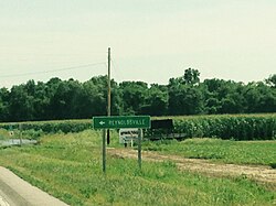
Illinois Route 3 roadsign
USA Illinois location map.svg
Red pog.svg
Reynoldsville
Location of Reynoldsville within Illinois
Coordinates: 37°22′02″N89°23′42″W / 37.36722°N 89.39500°W / 37.36722; -89.39500 Coordinates: 37°22′02″N89°23′42″W / 37.36722°N 89.39500°W / 37.36722; -89.39500
CountryUnited States
StateIllinois
County Union
Elevation
[1]
341 ft (104 m)
Time zone UTC-6 (CST)
  Summer (DST) UTC-5 (CDT)
Postal code
62952
Area code(s) 618

Reynoldsville is an unincorporated community in Union County, Illinois, United States. The community is along Illinois Route 3 and 146, just north of McClure and across the Mississippi River from Cape Girardeau, Missouri.

Gospel of the Kingdom church Reynoldsville, Illinois, Gospel of the Kingdom church.jpg
Gospel of the Kingdom church

The unincorporated community has a major railroad passing through. A fishing lake, Lyerla Lake, is just to the east. Kornthal Church from 1852 is located in the community and Old Cape Road connects with Illinois Route 127.

Notes

  1. "USGS detail on Newtown" . Retrieved 2007-10-21.


Related Research Articles

Buffalo Grove, Illinois Village in Illinois, United States

Buffalo Grove is a village in Lake and Cook counties in the U.S. state of Illinois, within the northwest suburbs of Chicago.

Pulaski may refer to:

Long Point may refer to:

Mossville, Illinois Unincorporated community in Illinois, United States

Mossville is an unincorporated community between Peoria and Chillicothe in Peoria County, Illinois, United States. Mossville is part of the Peoria, Illinois Metropolitan Statistical Area and resides closely to the northern part of Peoria. Centered on the Illinois River valley and the end of Illinois Route 6 at Illinois Route 29, Mossville informally encompasses a number of different neighborhoods along the valley: Renchville, Brookview, a cluster of houses along the Illinois River referred to as "The Lanes", and Cedar Hills Estates, as well as the unincorporated village of 900 that can be considered Mossville proper. The Lake of the Woods subdivision, as well as Colony Point, both on the west bluff of the Illinois River valley overlooking Mossville, can also be considered to be part of the greater Mossville area. It was previously served by the Rock Island Line at Mossville Station.

Rondout, Illinois Unincorporated community in Illinois, United States

Rondout is an unincorporated community in Lake County, Illinois, United States that first formed around a railroad junction. The area is located within Libertyville Township. As Rondout is an unincorporated community rather than a municipality, it lacks clearly defined borders, and shares postal codes with Lake Bluff, Lake Forest and Libertyville, Illinois. It has its own elementary school which comes under Rondout School District 72. Illinois Route 176 passes east–west through Rondout, serving as the "main street" of the community, where it is also called "Rockland Road".

Marblehead, Illinois Unincorporated community in Illinois, United States

Marblehead is an unincorporated community in Adams County, Illinois, United States, just south of Quincy. Illinois State Route 57 is the main auxiliary route through the town and travels north to the business district of Quincy or south to Interstate 72.

Rosecrans, Illinois Unincorporated place in Illinois, United States

Rosecrans is an unincorporated community along Rosecrans Road just west of U.S. Route 41 in northern Lake County, Illinois, 2.0 miles (3.2 km) south of the Wisconsin state line and 7.8 miles (12.6 km) west of Lake Michigan. The community is named for American Civil War General William Starke Rosecrans. The business district is at the intersection of IL 173 and US 41, east of the residential community.

Wolf Lake, Illinois Unincorporated community in Illinois, United States

Wolf Lake is an unincorporated community in Union County, Illinois, United States. The community is located on Illinois Route 3 between Aldridge to the north and Ware to the south. It is about 3 miles (4.8 km) east of the Mississippi River. The nearest incorporated city to Wolf Lake is Jonesboro, which is about 10 miles (16 km) southeast. Cape Girardeau, Missouri is about 10 miles (16 km) to the south-southeast.

Savoy, Arkansas Unincorporated community in Arkansas, United States

Savoy is an unincorporated community in Litteral Township, Washington County, Arkansas, United States. It is located on County Route 845 east of Lake Wedington. The Ozark National Forest is just west of the community. The Savoy area is marked with bluffs and streams. A distinctive feature is the dam on Clear Creek where a flour mill was once in operation. Savoy had a post office and businesses that no longer exist.

Wildwood, Illinois Unincorporated community in Illinois, United States

Wildwood is an unincorporated community along Belvidere Road just east of U.S. Route 45 in Lake County, Illinois. Wildwood is part of the Gages Lake census-designated place and is bordered by Gages Lake Road to the north, Gurnee to the northeast and east, Libertyville to the south, and Grayslake to the west.

North Carolina Highway 210 highway in North Carolina

North Carolina Highway 210 is a 192-mile-long (309 km) primary state highway in the U.S. state of North Carolina that connects settlements in the Atlantic Coastal Plain region. Due to its meandering route NC 210 changes directional orientation three times, changing from east-west to north-south at Old Stage Road east of Angier, then changing from north-south to west-east at the Bladen–Pender county line. The route traverses through central Fayetteville and the Fort Bragg Army installation and crosses both Topsail Island access bridges over the Atlantic Intracoastal Waterway. Owing primarily to its meandering route, NC 210 is the sixth longest state highway in North Carolina.

Keeneyville, Illinois Unincorporated community in Illinois, United States

Keeneyville is an unincorporated community in DuPage County, Illinois, United States. Keeneyville is located in Bloomingdale Township, along the southern borders of Hanover Park and Roselle on Gary Avenue, just south of Lake Street.

Diamond Lake, Illinois Unincorporated community in Illinois, United States

Diamond Lake is an unincorporated community in Lake County, Illinois, United States. Diamond Lake is located along Illinois Route 60 and Illinois Route 83, north of Long Grove and south of Mundelein.

Fremont Center, Illinois Unincorporated community in Illinois, United States

Fremont Center is an unincorporated community in Fremont Township, Lake County, Illinois, United States. Fremont Center is located at the junction of Illinois Route 60 and County Route 65V, 4.3 miles (6.9 km) west-northwest of downtown Mundelein.

Monaville, Illinois Unincorporated community in Illinois, United States

Monaville is an unincorporated community in Lake Villa Township, Lake County, Illinois, United States. Monaville is located at the junction of County Routes 18A and 65V near the southern border of Lake Villa.

Loon Lake, Illinois Unincorporated community in Illinois, United States

Loon Lake is an unincorporated community in Antioch Township, Lake County, Illinois, United States. Loon Lake is located at the junction of Illinois Route 83 and County Route 10A on the northern border of Lake Villa.

West Miltmore, Illinois Unincorporated community in Illinois, United States

West Miltmore is an unincorporated community in Lake Villa Township, Lake County, Illinois, United States. West Miltmore is located on County Route 18A near the northern border of Round Lake Beach. It is included in the Venetian Village census-designated place.

Grass Lake, Illinois Unincorporated community in Illinois, United States

Grass Lake is an unincorporated community in Antioch Township, Lake County, Illinois, United States. Grass Lake is located on County Route A10, 3 miles (4.8 km) southwest of Antioch.

Crump is an unincorporated community in western Cape Girardeau County, in the U.S. state of Missouri.

Reily Lake, Illinois Unincorporated community in Illinois, United States

Reily Lake is an unincorporated community in Randolph County, Illinois, United States. The community is on the Mississippi River and County Route 6 7 miles (11 km) northwest of Chester.