Bureau Junction, usually called Bureau, is a village in Bureau County, Illinois, United States. The population was 281 at the 2020 census. The village name is shown as both "Bureau Junction" and "Bureau" on federal maps, and is commonly called "Bureau", including by phone companies and the United States Post Office. It is part of the Ottawa Micropolitan Statistical Area. Bureau Junction was the point where the Rock Island Line railroad's branch line to Peoria split. Track west and south of Bureau is operated by Iowa Interstate, while tracks east to Chicago were formerly operated by CSX but are currently leased to Iowa Interstate.

Sailor Springs is a village in Clay County, Illinois, United States. The population was 89 at the 2020 census.

Hanaford is a village in Franklin County, Illinois, United States. The population was 320 at the 2020 census. Hanaford is also known as Logan.
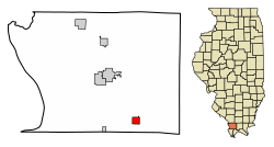
Valier is a village in Franklin County, Illinois, United States. The population was 554 at the 2020 census.

Campbell Hill is a village in Jackson County, Illinois, United States. The population was 309 at the 2020 census.

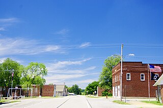
Elkville is a village in Jackson County, Illinois, United States. The population was 928 at the 2010 census, down from 1,001 at the 2000 census. As of 2018 the estimated population was 871.

Gorham is a village in Jackson County, Illinois, United States. The population was 236 at the 2010 census. It is known locally for its near-annihilation during the deadly Tri-State Tornado of 1925.

Cypress is a village in Johnson County, Illinois, United States. The population was 217 at the 2020 census.
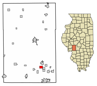
Mount Clare is a village in Macoupin County, Illinois, United States. Its population was 311 at the 2020 census.

Standard City is a village in Macoupin County, Illinois, United States. The population was 135 at the 2020 census.

St. Jacob or Saint Jacob is a village in Madison County, Illinois, United States. The population was 1,358 at the 2020 census, up from 1,098 in 2010.

Ullin is a village in Pulaski County, Illinois, United States. The population was 466 at the 2020 census.
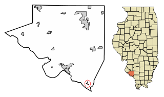
Rockwood is a village in Randolph County, Illinois, United States. The population was 32 at the 2020 census. It is the headquarters of the Middle Mississippi River National Wildlife Refuge.

Galatia is a village in Saline County, Illinois, in the United States. As of the 2010 census, the village population was 933.

Bush is a village in Williamson County, Illinois, United States. As of the 2000 census, the village population was 257.
Cambria is a village in northwestern Williamson County, Illinois, United States. The population was 1,228 at the 2010 census.

Colp is a village in Williamson County, Illinois, United States. The population was 225 at the 2010 census.

Crainville is a village in Williamson County, Illinois, United States. The population was 1,254 at the 2010 census.

Muscoda is a town in Grant County, Wisconsin, United States. The population was 674 at the 2000 census. The Village of Muscoda is located partially within the town.

Aniwa is a town in Shawano County, Wisconsin, United States. The population was 586 at the 2000 census. The Village of Aniwa is located within the town.