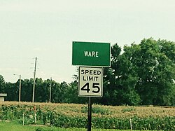
Ware, Illinois

Last updated
Ware
Ware, Illinois, town sign.jpg
Highway 3 sign
USA Illinois location map.svg
Red pog.svg
Ware
Location of Ware within Illinois
Coordinates: 37°26′52″N89°23′38″W / 37.44778°N 89.39389°W / 37.44778; -89.39389 Coordinates: 37°26′52″N89°23′38″W / 37.44778°N 89.39389°W / 37.44778; -89.39389
CountryUnited States
StateIllinois
County Union
Elevation
[1]
351 ft (107 m)
Time zone UTC-6 (CST)
  Summer (DST) UTC-5 (CDT)
Postal code
62952
Area code(s) 618

Ware is an unincorporated community in Union County, Illinois, and is located near Jonesboro.

Contents

History

The earliest inhabitants of the area around Ware were of Late Woodland and Mississippian cultures. A village with four mounds was occupied between around 800 and 1300 A.D. One of the four mounds was destroyed in the construction of Illinois Route 3. [2] The Ware Mounds and Village Site is situated just west of Ware. In January 1839, thousands of Cherokee Indians being forcibly relocated from their lands in Georgia to Indian Territory (Oklahoma) passed through Ware. Because of floating ice the Cherokee were unable to cross the Mississippi River and camped along Dutch Creek. The intense cold at this time led to many deaths. [3]

Community

Ware Baptist Church Ware, Illinois, Ware Baptist Church.jpg
Ware Baptist Church

The Illinois Central Railroad and Illinois Route 3 pass through Ware, Illinois, connecting the community to the rest of the state. Two churches, Ware Baptist Church and Ware United Methodist Church, provide religious services. [4]

2000 Census

As of Census 2000, the population is 3,422 [5] It is named for politician and farmer Jesse Ware. [6]

Notes

  1. "USGS detail on Ware" . Retrieved 2007-10-21.
  2. Philip Phillips (2003). Archaeological Survey in the Lower Mississippi Alluvial Valley 1940-1947. ISBN   9780817350222.
  3. "Illinois Historical Markers by County" . Retrieved 2015-07-15.
  4. "ShawneeHeartland.com" . Retrieved 2015-07-15.
  5. "Census Population for 62952". Archived from the original on 2020-02-12. Retrieved 2007-11-17.
  6. Adams, Jane H. (1994). The Transformation of Rural Life: Southern Illinois, 1890-1990. Chapel Hill, NC: University of North Carolina Press. p. 21.


Related Research Articles

Lawrence County, Alabama U.S. county in Alabama

Lawrence County is a county in the northern part of the U.S. state of Alabama. As of the 2010 census, the population was 34,339. This county has the highest number of residents who identify as Native American of any county in the state. The county seat is Moulton. The county was named after James Lawrence, a captain in the United States Navy from New Jersey.

Rock Island County, Illinois County in Illinois

Rock Island County is a county located in the U.S. state of Illinois, bounded on the west by the Mississippi River. According to the 2010 census, it had a population of 147,546. Its county seat is Rock Island; its largest city is neighboring Moline.

Monroe County, Illinois County in Illinois

Monroe County is a county located in the U.S. state of Illinois. According to the 2010 census, it had a population of 32,957. Its county seat and largest city is Waterloo.

Calhoun County, Illinois County in Illinois

Calhoun County is a county in the U.S. state of Illinois. As of the 2010 census, the population was 5,089, making it Illinois’ third-least populous county. Its county seat and biggest community is Hardin, with a population of 2,000. Its smallest incorporated community is Hamburg, with a population of 123. Calhoun County is at the tip of the peninsula formed by the courses of the Mississippi and Illinois rivers above their confluence and is almost completely surrounded by water. Calhoun County is sparsely populated; it has just five municipalities, all of them villages.

Alexander County, Illinois County in Illinois

Alexander County is the southernmost county of the U.S. state of Illinois. As of the 2010 census, the population was 8,238. Its county seat is Cairo and its western boundary is formed by the Mississippi River.

Towns County, Georgia County in Georgia, United States

Towns County is a county located in the northeastern part of the U.S. state of Georgia. As of the 2010 census, the population was 10,471. Its county seat is Hiawassee. The county was created on March 6, 1856 and named for United States lawyer, legislator, and politician George W. Towns.

Quincy, Illinois City in Illinois, United States

Quincy, known as Illinois's "Gem City", is a city in and the county seat of Adams County, Illinois, United States, located on the Mississippi River. The 2010 census counted a population of 40,633 in the city itself, up from 40,366 in 2000. As of July 1, 2015, the Quincy Micro Area had an estimated population of 77,220.

Altamont, Illinois City in Illinois, United States

Altamont is a city in Effingham County, Illinois, United States. The population was 2,319 at the 2010 census. Altamont is part of the Effingham, Illinois Micropolitan Statistical Area.

Grand Tower, Illinois City in Illinois, United States

Grand Tower is a city in Jackson County, Illinois, United States. The population was 605 at the 2010 census. The town gets its name from Tower Rock, a landmark island in the Mississippi River.

Hanover, Illinois Village in Illinois, United States

Hanover is a village in Jo Daviess County, Illinois, United States, along the Apple River. The town was previously named Wapello, in honor of Chief Wapello of the Meskwaki tribe. The population was 844 at the 2010 census, up from 836 in 2000.

Oregon, Illinois City in Illinois, United States

Oregon is a city in and the county seat of Ogle County, Illinois, United States. The population was 3,721 in 2010.

Golconda, Illinois City in Illinois, United States

Golconda is a city in and the county seat of Pope County, Illinois, United States, located along the Ohio River. The population was 668 at the 2010 census. Most of the city is part of the Golconda Historic District.

Kaskaskia, Illinois Village in Illinois, United States

Kaskaskia is a village in Randolph County, Illinois. Having been inhabited by indigenous peoples, it was settled by France as part of the Illinois Country. Its population peaked at about 7,000 in the 18th century, when it was a regional center. During the American Revolutionary War, the town, which by then had become an administrative center for the British Province of Quebec, was taken by the Virginia militia during the Illinois campaign. It was designated as the county seat of Illinois County, Virginia, after which it became part of the Northwest Territory in 1787. Kaskaskia was later named as the capital of the United States' Illinois Territory, created on February 3, 1809. In 1818, when Illinois became the 21st U.S. state, the town briefly served as the state's first capital until 1819, when the capital was moved to more centrally located Vandalia.

Prairie du Rocher, Illinois Village in Illinois, United States

Prairie du Rocher is a village in Randolph County, Illinois, United States. Founded in the French colonial period in the American Midwest, the community is located near bluffs that flank the east side of the Mississippi River along the floodplain often called the "American Bottom". The population was 604 at the 2010 census.

Cahokia, Illinois Village in Illinois, United States

Cahokia is a village in St. Clair County, Illinois, United States. It is located east of the Mississippi River in the Greater St. Louis metropolitan area. As of the 2010 census, 15,241 people lived in the village, a decline from 16,391 in 2000.

Greenville, Mississippi City in Mississippi, United States

Greenville is a city in, and the county seat of, Washington County, Mississippi, United States. The population was 34,400 at the 2010 census. It is located in the area of historic cotton plantations and culture known as the Mississippi Delta.

Pocahontas, Missouri Village in Missouri, United States

Pocahontas is a village in Cape Girardeau County, Missouri, United States. The population was 114 at the 2010 census. It is part of the Cape Girardeau–Jackson, MO-IL Metropolitan Statistical Area.

Franklin, North Carolina Town in North Carolina, United States

Franklin is a town in Franklin Township, Macon County, North Carolina, United States, within the Nantahala National Forest. The population was 3,845 as of the 2010 census. It is the county seat of Macon County. The Franklin area is rich in gems and minerals and is known locally as the "Gem Capital of The World."

Wickliffe Mounds Archaeological site in Kentucky, US

Wickliffe Mounds is a prehistoric, Mississippian culture archaeological site located in Ballard County, Kentucky, just outside the town of Wickliffe, about 3 miles (4.8 km) from the confluence of the Ohio and Mississippi rivers. Archaeological investigations have linked the site with others along the Ohio River in Illinois and Kentucky as part of the Angel Phase of Mississippian culture. Wickliffe Mounds is controlled by the State Parks Service, which operates a museum at the site for interpretation of the ancient community. Listed on the National Register of Historic Places, it is also a Kentucky Archeological Landmark and State Historic Site.

Too-Cowee United States national historic site and former Cherokee town

Too-Cowee, was an important historic Cherokee town located near the Little Tennessee River north of present-day Franklin, North Carolina. Developed around a prehistoric platform mound built by ancestral peoples, it was one of what were called the Middle Towns in the eighteenth and nineteenth centuries. The name translates to "pig fat" in English.