Central Plateau Conservation Area is an animal and plant conservation area in Tasmania, Australia. It is adjacent to the Walls of Jerusalem National Park.

Penna is a rural residential locality in the local government area (LGA) of Sorell in the South-east LGA region of Tasmania. The locality is about 5 kilometres (3.1 mi) north-west of the town of Sorell. The 2016 census has a population of 422 for the state suburb of Penna.
South Arm is a rural residential locality in the local government area of Clarence in the Hobart region of Tasmania. The locality is about 32 kilometres (20 mi) south-east of the town of Rosny Park. The 2016 census has a population of 880 for the state suburb of South Arm.

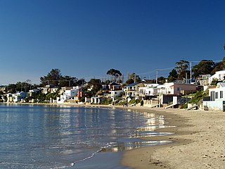
Opossum Bay is a rural residential locality in the local government area of Clarence in the Hobart region of Tasmania. The locality is about 37 kilometres (23 mi) south-east of the town of Rosny Park. The 2016 census has a population of 329 for the state suburb of Opossum Bay.

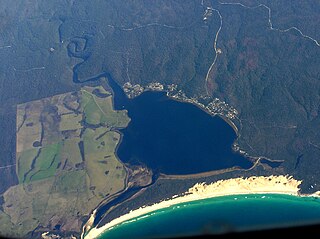
Ansons Bay is a rural locality in the local government area (LGA) of Break O'Day in the North-east LGA region of Tasmania. The locality is about 43 kilometres (27 mi) north of the town of St Helens. The 2021 census recorded a population of 62 for the state suburb of Ansons Bay.
Barnes Bay is a rural locality on Bruny Island in the local government area (LGA) of Kingborough in the Hobart LGA region of Tasmania. The locality is about 35 kilometres (22 mi) south of the town of Kingston. The 2016 census recorded a population of 22 for the state suburb of Barnes Bay.

Binalong Bay is a rural locality in the local government area (LGA) of Break O'Day in the North-east LGA region of Tasmania. The locality is about 12 kilometres (7.5 mi) north-east of the town of St Helens. The 2016 census recorded a population of 290 for the state suburb of Binalong Bay.
Bream Creek is a rural locality in the local government area (LGA) of Sorell in the South-east LGA region of Tasmania. The locality is about 25 kilometres (16 mi) east of the town of Sorell. The 2016 census has a population of 124 for the state suburb of Bream Creek.
Little Swanport is a rural locality and an estuary in the local government area of Glamorgan–Spring Bay in the South-east region of Tasmania. It is especially significant for the Little Swanport language. The locality is about 23 kilometres (14 mi) south of the town of Swansea. The 2016 census has a population of 117 for the state suburb of Little Swanport.

Cape Pillar is a rural locality in the local government area (LGA) of Tasman in the South-east LGA region of Tasmania. The locality is about 27 kilometres (17 mi) south-east of the town of Nubeena. The 2016 census recorded a population of four for the state suburb of Cape Pillar. It is on the Tasman Peninsula in the Tasman National Park, adjacent to Tasman Island.
Arthurs Lake is a rural locality in the local government area of Central Highlands in the Central region of Tasmania. It is located about 87 kilometres (54 mi) north of the town of Hamilton. The 2021 census recorded a population of 9 for Arthurs Lake.
Runnymede is a rural locality and town in the local government areas of Southern Midlands and Glamorgan–Spring Bay in the Central and South-east regions of Tasmania. It is located about 48 kilometres (30 mi) south-east of the town of Oatlands. The 2016 census determined a population of 71 for the state suburb of Runnymede.
Woodsdale is a rural locality and town in the local government areas of Southern Midlands and Glamorgan–Spring Bay in the Central and South-east regions of Tasmania. It is located about 32 kilometres (20 mi) south-east of the town of Oatlands. The 2016 census determined a population of 82 for the state suburb of Woodsdale.

Great Bay is a rural locality on Bruny Island in the local government area of Kingborough in the Hobart region of Tasmania. It is located about 18 kilometres (11 mi) north-east of the town of Alonnah, the largest town on the island. The 2016 census determined a population of 57 for the state suburb of Great Bay. The Bruny Island Airport is located within the suburb of Great Bay.
North Bruny is a rural locality on Bruny Island in the local government area of Kingborough in the Hobart region of Tasmania. It is located about 34 kilometres (21 mi) north-east of the town of Alonnah, the largest town on the island. The 2016 census determined a population of 95 for the state suburb of North Bruny.
South Bruny is a rural locality on Bruny Island in the local government area of Kingborough in the Hobart region of Tasmania. It is located about 14 kilometres (8.7 mi) south of the town of Alonnah, the largest town on the island. The 2016 census determined a population of 84 for the state suburb of South Bruny.
Simpsons Bay is a rural locality on Bruny Island in the local government area of Kingborough in the Hobart region of Tasmania. It is located about 9 kilometres (5.6 mi) north-east of the town of Alonnah, the largest town on the island. The 2016 census has a population of 55 for the state suburb of Simpsons Bay.
Gardners Bay is a rural residential locality and a body of water in the local government area of Huon Valley in the South-east region of Tasmania. It is located about 26 kilometres (16 mi) south-east of the town of Huonville. The 2016 census has a population of 329 for the state suburb of Gardners Bay.
Akaroa is a rural locality in the local government area (LGA) of Break O'Day in the North-east LGA region of Tasmania. The locality is about 13 kilometres (8.1 mi) north-east of the town of St Helens. The 2021 census recorded a population of 130 for Akaroa.
Spring Beach is a rural locality in the local government area (LGA) of Glamorgan–Spring Bay in the South-east LGA region of Tasmania. The locality is about 14 kilometres (8.7 mi) south of the town of Triabunna. The 2016 census recorded a population of 97 for the state suburb of Spring Beach.


