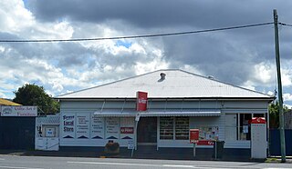
Sorell is a town in Tasmania, Australia, north-east of Hobart. It is located on the Tasman Highway at the junction with the Arthur Highway. Sorell is one of Tasmania's oldest towns, being first settled in 1808 as a small farming community and becoming an official township in 1821. At the 2006 census, Sorell had a population of 1,546, and at the 2011 census, a population of 2,476. and at the 2016 census, a population of 2,907.
Austral is a suburb of Sydney, in the state of New South Wales, Australia. It is 42 kilometres south-west of the Sydney central business district, in the local government area of the City of Liverpool.
Cressy is a small town 35 kilometres (22 mi) south-west of Launceston, Tasmania. It came into existence in the 1850s to service the surrounding wheat farms. At the 2006 census, Cressy had a population of 670. It is known as Tasmania's "Trout capital" for the good fishing in the area. It is also home to an extensive agriculture research facility for the Tasmanian Institute of Agricultural Research.
Leonay is a suburb of Sydney, in the state of New South Wales, Australia 58 kilometres west of the Sydney central business district, in the local government area of the City of Penrith. It is part of the Greater Western Sydney region.

Woodbridge is a semi-rural locality in the local government area (LGA) of Kingborough in the Hobart LGA region of Tasmania. The locality is about 26 kilometres (16 mi) south of the town of Kingston. The 2016 census has a population of 503 for the state suburb of Woodbridge. It is located 38 kilometres (24 mi) south of the state capital, Hobart.
South Arm is a rural residential locality in the local government area of Clarence in the Hobart region of Tasmania. The locality is about 32 kilometres (20 mi) south-east of the town of Rosny Park. The 2016 census has a population of 880 for the state suburb of South Arm.
Lapoinya is a small agricultural centre on the north-west coast of Tasmania west of Wynyard. The name is Tasmanian Aboriginal word for "fern tree", a plant that abounds in those surviving untouched parts of the original temperate rainforest. At the 2006 census, Lapoinya had a population of 368.
Ouse is a locality and small town in the Central Highlands Council local government area in Tasmania, Australia on the Lyell Highway. At the 2016 census, Ouse had a population of 303.
Peranga is a rural town and locality in the Toowoomba Region, Queensland, Australia. In the 2016 census the locality of Peranga had a population of 85 people.

Pilton is a rural town and locality in the Toowoomba Region, Queensland, Australia. It is south of the city of Toowoomba. In the 2021 census, the locality of Pilton had a population of 71 people.

Royal George is a rural locality in the local government areas (LGA) of Northern Midlands (46%), Break O'Day (27%) and Glamorgan-Spring Bay (27%) in the Central, North-east and South-east LGA regions of Tasmania. The locality is about 86 kilometres (53 mi) south-east of the town of Longford. The 2016 census recorded a population of 45 for the state suburb of Royal George.
Mundoo is a rural town and locality in the Cassowary Coast Region, Queensland, Australia. In the 2016 census the locality of Mundoo had a population of 224 people.

Karara is a rural town and locality in the Southern Downs Region, Queensland, Australia. In the 2016 census, the locality of Karara had a population of 123 people.

Macalister is a rural town and locality in the Western Downs Region, Queensland, Australia. In the 2016 census, the locality of Macalister had a population of 153.

Memerambi is a rural town and locality in the South Burnett Region, Queensland, Australia. In the 2021 census, the locality of Memerambi had a population of 338 people.

Brooloo is a rural town and locality in the Gympie Region, Queensland, Australia. In the 2016 census, the locality of Brooloo had a population of 348 people.

Allenby Gardens is a western suburb of Adelaide, South Australia. It is located in the City of Charles Sturt.
Kynuna is an outback town in the Shire of McKinlay and a locality split between the Shire of McKinlay and the Shire of Winton in Queensland, Australia. In the 2016 census the locality of Kynuna had a population of 55 people.

Bororen is a rural town and locality in the Gladstone Region, Queensland, Australia. In the 2016 census, Bororen had a population of 398 people.

Jimbour East is a rural locality in the Western Downs Region, Queensland, Australia. In the 2016 census Jimbour East had a population of 199 people. The town of Jimbour in the locality.


