Riceford | |
|---|---|
 Riceford  Riceford | |
| Coordinates: 43°34′34″N91°43′37″W / 43.57611°N 91.72694°W | |
| Country | United States |
| State | Minnesota |
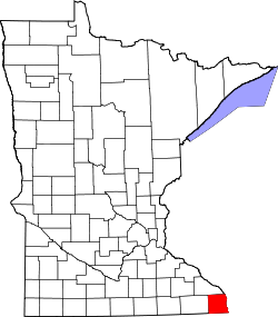
| County | Houston |
| Elevation | 1,014 ft (309 m) |
| Time zone | UTC-6 (Central (CST)) |
| • Summer (DST) | UTC-5 (CDT) |
| Area code | 507 |
| GNIS feature ID | 650057 [1] |
Riceford is an unincorporated community in Houston County, in the U.S. state of Minnesota. [1]