Related Research Articles

San Bernardino County, officially the County of San Bernardino and sometimes abbreviated as S.B. County, is a county located in the southern portion of the U.S. state of California, and is located within the Inland Empire area. As of the 2020 U.S. Census, the population was 2,181,654, making it the fifth-most populous county in California and the 14th-most populous in the United States. The county seat is San Bernardino.

Coconino County is a county in the North-Central part of the U.S. state of Arizona. Its population was 145,101 at the 2020 census. The county seat is Flagstaff. The county takes its name from Cohonino, a name applied to the Havasupai people. It is the second-largest county by area in the contiguous United States, behind San Bernardino County, California. It has 18,661 sq mi (48,300 km2), or 16.4% of Arizona's total area, and is larger than the nine smallest states in the U.S.

Commerce is a city located in southeast Los Angeles County, California, United States. The population was 12,823 at the 2010 census, up from 12,568 at the 2000 census. It is usually referred to as the City of Commerce to distinguish it from the common noun. It is bordered by Vernon on the west, Los Angeles on the northwest, East Los Angeles on the north, Montebello on the east, Downey and Bell Gardens on the south, and Maywood on the southwest. The Los Angeles River forms part of its southwestern boundary, and the Rio Hondo separates it from Downey. Commerce is served by the Long Beach and Santa Ana freeways, as well as the Metrolink commuter rail service at the Commerce station.

Crestline is a census-designated place in the San Bernardino Mountains of San Bernardino County, California, United States. The population was 10,770 at the 2010 census, up from 10,218 at the 2000 census.

Lake Arrowhead is an unincorporated community and a census-designated place (CDP) in the San Bernardino Mountains of San Bernardino County, California, surrounded by the San Bernardino National Forest, and surrounding the eponymous Lake Arrowhead Reservoir. Lake Arrowhead is located 13 miles north east of the San Bernardino city limits. The population of the CDP was estimated at 12,424 in the 2010 census. It was formerly called "Little Bear Lake", until around 1920, when a group from Los Angeles, the Arrowhead Lake Company, bought the lake and the land surrounding it, and changed its name to Arrowhead Lake.

Running Springs is a census-designated place (CDP) in San Bernardino County, California, United States. The population was 5,268 at the 2020 census, up from 4,862 at the 2010 census. Running Springs is situated 17 miles west of the city of Big Bear Lake.

San Bernardino is a city in and the county seat of San Bernardino County, California, United States. Located in the Inland Empire region of Southern California, the city had a population of 222,101 in the 2020 census, making it the 18th-largest city in California. San Bernardino is the economic, cultural, and political hub of the San Bernardino Valley and the Inland Empire. The governments of El Salvador, Guatemala, and Mexico have established the metropolitan area's only consulates in the downtown area of the city. Additionally, San Bernardino serves as an anchor city to the 3rd largest metropolitan area in California and the 12th largest metropolitan area in the United States; the San Bernardino-Riverside MSA. Furthermore, the city's University District serves as a college town, as home to California State University, San Bernardino.

Phelan is an unincorporated community and census-designated place in San Bernardino County, California, in the Victor Valley of the Mojave Desert, north of the San Gabriel Mountains. The population was 14,304 in the 2010 census.

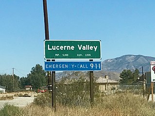
Lucerne Valley is a census-designated place (CDP) and valley landform in the southern Mojave Desert, in western San Bernardino County, California.

The Colton Joint Unified School District (CJUSD) is a school district in California.
Blue Jay is an unincorporated community located in San Bernardino County, California. It is located in the San Bernardino Mountains, above a region of California known as the Inland Empire. It is within the San Bernardino National Forest. Blue Jay Village itself is located one mile from the southwestern bank of Lake Arrowhead.

Silver Valley Unified School District is located in the High Desert of Southern California, between Los Angeles and Las Vegas. The district covers an area of approximately 3,345 square miles (8,660 km2), equivalent in size to the combined states of Rhode Island and Delaware.
Mountain Transit is the third largest regional transit agency in San Bernardino County, California. Mountain Transit serves the San Bernardino Mountain communities of Crestline, Lake Arrowhead, Running Springs, and Big Bear Lake, providing local service for more than 163,000 passengers each year.
The University District, often referred to as University or University Hills, is a foothill community and college town located approximately 5–8 miles north of downtown San Bernardino, California. The District is named after the California State University, San Bernardino. It is one of the most desirable neighborhoods in San Bernardino along with the Hospitality Lane District. As California State University, San Bernardino grew so did the region around it; it used to be nothing but mid-desert farmland, but has been developing quickly to become a neighborhood important to not only San Bernardino but also the entire region.

Verdemont, also known as Verdemont Heights, is a foothill and suburban neighborhood located in the northern portion of the city of San Bernardino, California. The neighborhood contains the Western Region Little League headquarters. Verdemont is one of the city's most desirable neighborhoods, holding the city's high income families, along with Arrowhead Springs, and the University District. Verdemont is home to most of the city's million dollar homes.
Cedar Glen is an unincorporated community in San Bernardino County, California, United States. This mountain community lies at an elevation of 5403 ft, and is located within the San Bernardino National Forest resort area immediately east of Lake Arrowhead. California State Highway 173 bisects Cedar Glen and passes through Lake Arrowhead.

Skyforest is an unincorporated community in San Bernardino County, California, United States.

Riverside County is a county located in the southern portion of the U.S. state of California. As of the 2020 census, the population was 2,418,185, making it the fourth-most populous county in California and the 10th-most populous in the United States. The name was derived from the city of Riverside, which is the county seat.
Victor Valley Union High School District (VVUHSD) is a school district in the Victor Valley of San Bernardino County, southern California.

The Line Fire is a large active wildfire in San Bernardino County, Southern California. The fire began on September 5 near the community of Highland and spread into the San Bernardino National Forest. The fire has forced the evacuation of multiple communities. On September 10, the San Bernardino County Sheriff's Department identified and arrested 34-year-old Justin Wayne Halstenberg, a resident of Norco, on suspicion of starting the fire on September 5. As of October 4, 2024, the Line Fire has burned 43,925 acres and is 79 percent contained.
References
- 1 2 3 4 5 "Search for Public School Districts – District Detail for Rim of the World Unified". National Center for Education Statistics . Institute of Education Sciences . Retrieved 2022-03-05.
- 1 2 Home. Rim of the World Unified School District. Retrieved on September 17, 2010. "27315 North Bay Road, Blue Jay, CA 92317"
- ↑ "2020 CENSUS - SCHOOL DISTRICT REFERENCE MAP: San Bernardino County, CA" (PDF). U.S. Census Bureau. p. 8 (PDF p. 9/12). Retrieved 2024-10-04. - Text list
- ↑ Home. Rim of the World High School. Retrieved on September 17, 2010. "27400 State Highway 18" "Lake Arrowhead, CA 92352"
- ↑ Mountain High School (alternative school)
- ↑ "Welcome Mountain Lions!" Mary Putnam Henck Intermediate School. Retrieved on September 17, 2010. "730 Rhine Road Lake Arrowhead, Ca. 92352"
- ↑ "Home of the Raccoons" Charles Hoffman Elementary School. Retrieved on September 17, 2010. "2851 Running Springs School Rd. Running Springs, CA 92832"
- ↑ Home. Lake Arrowhead Elementary School. Retrieved on September 17, 2010. "1300 Golden Rule Ln. Lake Arrowhead, CA 92352"
- ↑ Home. Valley of Enchantment Elementary School. Retrieved on May 05, 2011. "22836 Fir Lane. Cretline, CA 92325"