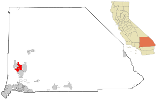
San Bernardino County, officially the County of San Bernardino and sometimes abbreviated as S.B. County, is a county located in the southern portion of the U.S. state of California, and is located within the Inland Empire area. As of the 2020 U.S. Census, the population was 2,181,654, making it the fifth-most populous county in California and the 14th-most populous in the United States. The county seat is San Bernardino.

Adelanto is a city in San Bernardino County, California, United States. It is approximately 9 miles (14 km) northwest of Victorville in the Victor Valley area of the Mojave Desert, in the northern region of the Inland Empire. The population was 38,046 at the 2020 census.

Apple Valley is an incorporated town in the Victor Valley of San Bernardino County, in the U.S. state of California. Its population was 75,791 as of the 2020 United States Census. The town is east of and adjoining to the neighboring cities of Victorville and Hesperia, 35 miles (56 km) south of Barstow, and 49 miles (79 km) north of San Bernardino through the Cajon Pass. It was incorporated on November 14, 1988, and is one of the 22 incorporated municipalities in California that use "town" in their names instead of "city".

Barstow is a city in San Bernardino County, California, in the Mojave Desert of Southern California. Located in the Inland Empire region of California, the population was 25,415 at the 2020 census. Barstow is an important crossroads for the Inland Empire and home to Marine Corps Logistics Base Barstow.

Hesperia is a city in San Bernardino County, California, United States. It is located 35 miles (56 km) north of downtown San Bernardino in Victor Valley and surrounded by the Mojave Desert. Because of its relatively high elevation and the unique and moderate weather patterns of the region, Hesperia is part of what is locally called the High Desert. The name "Hesperia" means "western land". The 2019 census report estimates that the city has a population of 95,750.

Victorville is a city in Victor Valley in San Bernardino County, California. Its population as of the 2020 census was 134,810.

The Mojave River is an intermittent river in the eastern San Bernardino Mountains and the Mojave Desert in San Bernardino County, California, United States. Most of its flow is underground, while its surface channels remain dry most of the time, except for the headwaters and several bedrock gorges in the lower reaches.

Area codes 760 and 442 are telephone area codes in the North American Numbering Plan (NANP) for the U.S. state of California. These area codes serve an overlay complex that comprises much of the southeastern and southernmost portions of California. It includes Imperial, Inyo, and Mono counties, as well as portions of North County San Diego, Riverside, San Bernardino, Los Angeles and Kern counties. Area code 760 was created on March 22, 1997 in a split of area code 619. Area code 442 was added to the same area on November 21, 2009.

The Victor Valley is a valley in the Mojave Desert and subregion of the Inland Empire, in San Bernardino County in Southern California.

Hesperia Unified School District is a school district in San Bernardino County, California. Hesperia Unified School District serves the City of Hesperia and adjacent areas in the High Desert of San Bernardino County and covers 140 square miles. The Hesperia Unified School District provides public education services for kindergarten through senior high school students. It includes 3 comprehensive high schools, 2 continuation high schools, 3 middle schools, 12 elementary schools, 3 choice schools, 2 alternative schools, 1 adult education school, and 5 charter schools.
Oro Grande is an unincorporated community in the Mojave Desert of San Bernardino County, California, United States. It lies on the city boundary of Victorville and Adelanto. It is at 3,000 feet (910 m) elevation in Victor Valley north of the San Bernardino mountain range. It is located on old Route 66 near Interstate 15 between Victorville and Barstow. The ZIP code is 92368 and the community is inside area codes 442 and 760. Less than 1,000 residents live in the unincorporated area.

Victor Valley College is a public community college in Victorville, California. It is part of the California Community College System. The Victor Valley Community College district includes Victorville, Hesperia, Apple Valley, Phelan and Adelanto.

The Serrano are an Indigenous people of California. Their autonyms are Taaqtam meaning "people", Maarrênga’yam meaning "people from Morongo", and Yuhaaviatam meaning "people of the pines."

High Desert is a vernacular region with non-discrete boundaries covering areas of the western Mojave Desert in Southern California. The region encompasses various terrain with elevations generally between 2,000 and 4,000 ft above sea level, and is located just north of the San Gabriel, San Bernardino, and Little San Bernardino Mountains.

The deserts of California are the distinct deserts that each have unique ecosystems and habitats. The deserts are home to a sociocultural and historical "Old West" collection of legends, districts, and communities, and they also form a popular tourism region of dramatic natural features and recreational development. Part of this region was even proposed to become a new county due to cultural, economic and geographic differences relative to the rest of the more urban region.

Victor Valley Transit Authority (VVTA), the second largest transit operator in San Bernardino County, is a transit agency providing bus service in the Victor Valley, California area. In 2023, the system had a ridership of 1,476,600.
Adelanto Elementary School District (AESD) is an elementary and middle school-only school district in San Bernardino County, California. It is headquartered in Adelanto.
Victor Valley Union High School District (VVUHSD) is a school district in the Victor Valley of San Bernardino County, southern California.


