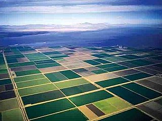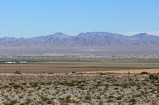
Imperial County is a county located on the southeast border of the U.S. state of California. As of the 2020 census, the population was 179,702, making it the least populous county in Southern California. The county seat and largest city is El Centro. Imperial is the most recent California county to be established, as it was created in 1907 out of portions of San Diego County.

San Bernardino County, officially the County of San Bernardino, is a county located in the southern portion of the U.S. state of California, and is located within the Inland Empire area. As of the 2020 U.S. Census, the population was 2,181,654, making it the fifth-most populous county in California and the 14th-most populous in the United States. The county seat is San Bernardino.

Trinity County is a county located in the northwestern portion of the U.S. state of California. Trinity County is rugged, mountainous, heavily forested, and lies along the Trinity River within the Salmon, Klamath Mountains, as well as a portion of the Scott, Trinity, and North Yolla Bolly Mountains. It is also one of three counties in California with no incorporated cities.

Mohave County is in the northwestern corner of the U.S. state of Arizona. As of the 2020 census, its population was 213,267. The county seat is Kingman, and the largest city is Lake Havasu City. It is the fifth largest county in the United States.

Lake Havasu City is a city in Mohave County, Arizona, United States. As of the 2020 census, the population of the city was 57,144, up from 52,527 in 2010. It is served by Lake Havasu City Airport.

Gridley is a city in Butte County, California, United States, 29 miles south of Chico, California, and 56 miles north of Sacramento, California. The population as of April 1, 2020, is 7,421. California State Route 99 runs through Gridley and Interstate 5 and California State Route 70 are both nearby.

Needles is a city in eastern San Bernardino County, California, in the Mojave Desert region of Southern California. Situated on the western banks of the Colorado River, Needles is located near the California border with Arizona and Nevada. The city is accessible via Interstate 40 and U.S. Route 95. The population was 4,959 at the 2020 census, up from 4,844 at the 2010 census.

The Richmond District is a neighborhood in the northwest corner of San Francisco, California, developed initially in the late 19th century. It is sometimes confused with the city of Richmond, which is 20 miles (32 km) northeast of San Francisco.

The Colorado River Aqueduct, or CRA, is a 242 mi (389 km) water conveyance in Southern California in the United States, operated by the Metropolitan Water District of Southern California (MWD). The aqueduct impounds water from the Colorado River at Lake Havasu on the California-Arizona border, west across the Mojave and Colorado deserts to the east side of the Santa Ana Mountains. It is one of the primary sources of drinking water for Southern California.

The Mohave Valley is a valley located mostly on the east shore of the south-flowing Colorado River in northwest Arizona. The valley extends into California's San Bernardino County; the northern side of the valley extends into extreme southeast Clark County, Nevada. The main part of the valley lies in southwest Mohave County, Arizona and is at the intersection of the southeast Mojave and northwest Sonoran deserts.

Parker Dam is a concrete arch-gravity dam that crosses the Colorado River 155 miles (249 km) downstream of Hoover Dam. Built between 1934 and 1938 by the Bureau of Reclamation, it is 320 feet (98 m) high, 235 feet (72 m) of which are below the riverbed (the deep excavation was necessary in order to reach the bedrock on which the foundation of the dam was built), making it the deepest dam in the world. The portion of the dam above the foundation stands 85 feet (25.9 m) tall, making it the only dam in the world that stands more underground than above ground. The dam's primary functions are to create a reservoir, and to generate hydroelectric power. The reservoir behind the dam is called Lake Havasu and can store 647,000 acre⋅ft (798,000,000 m3; 2.11×10¹¹ US gal; 1.76×10¹¹ imp gal). The dam straddles the Arizona-California state border at the narrows the river passes through between the Whipple Mountains in San Bernardino County, California and the Buckskin Mountains in La Paz County, Arizona.

Lake Havasu is a large reservoir formed by Parker Dam on the Colorado River, on the border between San Bernardino County, California and Mohave County, Arizona. Lake Havasu City sits on the Arizonan side of the lake with its Californian counterpart of Havasu Lake directly across the lake. The reservoir has an available capacity of 619,400 acre-feet (0.7640 km3). The concrete arch dam was built by the United States Bureau of Reclamation between 1934 and 1938. The lake's primary purpose is to store water for pumping into two aqueducts. Prior to the dam construction, the area was home to the Mojave people. The lake was named after the Mojave word for blue. In the early 19th century, it was frequented by beaver trappers. Spaniards also began to mine the areas along the river.
Lake Elsinore Unified School District is a public school district located in Lake Elsinore, California, USA. It was formed on July 1, 1989, when the Elsinore Union High School District merged with the Lake Elsinore School District (elementary). The Lake Elsinore Unified School District is the 8th largest school district in Riverside County and encompasses an area of 131.78 square miles.

State Route 95, also known as SR 95, is a north–south state highway along the western edge of Arizona that is split into two sections.
The Elk Grove Unified School District is a school district in southern Sacramento County, California, United States.

Yucca is an unincorporated community and census-designated place (CDP) in Mohave County, Arizona, United States. As of the 2020 census it had a population of 96, down from 126 at the 2010 census.

Havasu Lake is an unincorporated community in San Bernardino County, California, United States, located on Lake Havasu on the Chemehuevi Reservation in the Mojave Desert. The community serves as the seat of the tribal government of the Chemehuevi Indian Tribe and is home to the Havasu Landing Casino.

Havasu National Wildlife Refuge is a U.S. National Wildlife Refuge on the lower Colorado River in Arizona and California. It preserves habitat for desert bighorn sheep, the endangered southwestern willow flycatcher, and other animals. The refuge protects 30 river miles - 300 miles (480 km) of shoreline - from Needles, California, to Lake Havasu City, Arizona. One of the last remaining natural stretches of the lower Colorado River flows through the 20-mile-long (32 km) Topock Gorge.

The Colorado River is a major river of the western United States and northwest Mexico in North America. Its headwaters are in the Rocky Mountains where La Poudre Pass Lake is its source. Located in north central Colorado it flows southwest through the Colorado Plateau country of western Colorado, southeastern Utah and northwestern Arizona where it flows through the Grand Canyon. It turns south near Las Vegas, Nevada, forming the Arizona–Nevada border in Lake Mead and the Arizona–California border a few miles below Davis Dam between Laughlin, Nevada and Needles, California before entering Mexico in the Colorado Desert. Most of its waters are diverted into the Imperial Valley of Southern California. In Mexico its course forms the boundary between Sonora and Baja California before entering the Gulf of California. This article describes most of the major features along the river.
KDMM is a radio station licensed to serve the community of Parker Strip, Arizona. Its coverage area includes the communities of Parker, Lake Havasu City and Parker Dam. The station is owned by Sanford and Terry Cohen, through licensee River Rat Radio, LLC, and airs a Hot Hits format. The station is known locally as K-DAM and streams worldwide on its website www.bestdamradio.com and on the River Rat Radio app.


