Riner, Virginia

Last updated

Riner
CDP
Shenandoah Valley.svg
Red pog.svg
Riner
USA Virginia location map.svg
Red pog.svg
Riner
Usa edcp location map.svg
Red pog.svg
Riner
Coordinates: 37°3′46″N80°26′22″W / 37.06278°N 80.43944°W / 37.06278; -80.43944
CountryUnited States
State Virginia
County Montgomery
Population
 (2020)
  Total1,196
Time zone UTC−5 (Eastern (EST))
  Summer (DST) UTC−4 (EDT)
ZIP codes
24149
Area code 540
FIPS code 51-67256
GNIS feature ID2584908

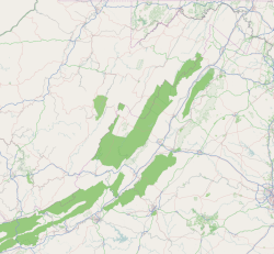
Riner is a census-designated place in Montgomery County, Virginia, United States. The population as of the 2020 Census was 1,196. [1]

Riner had its beginnings in 1808 when a sawmill was put into operation. The town was first called Old Forks, and then later Five Forks and Five Points. It was known primarily as Auburn from about 1850 until 1882. [2]

The U.S. post office was the reason that the name of the village was changed from Auburn to Riner in 1882. Between the establishment of the original U.S. Post office in the community in the 1871-73 congressional session and 1882 there was no postmaster in the town, and the mail was distributed at the local store by the proprietor Major Lawrence. The citizens of the Auburn community petitioned the government for a postmaster and one was appointed in 1882. However, the result was the determination that another locale in Virginia already had the Auburn postmark. The post office was instead given the name of a prominent citizen of the village, Mr. David Riner, who later served in the Virginia House of Delegates. [3]

The Howard-Bell-Feather House and Riner Historic District are listed on the National Register of Historic Places. [4]

Auburn Elementary School, [5] Auburn Middle School, [6] and Auburn High School [7] are all located in Riner. Camp Carysbrook [8] is the oldest overnight camp for girls in Virginia since 1923.
Related Research Articles

<span class="mw-page-title-main">Rowan County, North Carolina</span> County in North Carolina, United States

Rowan County is a county in the U.S. state of North Carolina that was formed in 1753, as part of the British Province of North Carolina. It was originally a vast territory with unlimited western boundaries, but its size was reduced to 524 square miles (1,360 km2) after several counties were formed from Rowan County in the 18th and 19th centuries. As of the 2020 census, its population was 146,875. Its county seat, Salisbury, is the oldest continuously populated European-American town in the western half of North Carolina. Rowan County is located northeast of Charlotte, and is considered part of the Charlotte-Concord-Gastonia, NC-SC Metropolitan Statistical Area.

<span class="mw-page-title-main">Trimble County, Kentucky</span> County in Kentucky, United States

Trimble County is a county located in the north central part of the U.S. state of Kentucky. Its county seat is Bedford. The county was founded in 1837 and is named for Robert Trimble. Trimble is no longer a prohibition or dry county. Trimble County is part of the Louisville/Jefferson County, KY–IN Metropolitan Statistical Area.

<span class="mw-page-title-main">Ash Fork, Arizona</span> CDP in Yavapai County, Arizona

Ash Fork is a census-designated place in Yavapai County, Arizona, United States. Its population was 396 at the 2010 U.S. Census, down from 457 in 2000.

<span class="mw-page-title-main">Burlington, Ohio</span> Census-designated place in Ohio, United States

Burlington is an unincorporated community and census-designated place in Lawrence County, Ohio, United States, along the Ohio River. The population was 2,416 at the 2020 census. Connected to neighboring Huntington, West Virginia and connected via the West Huntington Bridge over the Ohio River, it is part of the Huntington–Ashland metropolitan area. Burlington was once the leading community of Lawrence County, being the first county seat and the location of the county's first post office. “The Memory Man” by David Baldacci takes place in Burlington. The main character is Amos Decker. There are 7 books in this series.

<span class="mw-page-title-main">Sevierville, Tennessee</span> City in Tennessee, United States

Sevierville is a city in and the county seat of Sevier County, Tennessee, United States, located in eastern Tennessee. The population was 17,889 at the 2020 United States Census.

<span class="mw-page-title-main">Elkton, Virginia</span> Town in Virginia, United States

Elkton is an incorporated town in Rockingham County, Virginia, United States. It is included in the Harrisonburg Metropolitan Statistical Area. The population was 2,941 at the 2020 census and 2,762 at the 2010 census. Elkton was named for the Elk Run stream.

<span class="mw-page-title-main">Pocahontas, Virginia</span> Town in Virginia, United States

Pocahontas is a town in Tazewell County, Virginia, United States. It was named for Chief Powhatan's daughter, Pocahontas, who lived in the 17th-century Jamestown Settlement. The town was founded as a company mining town by the Southwest Virginia Improvement Company in 1881. It was the first company mining town in Virginia. The post office opened on June 30, 1882.

<span class="mw-page-title-main">Matewan, West Virginia</span> Town in West Virginia, United States

Matewan is a town in Mingo County, West Virginia, United States at the confluence of the Tug Fork River and Mate Creek. The population was 412 at the 2020 census, down from 499 in 2010. The Norfolk Southern Railway's Pocahontas District passes through the town. It was a key site of the Coal Wars and the location of the Battle of Matewan in 1920.

Leicester is an unincorporated community in Buncombe County, North Carolina United States; although incorporating was proposed in 2007 and an incorporation bill was briefly filed in the North Carolina General Assembly, no measure has been adopted. Leicester is part of the Asheville Metropolitan Statistical Area. As of 2007, Leicester's population is 12,514 people. Since 2000, it has had a population growth of 16.26 percent.

Catlett is a census-designated place (CDP) in Fauquier County, Virginia, United States. The population as of the 2010 census was 297. It is located west of the Prince William County line. Catlett was formerly a rail stop on the Orange and Alexandria Railroad, and the area was the site of many raids on the railroad during the American Civil War.

Burlington is a census-designated place (CDP) in Mineral County, West Virginia, United States, along U.S. Route 50 crossing Pattersons Creek. As of the 2020 census, its population was 131. It is part of the Cumberland, MD-WV Metropolitan Statistical Area.

Arcola is a census-designated place in Loudoun County, Virginia, United States. The population as of the 2010 United States Census was 233.

<span class="mw-page-title-main">Nora, Virginia</span> Unincorporated community in Virginia, United States

Nora is an unincorporated community in Dickenson County in the southern U.S. state of Virginia. In the 2000 US census, its population is listed as 566. Nora is situated along the McClure River.

<span class="mw-page-title-main">Fork Union, Virginia</span> Unincorporated community in Virginia, United States

Fork Union is an unincorporated community in southern Fluvanna County, Virginia, along U.S. Highway 15. Its ZIP code is 23055; the population within that ZIP code was 1148 according to the 2000 Census. It is known mainly as the home of Fork Union Military Academy, Fork Union Animal Clinic and formerly had one of the few surviving drive-in theatres in Virginia. Fork Union is also home to a post office, a bank, a small grocery store, a supermarket, a dollar store and two independently owned restaurants. The Village of Fork Union is the location of Fluvanna County's only Presbyterian congregation, Fork Union Presbyterian Church. The James River is just a few miles from Fork Union.

<span class="mw-page-title-main">Itmann, West Virginia</span> Census-designated place in West Virginia, United States

Itmann is a census-designated place (CDP) and former mining town located in Wyoming County, West Virginia, United States, between Pineville and Mullens off West Virginia Route 16. As of the 2010 census, its population was 293; it had 138 homes, 119 of which were occupied.

Woodwardville is an unincorporated community situated in western Anne Arundel County, Maryland, United States, containing 27 structures, 16 of which are historic and included in the Woodwardville Historic District, listed on the National Register of Historic Places in 2003. Most of the structures are located adjacent to Patuxent Road, which runs through the center of the community. On the north end of the district, a small street, 5th Avenue, runs west from Patuxent Road underneath the train tracks. Prior to the establishment of what would be later known as Fort George G. Meade in 1917, the road once continued on to Laurel. Three of the seven buildings along 5th Avenue are historic. Woodwardville's building stock consists principally of late-19th and early-20th century domestic architecture. Good examples of the Bungalow, Foursquare, Tudor Revival, and Queen Anne styles are present, as well as older traditional vernacular classifications such as the I-house. These older forms are supplemented by a handful of post-World War II era structures. Woodwardville also features several public or commercial buildings including a church, a former schoolhouse, the ruins of a store and storage or service buildings associated with the railroad. Many of Woodwardville's older buildings fell into decline following World War II, but in recent years, due to its close proximity to commuter rail service, Woodwardville has evolved into a bedroom community for persons working in Washington and Baltimore. Investment by new residents resulted in the restoration and renovation of many buildings which had formerly been in deteriorating condition. Despite the intense development a mile away in Piney Orchard, this quaint community retains its ability to communicate its historic qualities and distinct sense of place.

<span class="mw-page-title-main">New Baltimore, Virginia</span> Census-designated place in Virginia, United States

New Baltimore is an unincorporated community and census-designated place (CDP) in eastern Fauquier County, Virginia, United States. The population as of the 2010 census was 8,119. The community has existed since the early 19th century, but it has had its most significant growth since the 1980s. It is the portion of Fauquier County with the easiest access to Washington, D.C., and as a result, many people who live in New Baltimore commute into DC. Other major communities close to New Baltimore are Warrenton, Gainesville/Haymarket area, and Manassas. The area officially considered to be New Baltimore expanded significantly in 2006 with Fauquier County's designation of service districts, of which New Baltimore is one. The service district designation provides added access to utilities such as water and sewer, and targets the area for growth.

Helena is a ghost town in unincorporated Trinity County, California, United States. It is located on the North Fork of the Trinity River, 10 miles (16 km) west-northwest of Weaverville. State Route 299 runs right past the former town to the south; East Fork Road connects the highway to Helena.

Laurel Fork is an unincorporated community in Carroll County, Virginia. It is located off U.S. Route 58 and is 12.4 miles (20.0 km) east-southeast of Hillsville, Virginia. Laurel Fork has a post office with the ZIP code 24352.

<span class="mw-page-title-main">Riner Historic District</span> Historic district in Virginia, United States

Riner Historic District is a national historic district located at Riner, Montgomery County, Virginia. The district encompasses 23 contributing buildings and 1 contributing structure in the village of Riner. It includes a variety of vernacular residential, commercial, and institutional buildings dating from the 1850s to 1920s. Notable buildings include the Methodist Episcopal Church (1908), Bank of Riner (1912–1913), Jonathan E. Hall House / Store, Kinsey-Lawrence House (1908–1909), Dr. Stone Farm, Surface Mill, Auburn United Methodist Church (1885), and Sam Barnett Store.

References

  1. "Riner Demographics - Get Current Census Data for Riner, VA".
  2. Lawrence, Virginia Deal (1981). "Memories of Riner".
  3. "060-0044". DHR. Retrieved August 22, 2024.
  4. "National Register Information System". National Register of Historic Places . National Park Service. July 9, 2010.
  5. "AES".
  6. "AMS".
  7. "AHS".
  8. "Camp Carysbrook".