Sugar Grove, Montgomery County, Virginia

Last updated
Sugar Grove
Shenandoah Valley.svg
Red pog.svg
Sugar Grove
USA Virginia location map.svg
Red pog.svg
Sugar Grove
Usa edcp location map.svg
Red pog.svg
Sugar Grove
Coordinates: 37°6′7″N80°20′34″W / 37.10194°N 80.34278°W / 37.10194; -80.34278 Coordinates: 37°6′7″N80°20′34″W / 37.10194°N 80.34278°W / 37.10194; -80.34278
CountryUnited States
State Virginia
County Montgomery
Elevation
1,637 ft (499 m)
Time zone UTC−5 (Eastern (EST))
  Summer (DST) UTC−4 (EDT)
GNIS feature ID1497169 [1]

Sugar Grove is an unincorporated community in Montgomery County, Virginia, United States. [1] Sugar Grove is part of the Blacksburg-Christiansburg metropolitan area . Sugar Grove at one time hosted a school, a post office, two stores, a vegetable canning facility, and a little less than one hundred families.
Contents

Geography and transportation

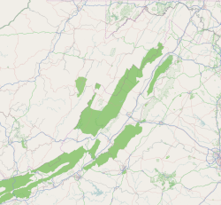
The Sugar Grove is generally agreed[ by whom? ] to be bounded by the intersection of Bow Hill Road, Sugar Grove Road, and Elliots Creek Road. Craigs Mountain Road (VA 674) is the only way into Sugar Grove. From Pilot Road (VA 615) to the end of state maintenance on Bow Hill Road, it is approximately six miles, three and one half of those miles being a gravel road.

Roads in the area have often been overlooked. It was not until 1999 that the Virginia Department of Transportation paved the worst one and one-half miles of road that contained at least one-half miles of one hundred foot drop-offs with no guard rail and no room to pass.

Economy

There are a few commercial enterprises based in Sugar Grove and agricultural activity centers on timber harvesting and firewood suppliers.

Related Research Articles

Pendleton County, West Virginia U.S. county in West Virginia

Pendleton County is a county located in the U.S. state of West Virginia. As of the 2010 census, the population was 7,695, making it the fifth-least populous county in West Virginia. Its county seat is Franklin. The county was created by the Virginia General Assembly in 1788 from parts of Augusta, Hardy, and Rockingham Counties and was named for Edmund Pendleton (1721–1803), a distinguished Virginia statesman and jurist. Pendleton County was strongly pro-Confederate during the American Civil War; however, there were pockets of Unionists who supported the state government in Wheeling.

James City County, Virginia U.S. county in Virginia

James City County is a county located in the Commonwealth of Virginia. As of the 2010 census, the population was 67,009. Although politically separate from the county, the county seat is the adjacent independent city of Williamsburg.

Bristol, Virginia Independent city in Virginia, United States

Bristol is an independent city in the Commonwealth of Virginia. As of the 2010 census, the population was 17,835. It is the twin city of Bristol, Tennessee, just across the state line, which runs down the middle of its main street, State Street. The Bureau of Economic Analysis combines the city of Bristol, Virginia, with neighboring Washington County, Virginia, for statistical purposes. Bristol is a principal city of the Kingsport–Bristol–Bristol, TN-VA Metropolitan Statistical Area, which is a component of the Johnson City–Kingsport–Bristol, TN-VA Combined Statistical Area – commonly known as the "Tri-Cities" region.

Kane County, Illinois County in Illinois

Kane County is a county in the U.S. state of Illinois. According to the 2010 census, it has a population of 515,269, making it the fifth-most populous county in Illinois. Its county seat is Geneva, and its largest city is Aurora.

Tysons, Virginia Census-designated place in Virginia, United States

Tysons, also known as Tysons Corner, is a census-designated place (CDP) and unincorporated community in Fairfax County, Virginia, United States. Located in Northern Virginia between the community of McLean and the town of Vienna along the Capital Beltway (I-495), it lies within the Washington Metropolitan Area. Tysons is home to two super-regional shopping malls—Tysons Corner Center and Tysons Galleria—and the corporate headquarters of numerous companies such as Intelsat, DXC Technology, Gannett, Hilton Worldwide, Cvent, Freddie Mac, Capital One, and Booz Allen Hamilton. Tysons is Fairfax County's central business district and a regional commercial center. It has been characterized as a quintessential example of an edge city. The population was 19,627 as of the 2010 census.

Shenandoah River river in Virginia and West Virginia, United States

The Shenandoah River is a tributary of the Potomac River, 55.6 miles (89.5 km) long with two forks approximately 100 miles (160 km) long each, in the U.S. states of Virginia and West Virginia. The principal tributary of the Potomac, the river and its tributaries drain the central and lower Shenandoah Valley and the Page Valley in the Appalachians on the west side of the Blue Ridge Mountains, in northwestern Virginia and the Eastern Panhandle of West Virginia.

The Potomac Heritage Trail, also known as the Potomac Heritage National Scenic Trail or the PHT, is a designated National Scenic Trail corridor spanning parts of the mid-Atlantic and upper southeastern regions of the United States that will connect various trails and historic sites in the states of Virginia, Maryland, and Pennsylvania and the District of Columbia. The trail network includes 710 miles (1,140 km) of existing and planned sections, tracing the outstanding natural, historical, and cultural features of the Potomac River corridor, the upper Ohio River watershed in Pennsylvania and western Maryland, and a portion of the Rappahannock River watershed in Virginia. The trail is managed by the National Park Service.

Grove, Virginia human settlement in Virginia, United States of America

Grove is an unincorporated community in the southeastern portion of James City County in the Virginia Peninsula subregion of Virginia in the United States. It is located in the center of the Historic Triangle of Colonial Virginia, communities linked by the Colonial Parkway. This area is one of the busiest tourist destinations in the world.

Sugar Grove Station is a National Security Agency (NSA) communications site located near Sugar Grove in Pendleton County, West Virginia. According to a 2005 article in the New York Times, the site intercepts all international communications entering the Eastern United States. Activities at the site previously involved the Naval Information Operations Command (NAVIOCOM). In April 2013, the Chief of Naval Operations ordered that the NAVIOCOM base be closed by September 30, 2015, as "a result of the determination by the resource sponsor National Security Agency to relocate the command's mission." The naval base is being repurposed as a privately owned healthcare facility for veterans, while the NSA listening station, to the south, continues to operate.

Virginia State Route 16 state highway in Virginia, United States

State Route 16 is a primary state highway in the southwest part of the U.S. state of Virginia. It runs from the North Carolina border at North Carolina Highway 16 north to the West Virginia border at West Virginia Route 16, passing through the towns of Troutdale, Marion, and Tazewell. Highway 16 is part of a three-state route 16 that connects the Charlotte region with northwestern West Virginia.

Virginia State Route 69 state highway in Wythe and Carroll counties in Virginia, United States

State Route 69 is a primary state highway in the U.S. state of Virginia. Known as Lead Mine Road, the state highway runs 3.59 miles (5.78 km) from SR 636 in Austinville east to U.S. Route 52 in Poplar Camp. SR 69 is the last remnant of a much longer route. At its peak from 1940 to 1945, this route ran from State Route 91 at Lodi east via St. Clair Bottom, Sugar Grove, Cedar Springs, Speedwell, Porters Crossroads, and Austinville to today's SR 69. However, it was never fully continuous; portions from Sugar Grove to Cedar Springs and west of Porters Crossroads to east of Austinville were secondary routes. The full length of this route as it existed and was planned is now part of SR 762, part of SR 660, all of SR 650, part of SR 16, all of SR 614, part of SR 749, part of US 21, part of SR 690, a small piece of SR 642, part of SR 619, part of SR 636, and SR 69.

Interstate 70 (I-70) is a portion of the Interstate Highway System that runs from near Cove Fort, Utah, at a junction with Interstate 15 to Baltimore, Maryland. It crosses the Northern Panhandle of West Virginia through Ohio County and the city of Wheeling. This segment is the shortest of all states' through which I-70 passes, crossing West Virginia in only 14.45 miles (23.26 km). The longest segment is Colorado's, which measures 451.04 miles (725.88 km). The Fort Henry Bridge carries I-70 from Wheeling Island across the Ohio River and into downtown Wheeling before the freeway enters the Wheeling Tunnel. I-470, a southerly bypass of Wheeling and the lone auxiliary Interstate Highway in West Virginia, is intersected near Elm Grove. Before crossing into Pennsylvania, I-70 passes The Highlands, a major shopping center in the panhandle, and the Bear Rock Lakes Wildlife Management Area. On average, between 27,000 and 53,000 vehicles use the freeway every day.

Red Hills (Charlottesville, Virginia) United States historic place

Red Hills is a historic home and farm complex located near Charlottesville, Albemarle County, Virginia. It consists of a two-story, five bay brick main section built about 1797 in the Georgian style, and two brick rear wings. It has a modern, one-story frame wing. The front facade features one-story, gabled portico of Colonial Revival design added about 1939. Also on the property are a contributing barn, corncrib and shed, shed, well, and slave cemetery.

Big Run (North Fork South Branch Potomac River tributary)

Big Run is a river of 13 miles in length, located one-and-a-half miles west of Spruce Knob in Monongahela National Forest, in Pendleton County, West Virginia. It is a tributary of the North Fork South Branch Potomac River.

Clendenin District, Mason County, West Virginia Magisterial district in West Virginia, United States

Clendenin Magisterial District is one of ten magisterial districts in Mason County, West Virginia. The district was originally established as a civil township in 1863, and converted into a magisterial district in 1872. In 2010, Clendenin District was home to 3,715 people.

Union District, Jackson County, West Virginia Magisterial district in West Virginia, United States

Union District, formerly Union Magisterial District, is one of five historic magisterial districts in Jackson County, West Virginia. The district was originally known as Hushan's Mills Township, one of five civil townships established in 1863, at the height of the Civil War; it was subsequently given the patriotic name of Union Township. In 1872, West Virginia's townships were converted into magisterial districts. When Jackson County was redistricted in the 1990s, the area of Union District was included in the new Western Magisterial District. However, the county's historic magisterial districts continue to exist in the form of tax districts, serving all of their former administrative functions except for the election of county officials.

Washington District, Jackson County, West Virginia Magisterial district in West Virginia, United States

Washington District, formerly Washington Magisterial District, is one of five historic magisterial districts in Jackson County, West Virginia. The district was originally established as one of five civil townships in Jackson County after West Virginia became a state in 1863; in 1872, all of West Virginia's townships were converted into magisterial districts. When Jackson County was redistricted in the 1990s, Washington District was combined with the eastern portion of Ripley District, including the city of Ripley, to form the new Eastern Magisterial District. However, the county's historic magisterial districts continue to exist in the form of tax districts, serving all of their former administrative functions except for the election of county officials.

References

  1. 1 2 "Sugar Grove". Geographic Names Information System . United States Geological Survey . Retrieved February 26, 2014.