Environment
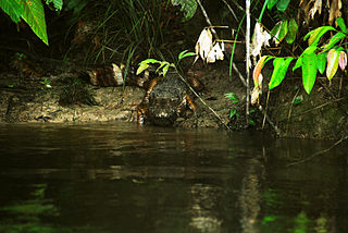
The forest is in the interfluvial region between the Rio Negro and the Uatumã River. About half of the terrain is slopes cut by streams. Features include extensive areas of buriti palms in the Urubu River floodplain, rapids and waterfalls of great scenic beauty. Vegetation is mostly intact primary terra firma rainforest, with trees up to 37 metres (121 ft) tall. The area is among the most diverse in tree species of all tropical forests in the world. Common tree species are Couroupita guianensis , Dinizia excelsa , Hevea brasiliensis , Aniba rosaeodora , Licaria brasiliensis , Aniba canelilla and Dipteryx odorata . The rich fauna includes rare species such as harpy eagle (Harpia harpyja), grey-winged trumpeter (Psophia crepitans), Guyanan red howler (Alouatta macconnelli) and red-handed tamarin (Saguinus midas).
There are three settlements in the forest. The forest has a detailed plan for a special economic zone with potential activities including large-scale timber extraction by private companies or local communities, extraction of non-timber products, with the possibility of a community management model, ecotourism, scientific research and conservation.

Novo Aripuanã is a municipality located in the Brazilian state of Amazonas.
The Jutaí-Solimões Ecological Station is an ecological station in the state of Amazonas, Brazil. It protects an area of flooded and terra firme forest in the Amazon biome.
The Rio Roosevelt Ecological Station is an ecological station in the state of Mato Grosso, Brazil.
The Antimary State Forest is a state forest in the state of Acre, Brazil. It was the first state forest in Acre, established with the goal of understanding and implementing sustainable forest exploitation, including extraction of nuts and rubber as well as selective extraction of timber. It has been extensively studied and discussed internationally as a model of sustainable forest management.
The Sucunduri State Forest is a state forest in the state of Amazonas, Brazil.
The Manicoré State Forest is a state forest in the state of Amazonas, Brazil.
The Aripuanã State Forest is a State forest in the state of Amazonas, Brazil.
The Cujubim Sustainable Development Reserve is a sustainable development reserve in the state of Amazonas, Brazil.
The Canutama State Forest is a state forest in the state of Amazonas, Brazil.
The Tapauá State Forest is a state forest in the state of Amazonas, Brazil.
The Rio Madeira Sustainable Yield Forest is a set of managed forests in the state of Rondônia, Brazil. Three sectors, A, B and C, were created in 1990 but only sectors B and C remain. The forests have not been managed in a sustainable manner.
The Uacari Sustainable Development Reserve is a sustainable development reserve in the state of Amazonas, Brazil. As of 2011 the reserve supported about 265 traditional extractive families.
The Trombetas State Forest is a state forest in the state of Pará, Brazil.
The Rio Unini Extractive Reserve is an extractive reserve in the state of Amazonas, Brazil.
The Apuí State Forest is a state forest in the state of Amazonas, Brazil.
The Biological Dynamics of Forest Fragments Project Area of Relevant Ecological Interest is an area of relevant ecological interest in the state of Amazonas, Brazil. It is the location of the Biological Dynamics of Forest Fragments Project, which explores the effects of habitat fragmentation and the processes of regeneration of forest fragments isolated by human activity.

The Tefé National Forest is a national forest in Amazonas, Brazil. It protects a relatively well-preserved area of Amazon rainforest to the south of the town of Tefé on the Solimões River . The resident population, scattered in small communities along the rivers, are engaged in sustainable farming, fishing and extraction of forest products.

The Caverna do Maroaga Environmental Protection Area is an environmental protection area in the state of Amazonas, Brazil. It contains caves and waterfalls that have tourist potential if the infrastructure were provided.
The Rio Jutaí Extractive Reserve is an extractive reserve in the state of Amazonas, Brazil.
The Maués State Forest is a state forest in the state of Amazonas, Brazil.
This page is based on this
Wikipedia article Text is available under the
CC BY-SA 4.0 license; additional terms may apply.
Images, videos and audio are available under their respective licenses.
