| River Oaks Park | |
|---|---|
 | |
 | |
| Location | San Jose, California |
| Coordinates | 37°24′13″N121°55′49″W / 37.4037°N 121.9302°W |
| Area | 5 acres (2.0 ha) |
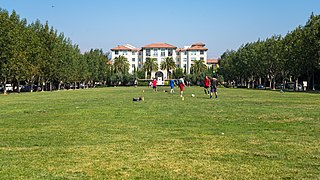
River Oaks Park is a park in San Jose, California, located in the Rincon district of North San Jose
| River Oaks Park | |
|---|---|
| | |
| | |
| Location | San Jose, California |
| Coordinates | 37°24′13″N121°55′49″W / 37.4037°N 121.9302°W |
| Area | 5 acres (2.0 ha) |
River Oaks Park is a park in San Jose, California, located in the Rincon district of North San Jose

The park was built and dedicated in 2013, on the site of Sony's former Silicon Valley manufacturing facility. [1] [2]
The land where River Oaks Park and much of its surroundings sit today was once part of the River Oaks Ranch, owned by the Okuba family, a well-established Japanese-American family of San Jose. During World War II, the Okuba family were sent to internment camps, but eventually returned to reclaim their land after the war. [3]

River Oaks Park is a crescent-shaped park located on the River Oaks Parkway, an important thoroughfare in the Rincon district of North San Jose
It is located within walking distance of the River Oaks station on the VTA light rail.
Palo Alto is a charter city located in the northwestern corner of Santa Clara County, California, United States, in the San Francisco Bay Area. The city is named after a coastal redwood tree known as El Palo Alto.
San Jose, officially San José, is the largest city in Northern California by both population and area. With a 2020 population of 1,013,240, it is the third-most populous city in California and the tenth-most populous in the United States. Located in the center of the Santa Clara Valley, on the southern shore of San Francisco Bay, San Jose covers an area of 179.97 sq mi (466.1 km2). San Jose is the county seat of Santa Clara County, the most affluent county in California and one of the most affluent counties in the United States. San Jose is the main component of the San Jose–Sunnyvale–Santa Clara Metropolitan Statistical Area, with an estimated population of around 2 million residents in 2018. It is also the most populous city in both the San Francisco Bay Area and the San Jose-San Francisco-Oakland Combined Statistical Area, which contain 7.7 million and 9.7 million people respectively.

The San Fernando Valley, known locally as the Valley, is an urbanized valley in Los Angeles County, California. Located just north of the Los Angeles Basin, it contains a large portion of the City of Los Angeles, as well as unincorporated areas and the incorporated cities of Burbank, Calabasas, Glendale, Hidden Hills, and San Fernando. The valley is well known for its iconic film studios such as Warner Bros. Studio and Walt Disney Studios. In addition, it is home to the Universal Studios Hollywood theme park.

Santa Teresa is a district of San Jose, California, located in South San Jose. Founded in 1834, Santa Teresa was originally established as Rancho Santa Teresa by the Bernal family, a prominent Californio clan. Today, Santa Teresa is largely a residential area, but also home to numerous Silicon Valley tech campuses.
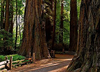
Henry Cowell Redwoods State Park is a state park of California, United States, preserving mainly forest and riparian areas in the watershed of the San Lorenzo River, including a grove of old-growth coast redwood. It is located in Santa Cruz County, primarily in the area between the cities of Santa Cruz and Scotts Valley, near the community of Felton and the University of California at Santa Cruz. The park includes a non-contiguous extension in the Fall Creek area north of Felton. The 4,623-acre (1,871 ha) park was established in 1954.
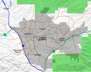
Canyon Country is a neighborhood in the eastern part of the city of Santa Clarita, in northwestern Los Angeles County, California, United States. It lies along the Santa Clara River between the Sierra Pelona Mountains and the San Gabriel Mountains. It is the most populous of Santa Clarita's four neighborhoods.

The Rincon Mountains are a significant mountain range east of Tucson, Pima County, Arizona, in the United States. The Rincon Mountains are one of five mountain ranges surrounding the Tucson valley. The other ranges include the most prominent, the Santa Catalina Mountains to the north, the Santa Rita Mountains to the south, the Tucson Mountains to the west, and the Tortolita Mountains to the northwest. Redington Pass separates the Rincon Mountains from the Santa Catalina Mountains. The Rincon Mountains are generally less rugged than the Santa Catalina Mountains and Santa Rita Mountains. The Rincon Mountains are also included in the Madrean sky island mountain ranges of southeast Arizona, extreme southwest New Mexico, and northern Sonora Mexico.

River Oaks is a light rail station operated by Santa Clara Valley Transportation Authority. This station is served by the Blue and Green lines of the VTA Light Rail system.

Santa Cruz is a district in the northern part of the City of Manila, Philippines, located on the right bank of the Pasig River near its mouth, bordered by the districts of Tondo, Binondo, Quiapo, and Sampaloc, and Grace Park (Caloocan) and La Loma. The district belongs to the 3rd congressional district of Manila in the Philippines.

Rancho Rincón de los Esteros was a 6,353-acre (25.71 km2) Mexican land grant in present-day Santa Clara County, California.
Rancho El Rincón was a 4,431-acre (17.93 km2) Mexican land grant in present-day San Bernardino County and Riverside County, California given in 1839 to Juan Bandini by Governor Juan Alvarado. El rincón means "the corner" in Spanish. The grant, located south of present-day Chino, was bounded on the east by Rancho Jurupa, on the south by the Santa Ana River, on the west by Rancho Cañón de Santa Ana, and extending northerly from the river one league. The rancho lands include Prado Regional Park.
Rancho Los Laureles was a 6,625-acre (26.81 km2) Mexican land grant in present-day Monterey County, California given in 1839 by Governor Juan Alvarado to José M. Boronda and Vicente Blas Martínez. Los Laureles refers to the California Bay Laurel tree. The grant extended along the Carmel River and the Carmel Valley, was bounded to the east by the Rancho Tularcitos and Rancho Los Laureles (Ransom) on the west, and encompasses present day Carmel Valley Village.
Rancho Cañada del Rincon en el Rio San Lorenzo was a 5,827-acre (23.58 km2) Mexican land grant in present-day Santa Cruz County, California given in 1843 by Governor Manuel Micheltorena, and confirmed in 1846 by Governor Pío Pico, to Pedro Sainsevain. The name means "valley on a corner on the San Lorenzo River". The grant was north of present-day Santa Cruz on the San Lorenzo River.

Rancho Rincón del Sanjón was a 2,230-acre (9.0 km2) Mexican land grant in present-day Monterey County, California given in 1840 by Governor Juan B. Alvarado to José Eusebio Boronda. The name means "corner of Sanjo del Alisal". The grant was located on the north side of the Sanjo del Alisal,, between Cooper's Rancho Bolsa del Potrero y Moro Cojo on the west, Castro's Rancho Sausal on the east, and bordering Espinosa's Rancho Bolsa de las Escorpinas on the north. The grant was on the northwest of present-day Salinas, where Boronda, California is located.

Rincon de los Esteros, also known as Innovation Triangle, the Golden Triangle, the Innovation District, or simply as Rincon, is a vast district of San Jose, California, making up a significant portion of North San Jose. The district has one of the largest concentrations of high tech company headquarters and campuses in Silicon Valley.
San José del Rincón is a municipality in the State of Mexico. Its inhabitants are referred to as monteros.

Communications Hill is a neighborhood located in the San Juan Bautista Hills of San Jose, California.
Moitozo Park is a park in San Jose, California, located in the Rincon district of North San Jose.

Riverview Park is a park in San Jose, California, located along the Guadalupe River in the Rincon district of North San Jose

Rincon South is a neighborhood of San Jose, California, located in North San Jose. Rincon South is a major employment hub for Silicon Valley businesses, and is home to numerous high tech companies.
| Wikimedia Commons has media related to River Oaks Park . |