
Cupertino is a city in Santa Clara County, California, United States, directly west of San Jose on the western edge of the Santa Clara Valley with portions extending into the foothills of the Santa Cruz Mountains. The population was 57,820 as of the 2020 census.

Noe Valley is a neighborhood in the central part of San Francisco, California. It is named for Don José de Jesús Noé, noted 19th-century Californio statesman and ranchero, who owned much of the area and served as mayor.
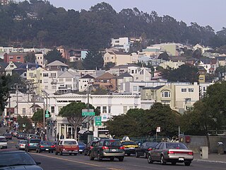
Glen Park is a residential neighborhood in San Francisco, California, located south of Twin Peaks and adjacent to Glen Canyon Park.
West San Jose is the western region of San Jose, California. The area of West San Jose is bounded on the north by the city of Santa Clara, on the east by San Tomas Expressway, on the south by Prospect Road, and on the west by De Anza Boulevard. The eastern boundary of San Jose City Council District 1 is at State Route 17.

Berryessa is a district of San Jose, California, located in North San Jose. The district is named after the Berryessa family, a prominent Californio family of the Bay Area which historically owned most of the area.

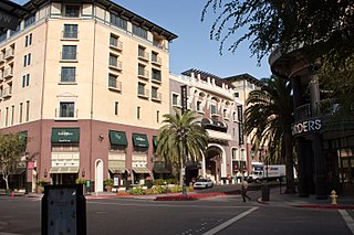
Santana Row is a residential and commercial district of West San Jose in San Jose, California. Santana Row is intersected by Stevens Creek Boulevard, a major thoroughfare, and nearby to local landmarks like Westfield Valley Fair and the Winchester Mystery House.

Stevens Creek is a creek in Santa Clara County, California. The creek originates in the Santa Cruz Mountains on the western flank of Black Mountain in the Monte Bello Open Space Preserve near the terminus of Page Mill Road at Skyline Boulevard. It flows southeasterly through the Stevens Creek County Park before turning northeast into Stevens Creek Reservoir. It then continues north for 12.5 miles through Cupertino, Los Altos, Sunnyvale and Mountain View before emptying into the San Francisco Bay at the Whisman Slough, near Google's main campus.

Westfield Valley Fair, commonly known as Valley Fair, is a prominent shopping mall in San Jose, California. Valley Fair is one of the largest malls in the United States and has the highest sales revenue of any mall in California. It is located on Stevens Creek Boulevard in West San Jose. The anchor stores are 2 Macy's stores, Bloomingdale's, and Nordstrom.
Barangka is one of sixteen barangays in Marikina, Philippines and one of the barangays in 1st district of Marikina. It is also one of the oldest barangay founded in Marikina.

Valencia Park is an urban community in the southeastern section of the city of San Diego. It is bordered by Emerald Hills and Market Street on the north, Lincoln Park and Euclid Avenue on the west, Encanto on the east, and Alta Vista and National City, California on the south. Major thoroughfares include Imperial Avenue, Churchward Street, and Valencia Parkway.

Valencia Hotel Group is a privately held corporation based in Houston that has 8 hotel properties in the United States and several projects under development.

Senator Gil J. Puyat Avenue, also known simply as Gil Puyat Avenue and formerly and still referred to as Buendia Avenue, is a major arterial thoroughfare which travels east–west through the cities of Makati and Pasay in western Metro Manila, Philippines. It is one of the busiest avenues in Metro Manila linking the Makati Central Business District with the rest of the metropolis. Its western end begins at Roxas Boulevard and continues through the district of San Isidro, Pasay until intersecting with Taft Avenue. Past the intersection with the elevated Gil Puyat LRT Station, the road runs through Tramo Street and Barangays Palanan and San Isidro in Makati. East of Osmeña Highway, Gil Puyat intersects with the busy streets of the Makati Central Business District before finally reaching its terminus on Epifanio de los Santos Avenue (EDSA). The avenue also has an extension into Forbes Park in Makati as Buendia Avenue Extension.

The following is an alphabetical list of articles related to the Philippine capital region of Metro Manila.
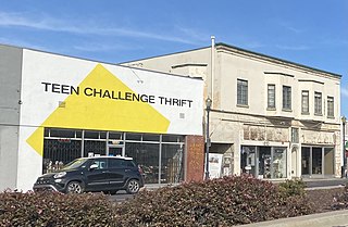
West San Carlos is a neighborhood and urban village of San Jose, California, which lies to the west of Midtown San Jose and to the east of Santana Row.

Stevens Creek Boulevard is a major thoroughfare in Santa Clara County, California, spanning from San Carlos Street, in San Jose's West San Carlos district in the East to Permanente, in the Santa Cruz Mountains west of Cupertino. It is a part of the larger Stevens Creek Boulevard/San Carlos Street corridor. Freeways that intersect it include I-880/SR 17, SR 85, and I-280.


