River terraces (tectonic–climatic interaction)

Last updated
A series of terraces along a river. The oldest terraces (T1) are higher standing than the younger terraces (T3). The present floodplain (T4) will soon become the youngest terrace surface as the river incises. A series of paired river terraces plainsvg.svg
A series of terraces along a river. The oldest terraces (T1) are higher standing than the younger terraces (T3). The present floodplain (T4) will soon become the youngest terrace surface as the river incises.

Terraces can be formed in many ways and in several geologic and environmental settings. By studying the size, shape, and age of terraces, one can determine the geologic processes that formed them. When terraces have the same age and/or shape over a region, it is often indicative that a large-scale geologic or environmental mechanism is responsible. Tectonic uplift and climate change are viewed as dominant mechanisms that can shape the earth’s surface through erosion. River terraces can be influenced by one or both of these forcing mechanisms and therefore can be used to study variation in tectonics, climate, and erosion, and how these processes interact.

Terrace (geology) A step-like landform

In geology, a terrace is a step-like landform. A terrace consists of a flat or gently sloping geomorphic surface, called a tread, that is typically bounded one side by a steeper ascending slope, which is called a "riser" or "scarp." The tread and the steeper descending slope together constitute the terrace. Terraces can also consist of a tread bounded on all sides by a descending riser or scarp. A narrow terrace is often called a bench.

Tectonic uplift The portion of the total geologic uplift of the mean earth surface that is not attributable to an isostatic response to unloading

Tectonic uplift is the portion of the total geologic uplift of the mean Earth surface that is not attributable to an isostatic response to unloading. While isostatic response is important, an increase in the mean elevation of a region can only occur in response to tectonic processes of crustal thickening, changes in the density distribution of the crust and underlying mantle, and flexural support due to the bending of rigid lithosphere.

Climate change Change in the statistical distribution of weather patterns for an extended period

Climate change is a change in the statistical distribution of weather patterns when that change lasts for an extended period of time. Climate change is caused by factors such as biotic processes, variations in solar radiation received by Earth, plate tectonics, and volcanic eruptions and certain human activities have been identified as primary causes of ongoing climate change, often referred to as global warming. There is no general agreement in scientific, media or policy documents as to the precise term to be used to refer to anthropogenic forced change; either "global warming" or "climate change" may be used.

Contents

River terrace formation

The Rio Grande, flowing down through the Rio Grande Rift for the last several million years. The last stage of incision by the river is thought to be driven by the Milankovitch eccentricity cycle. Increased precipitation and sediment supply drove incision of the high standing terraces, beginning at ~800ka. Rio Grande White Rock Overlook Park View 2006 09 05.jpg
The Rio Grande, flowing down through the Rio Grande Rift for the last several million years. The last stage of incision by the river is thought to be driven by the Milankovitch eccentricity cycle. Increased precipitation and sediment supply drove incision of the high standing terraces, beginning at ~800ka.

Long-lived river (fluvial) systems can produce a series of terrace surfaces over the course of their geologic lifetime. When rivers flood, sediment deposits in sheets across the floodplain and build up over time. Later, during a time of river erosion, this sediment is cut into, or incised, by the river and flushed downstream. The previous floodplain is therefore abandoned and becomes a river terrace. A river terrace is composed of an abandoned surface, or tread, and the incised surface, or riser. [2] If you can date the age of the terrace tread, one can get an estimate of the age of abandonment of that surface, and the age of incision. A simple calculation of h1/t1 can give the average rate of incision(ri), where hi = height of river terrace from river and ti = age of surface. [3] It is important to note that these rates of incision assume a constant rate of incision over the entire height and time.

Aggradation The increase in land elevation due to the deposition of sediment

Aggradation is the term used in geology for the increase in land elevation, typically in a river system, due to the deposition of sediment. Aggradation occurs in areas in which the supply of sediment is greater than the amount of material that the system is able to transport. The mass balance between sediment being transported and sediment in the bed is described by the Exner equation.

Floodplain Land adjacent to a stream or river which is flooded during periods of high discharge

A floodplain or flood plain is an area of land adjacent to a stream or river which stretches from the banks of its channel to the base of the enclosing valley walls, and which experiences flooding during periods of high discharge. The soils usually consist of levees, silts, and sands deposited during floods. Levees are the heaviest materials and they are deposited first; silts and sands are finer materials.

River incision

River incision is the narrow erosion caused by a river or stream that is far from its base level. River incision is common after tectonic uplift of the landscape. Incision by multiple rivers result in a dissected landscape, for example a dissected plateau. River Incision is the natural process by which a river cuts downward into its bed, deepening the active channel. Though it is a natural process, it can be accelerated rapidly by human factors including land use changes such as timber harvest, mining, agriculture, and road and dam construction. The rate of incision is a function of basal shear-stress. Shear stress is increased by factors such as sediment in the water, which increase its density. Shear stress is proportional to water mass, gravity, and Sw, where t= Shear Stress (N/m2), g= Weight Density of Water, D = Average water depth, and Sw = Water Surface slope. Increases in slope, depth, or density of water increase the water’s potential to cause erosion.

Age of terraces

Time of incision versus time of aggradation

The ages of incision and flooding (aggradation) can have different interpretations for each fluvial system, where each region may respond independently to external variation. Many variables control the behavior of the river and whether it erodes or floods. Changes in the steepness of the stream gradient, the amount of sediment contained in the river, and the total amount of water flowing through the system, all influence how a river behaves. There is a delicate equilibrium that controls a river system, which, when disturbed, causes flooding and incising events to occur and produce terracing. [3] [4]

In hydrology, discharge is the volumetric flow rate of water that is transported through a given cross-sectional area. It includes any suspended solids (e.g. sediment), dissolved chemicals (e.g. CaCO3(aq)), or biologic material (e.g. diatoms) in addition to the water itself.

Dating of these abandoned terrace surfaces (treads) is possible using a variety of geochronologic techniques. The type of technique used, however, is dependent on the composition and age of the terraces. Currently used techniques are magnetostratigraphy, low temperature thermochronology, cosmogenic nuclides, radiocarbon, thermoluminescence, optically stimulated luminescence, and U-Th disequilibria. Additionally, if there is a succession of preserved fossils, biostratigraphy can be used.

Geochronology Science of determining the age of rocks, sediments and fossils

Geochronology is the science of determining the age of rocks, fossils, and sediments using signatures inherent in the rocks themselves. Absolute geochronology can be accomplished through radioactive isotopes, whereas relative geochronology is provided by tools such as palaeomagnetism and stable isotope ratios. By combining multiple geochronological indicators the precision of the recovered age can be improved.

Magnetostratigraphy is a geophysical correlation technique used to date sedimentary and volcanic sequences. The method works by collecting oriented samples at measured intervals throughout the section. The samples are analyzed to determine their characteristic remanent magnetization (ChRM), that is, the polarity of Earth's magnetic field at the time a stratum was deposited. This is possible because volcanic flows acquire a thermoremanent magnetization and sediments acquire a depositional remanent magnetization, both of which reflect the direction of the Earth's field at the time of formation. This technique is typically used to date sequences that generally lack fossils or interbedded igneous rock.

Thermochronology is the study of the thermal evolution of a region of a planet. Thermochronologists use radiometric dating along with the closure temperatures that represent the temperature of the mineral being studied at the time given by the date recorded, to understand the thermal history of a specific rock, mineral, or geologic unit. It is a subfield within geology, and is closely associated with geochronology.

Scale of observation

Scale of observation is always a factor when evaluating tectonic and climatic forcing. At a glimpse in geologic time, one of these forcing mechanisms may look to be the dominant process. Observations made on long geologic times scales (≥106 annum) typically reveal much about slower, larger-magnitude geologic processes such as tectonism [5] from a regional to even global scale. Evaluation on geologically short time scales (103-105 a) can reveal much about the relatively shorter climatic cycles, [5] local to regional erosion, and how they could drive terrace development. Regional periods of terrace formation likely mark a time of when stream erosion was much greater than sediment accumulation. River erosion can be driven by tectonic uplift, climate, or potentially both mechanisms. It is difficult in many areas, however, to decisively pinpoint whether tectonism or climate change can individually drive tectonic uplift, enhanced erosion, and therefore terrace formation. In many cases, simplifying the geologic issue to tectonic-driven vs. climate-driven is a mistake because tectonic-climate interactions occur together in a positive feedback cycle.

Climate and terraces

A schematic diagram of the morphology of coastal/marine terraces. Periodic uplift will force old shorelines up, which create the terrace treads. Wave erosion on these old shorelines will produce the scarp, or terrace riser. Marine Terrace diagram(plain svg).svg
A schematic diagram of the morphology of coastal/marine terraces. Periodic uplift will force old shorelines up, which create the terrace treads. Wave erosion on these old shorelines will produce the scarp, or terrace riser.
A satellite image of the Himalayas and the rainshadow effect. Development of the Himalayan front and South Asian Monsoon is thought to be driven by tectonic-climatic interactions. Himalayas landsat 7.png
A satellite image of the Himalayas and the rainshadow effect. Development of the Himalayan front and South Asian Monsoon is thought to be driven by tectonic-climatic interactions.

Rivers in continental interiors that have not experienced tectonic activity in the geological recent history likely record climatic changes through terracing. Terraces record natural, periodic variations driven by cycles such as the Milankovitch cycle. These cycles can describe how the Earth's orbit and rotational wobble vary over time. The Milankovitch cycles, along with solar forcing, have been determined to drive periodic environmental change on a global scale, namely between glacial and interglacial environments. Each river system will respond to these climate variations on a regional scale. In addition, the regional environment will determine how change in sediment and precipitation will drive river incision and aggradation. Terraces along the river will record the cyclic changes, where glacial and interglacial time periods are associated with either incision or aggradation.

Milankovitch cycles

Milankovitch cycles describe the collective effects of changes in the Earth's movements on its climate over thousands of years. The term is named for Serbian geophysicist and astronomer Milutin Milanković. In the 1920s, he hypothesized that variations in eccentricity, axial tilt, and precession of the Earth's orbit resulted in cyclical variation in the solar radiation reaching the Earth, and that this orbital forcing strongly influenced climatic patterns on Earth.

Interglacial interval of time within an ice age that is marked by warmer temperatures

An interglacial period is a geological interval of warmer global average temperature lasting thousands of years that separates consecutive glacial periods within an ice age. The current Holocene interglacial began at the end of the Pleistocene, about 11,700 years ago.

Tectonic uplift and terraces

In contrast, coastal marine terraces can be preserved only by tectonism or a progressive lowering of sea level. The seismically active coastline of southern California, USA, [6] for example, can be considered an emergent coastline, where tectonism due to transpression provides uplift of shorelines formed during periods of relatively high sea level. Subsequent wave erosion along uplifted portions of the coastline produces an inset wave cut platform and terrace riser below the abandoned marine terrace surface that formed initially at sea level. Uplift can therefore lead to a sequence of marine terraces at a few distinct elevations along the coast. Although these surfaces formed at sea level maxima during interglacial periods, the landforms are preserved solely due to tectonic uplift.

Tectonic–climatic interactions and terraces

Tectonic uplift and climatic factors interact as a positive feedback system, where each forcing mechanism drives the other. One of the greatest examples of this feedback between tectonic and climatic interactions may be preserved in the Himalayan front and in the development of the rain shadow effect and the Asian Monsoon.

The Himalayas act as an orographic barrier that can impede atmospheric circulation and moving air masses. When these air masses try to move up and over the Himalaya, they are forced up against the barrier. The mass condenses as it rises, releasing moisture, which results in precipitation on that flank of the mountains. As the air mass moves over the mountain, it gradually becomes drier until it descends on the other side of the barrier with little moisture left. This effect is known the " rain shadow effect. In the Himalaya, this barrier effect is so great that it was an important environmental factor in developing the Asian Monsoon. [7] [8] [9]

Tectonic uplift during the creation of high mountainous regions can produce incredible surface elevations and therefore exposure of rocks to wind and water. High precipitation can drive enhanced erosion of the exposed rocks and lead to rapid denudation of sediment from the mountains. Buoyancy of the crust, or isostasy, will then drive further tectonic uplift, in order to achieve equilibrium, as sediment is continuously stripped from the top. [10] Enhanced uplift will then create higher topography, drive increased precipitation which will concentrate erosion, and further uplift.

See also

Related Research Articles

Entrenched river

An entrenched river, or entrenched stream is a river or stream that flows in a narrow trench or valley cut into a plain or relatively level upland. In the case of or either an entrenched stream or river, it is often presumed that the watercourse has inherited its course by cutting down into bedrock from a pre-existing plain with little modification of the original course. The down-cutting of the river system could be the result not only of tectonic uplift but also of other factors such as river piracy, decrease of load, increase of runoff, extension of the drainage basin, or change in base level such as a fall in sea level. General, nongeneric terminology for either a river or stream that flows in a narrow trench or valley, for which evidence of a preexisting plain or relatively level upland can be either absent or present is either valley meander or meander valley with the latter term being preferred in literature.

Geomorphology The scientific study of landforms and the processes that shape them

Geomorphology is the scientific study of the origin and evolution of topographic and bathymetric features created by physical, chemical or biological processes operating at or near the Earth's surface. Geomorphologists seek to understand why landscapes look the way they do, to understand landform history and dynamics and to predict changes through a combination of field observations, physical experiments and numerical modeling. Geomorphologists work within disciplines such as physical geography, geology, geodesy, engineering geology, archaeology, climatology and geotechnical engineering. This broad base of interests contributes to many research styles and interests within the field.

Peneplain A low-relief plain formed by protracted erosion

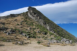
In geomorphology and geology a peneplain is a low-relief plain formed by protracted erosion. This is the definition in the broadest of terms, albeit with frequency the usage of peneplain is meant to imply the representation of a near-final stage of fluvial erosion during times of extended tectonic stability. Peneplains are sometimes associated with the cycle of erosion theory of William Morris Davis, but Davis and other workers have also used the term in a purely descriptive manner without any theory or particular genesis attached.

Raised beach A beach or wave-cut platform raised above the shoreline by a relative fall in the sea level

A raised beach, coastal terrace, or perched coastline is a relatively flat, horizontal or gently inclined surface of marine origin, mostly an old abrasion platform which has been lifted out of the sphere of wave activity. Thus, it lies above or under the current sea level, depending on the time of its formation. It is bounded by a steeper ascending slope on the landward side and a steeper descending slope on the seaward side. Due to its generally flat shape it is often used for anthropogenic structures such as settlements and infrastructure.

Terrain Vertical and horizontal dimension and shape of land surface

Terrain or relief involves the vertical and horizontal dimensions of land surface. The term bathymetry is used to describe underwater relief, while hypsometry studies terrain relative to sea level. The Latin word terra means "earth."

Kobuk River watercourse in the United States of America

The Kobuk River is a river located in the Arctic region of northwestern Alaska in the United States. It is approximately 280 miles (451 km) long. Draining a basin with an area of 12,300 square miles (32,000 km2), the Kobuk River is among the largest rivers in northwest Alaska with widths of up to 1500 feet and flow at a speed of 3–5 miles per hour in its lower and middle reaches. The average elevation for the Kobuk River Basin is 1,300 feet (400 m) above sea level, ranging from near sea level to 11,400 feet. Topography includes low, rolling mountains, plains and lowlands, moderately high rugged mountainous land, and some gently sloped plateaus and highlands. The river contains an exceptional population of sheefish, a large predatory whitefish within the salmon family, found throughout the Arctic that spawns in the river's upper reaches during the autumn. A portion of the vast Western Arctic Caribou Herd utilize the Kobuk river valley as winter range.

Sequence stratigraphy is a branch of geology that attempts to subdivide and link sedimentary deposits into unconformity bound units on a variety of scales and explain these stratigraphic units in terms of variations in sediment supply and variations in the rate of change in accommodation space. The essence of the method is mapping of strata based on identification of surfaces which are assumed to represent time lines, and therefore placing stratigraphy in chronostratigraphic framework. Sequence stratigraphy is a useful alternative to a lithostratigraphic approach, which emphasizes similarity of the lithology of rock units rather than time significance.

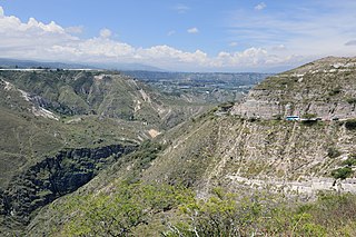
Fluvial terraces are elongated terraces that flank the sides of floodplains and fluvial valleys all over the world. They consist of a relatively level strip of land, called a “tread,” separated from either an adjacent floodplain, other fluvial terraces, or uplands by distinctly steeper strips of land called “risers.” These terraces lie parallel to and above the river channel and its floodplain. Because of the manner in which they form, fluvial terraces are underlain by fluvial sediments of highly variable thickness.

The geographic cycle or cycle of erosion is an idealized model that explains the development of relief in landscapes. The model starts with the erosion that follows uplift of land above a base level and ends – if conditions allow – in the formation of a peneplain. Landscapes that show evidence of more than one cycle of erosion are termed "polycyclical". The cycle of erosion and some of its associated concepts have, despite popularity, been a subject of much criticism.

Knickpoint

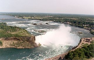
In geomorphology, a knickpoint or nickpoint is part of a river or channel where there is a sharp change in channel slope, such as a waterfall or lake. Knickpoints reflect different conditions and processes on the river, often caused by previous erosion due to glaciation or variance in lithology. In the cycle of erosion model, knickpoints advance one cycle upstream, or inland, replacing an older cycle.

Abrasion (geology)

Abrasion is a process of erosion which occurs when material being transported wears away at a surface over time. It is the process of friction caused by scuffing, scratching, wearing down, marring, and rubbing away of materials. The intensity of abrasion depends on the hardness, concentration, velocity and mass of the moving particles. Abrasion generally occurs four ways. Glaciation slowly grinds rocks picked up by ice against rock surfaces. Solid objects transported in river channels make abrasive surface contact with the bed and walls. Objects transported in waves breaking on coastlines cause abrasion. And, finally, abrasion can be caused by wind transporting sand or small stones against surface rocks.

In geology, lake capture is the process of capture of the waters collected in a lake by a neighbor river basin.

Erosion and tectonics

The interaction between erosion and tectonics has been a topic of debate since the early 1990s. While the tectonic effects on surface processes such as erosion have long been recognized, the opposite has only recently been addressed. The primary questions surrounding this topic are what types of interactions exist between erosion and tectonics and what are the implications of these interactions. While this is still a matter of debate, one thing is clear, the Earth's landscape is a product of two factors: tectonics, which can create topography and maintain relief through surface and rock uplift, and climate, which mediates the erosional processes that wear away upland areas over time. The interaction of these processes can form, modify, or destroy geomorphic features on the Earth’s surface.

An alluvial river is a river in which the bed and banks are made up of mobile sediment and/or soil. Alluvial rivers are self-formed, meaning that their channels are shaped by the magnitude and frequency of the floods that they experience, and the ability of these floods to erode, deposit, and transport sediment. For this reason, alluvial rivers can assume a number of forms based on the properties of their banks; the flows they experience; the local riparian ecology; and the amount, size, and type of sediment that they carry.

In geology, degradation refers to the lowering of a fluvial surface, such as a stream bed or floodplain, through erosional processes. Degradation is the opposite of aggradation. Degradation is characteristic of channel networks in which either bedrock erosion is taking place, or in systems that are sediment-starved and are therefore entraining more material than they are depositing. When a stream degrades, it leaves behind a fluvial terrace. This can be further classified as a strath terrace—a bedrock terrace that may have a thin mantle of alluvium—if the river is incising through bedrock. These terraces may be dated with methods such as cosmogenic radionuclide dating, OSL dating, and paleomagnetic dating to find when a river was at a particular level and how quickly it is downcutting.

Tectonic–climatic interaction is the interrelationship between tectonic processes and the climate system. The tectonic processes in question include orogenesis, volcanism, and erosion, while relevant climatic processes include atmospheric circulation, orographic lift, monsoon circulation and the rain shadow effect. As the geological record of past climate changes over millions of years is sparse and poorly resolved, many questions remain unresolved regarding the nature of tectonic-climate interaction, although it is an area of active research by geologists and palaeoclimatologists.

A river anticline is a geologic structure that is formed by the focused uplift of rock caused by high erosion rates from large rivers relative to the surrounding areas. An anticline is a fold that is concave down, whose limbs are dipping away from its axis, and whose oldest units are in the middle of the fold. These features form in a number of structural settings. In the case of river anticlines, they form due to high erosion rates, usually in orogenic settings. In a mountain building setting, like that of the Himalaya or the Andes, erosion rates are high and the river anticline's fold axis will trend parallel to a major river. When river anticlines form, they have a zone of uplift between 50-80 kilometers wide along the rivers that form them.

The glacial buzzsaw is a hypothesis claiming erosion by warm-based glaciers is key to limit the height of mountains above certain threshold altitude. To this the hypothesis adds that great mountain massifs are leveled towards the equilibrium line altitude (ELA), which would act as a “climatic base level”. Starting from the hypothesis it has been predicted that local climate restricts the maximum height that mountain massifs can attain by effect of uplifting tectonic forces. It follows that as local climate is cooler at higher latitudes the highest mountains are lower there compared to the tropics where glaciation is and has been more limited. The mechanism behind the glacial buzzsaw effect would be the erosion of small glaciers that are mostly unable to erode much below the equilibrium line altitude since they do not reach these altitudes because of increased ablation. Instead, large valley glaciers may easily surpass the equilibrium line altitude and do therefore not contribute to a glacial buzzsaw effect. This is said to be the case of the Patagonian ice fields where lack of buzzsaw effect results in rapid tectonic uplift rates.

References

  1. Leeder, M.R., and Mack, G.M., 2002, Basin-fill incision, Rio Grande and Gulf of Corinth rifts: Convergent response to climatic and tectonic drivers, in, Nichols, G., Williams, E., and Paola, C., eds., Sedimentary Processes, Environments and Basins: A tribute to Peter Friend: International Association of Sedimentologists Special Publication No. 38, p. 9-27.
  2. Easterbrook, D.J., 1999, Surface Processes and Landforms: New York, New York, Prentice Hall, 546 p.
  3. 1 2 Blum, M.D., and Tornqvist, T. E., 2000, Fluvial responses to climate and sea-level change: a review and look forward: Sedimentology, 47, p. 2-48.
  4. Schumm, S., 1979, The fluvial system: Blackburn Press, 338 p.
  5. 1 2 Einsele, G., Ricken, W., Sielacher, A., 1991, Cycles and events in stratigraphy: basic concepts and terms, in Einsele, G., Ricken, W., and Sielacher, A., eds., Cycles and events in Stratigraphy, New York, Springer-Verlag, pp 1-19.
  6. Lajoie, K.R., 1986, Coastal Tectonics, in Active Tectonics: studies in geophysics: Washington, D.C., National Academy Press, 266 p.
  7. Zisheng, A., Kutzbach, J. E., Prell, W. L., and Porter, S. C., 2001, "Evolution of Asian monsoons and phased uplift of the Himalayan–Tibetan plateau since Late Miocene times": Nature, 411, p. 62-66
  8. Clift, P. D., and Plumb, R. A., The Asian Monsoon: Causes, history and effects: Cambridge, Cambridge University Press, 270 pp.
  9. Clift, P. D., Tada, R., and Zheng, H., Monsoon evolution and tectonics-climate linkages in Asian:an introduction: Geological Society of London, Special Publications, 342, p. 1–4.
  10. Pinter, N., and Brandon, M. T., 1997, "How erosion builds mountains": Scientific American, 1997, p. 74–79.