Riverside, Harford County, Maryland | |
---|---|
![]() | |
Coordinates: 39°28′35″N76°14′42″W / 39.47639°N 76.24500°W | |
Country | United States |
State | Maryland |
County | Harford |
Area | |
• Total | 2.62 sq mi (6.78 km2) |
• Land | 2.61 sq mi (6.77 km2) |
• Water | 0.00 sq mi (0.01 km2) |
Elevation | 79 ft (24 m) |
Population (2020) | |
• Total | 7,021 |
• Density | 2,686.95/sq mi (1,037.25/km2) |
Time zone | UTC−5 (Eastern (EST)) |
• Summer (DST) | UTC−4 (EDT) |
ZIP code | 21017 |
Area code | 410 |
FIPS code | 24-66762 |
GNIS feature ID | 1698813 |
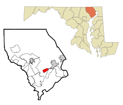
Riverside is a census-designated place (CDP) in Harford County, Maryland, United States. The population was 6,425 at the 2010 census. [2] The term "Riverside" is generally used interchangeably with "Belcamp"; both names are accepted for the U.S. Postal Service's ZIP Code of 21017. However, the original community of Belcamp is located south of U.S. Route 40, outside the Riverside CDP.
Riverside is located at 39°28′35″N76°14′42″W / 39.47639°N 76.24500°W (39.476385, −76.244943). [3] It is bordered to the north by Maryland Route 7 (Philadelphia Road) and to the south by U.S. Route 40 (Pulaski Highway). It extends west to the Bush River and James Run, and to the east it reaches to Grays Run. Maryland Route 543 (Riverside Parkway) passes through the center of the CDP, crossing Route 7 and ending at US 40. Just north of the CDP, MD 543 crosses Interstate 95 at Exit 80. I-95 leads southwest 30 miles (48 km) to Baltimore and northeast 45 miles (72 km) to Wilmington, Delaware. Bel Air, the Harford County seat, is 8 miles (13 km) northwest of Riverside via MD 543.
According to the United States Census Bureau, the Riverside CDP has a total area of 2.4 square miles (6.1 km2), of which 0.01 square miles (0.03 km2), or 0.48%, is water. [2]
One of the major revenue sources in Riverside is derived from its location, connecting Route 40 with Interstate 95 via Route 543. Hence, many of the commercial establishments in this area are designed for long-distance drivers. These include four hotels and four gas stations/convenience stores. All commercially zoned property is located off Route 543, also known as the Riverside Parkway.
The Riverside area also includes multiple business parks, among which is a major industrial park that features numerous corporations and business offices such as Northrop Grumman. Mercedes-Benz had a manufacturing building at one time, but that is now closed and the building is for sale. A business park built on Route 40 at the former site of the Bata Shoes factory opened in 2000 and originally provided offices for Clark Turner Signature Homes and SURVICE Engineering. Expansion to the business park has brought in Booz Allen Hamilton and SafeNet.
Census | Pop. | Note | %± |
---|---|---|---|
2020 | 7,021 | — | |
U.S. Decennial Census [4] |
As of the census [5] of 2000, there were 6,128 people, 2,322 households, and 1,569 families residing in the CDP. The population density was 2,541.0 inhabitants per square mile (981.1/km2). There were 2,466 housing units at an average density of 1,022.5 per square mile (394.8/km2). The racial makeup of the CDP was 79.62% White, 15.19% African American, 0.39% Native American, 1.58% Asian, 0.05% Pacific Islander, 1.17% from other races, and 1.99% from two or more races. Hispanic or Latino of any race were 3.21% of the population.
There were 2,322 households, out of which 40.9% had children under the age of 18 living with them, 53.9% were married couples living together, 10.4% had a female householder with no husband present, and 32.4% were non-families. 24.1% of all households were made up of individuals, and 2.3% had someone living alone who was 65 years of age or older. The average household size was 2.59 and the average family size was 3.12.
In the CDP, the population was spread out, with 29.0% under the age of 18, 6.9% from 18 to 24, 43.9% from 25 to 44, 15.5% from 45 to 64, and 4.7% who were 65 years of age or older. The median age was 31 years. For every 100 females, there were 92.0 males. For every 100 females age 18 and over, there were 89.5 males.
The median income for a household in the CDP was $57,641, and the median income for a family was $60,088. Males had a median income of $40,750 versus $31,600 for females. The per capita income for the CDP was $23,158. About 1.6% of families and 3.3% of the population were below the poverty line, including 2.1% of those under age 18 and 3.3% of those age 65 or over.
Harford County is located in the U.S. state of Maryland. As of the 2020 census, the population was 260,924. Its county seat is Bel Air. Harford County is included in the Baltimore-Columbia-Towson, MD Metropolitan Statistical Area, which is also included in the Washington-Baltimore-Arlington, DC-MD-VA-WV-PA Combined Statistical Area.
Brooklyn Park is a census-designated place (CDP) in Anne Arundel County, Maryland, United States. The population was 14,373 at the 2010 census.
Ferndale is a census-designated place (CDP) in Anne Arundel County, Maryland, United States. At the 2010 census, the population was 16,746.
Maryland City is a census-designated place (CDP) in Anne Arundel County, Maryland, United States. The population was 16,093 at the 2010 census. It is located east of Laurel, just over the border with Prince George's County, and it has a Laurel ZIP Code. Maryland City mostly consists of an older, compact housing development and is adjacent to Fort Meade army base. A large newer development on the north side of Maryland Route 198 is known as Russett and is included within the Maryland City CDP.
Carney is an unincorporated community and census-designated place in Baltimore County, Maryland, United States. The population was 29,941 at the 2010 census.
Edgemere is an unincorporated community and census-designated place in Baltimore County, Maryland, United States. The population was 8,669 at the 2010 census. Founded in 1899 as Edgemere being renamed from previous name "Fitzell". Meeting held at the Fitzell Farm which was situated where the old Rheem plant was located.
Lochearn is an unincorporated community and census-designated place in Baltimore County, Maryland, United States, located immediately to the west of the City of Baltimore. Per the 2020 census, the population was 25,511.
Overlea is an unincorporated community and census-designated place in Baltimore County, Maryland, United States. The population was 12,275 at the 2010 census. Students attend Overlea High School. Area roads include Belair Road and Kenwood Avenue.
Parkville is an unincorporated community and census-designated place in Baltimore County, Maryland, United States. As of the 2010 census, the population was 30,734.
Rosedale is an unincorporated community and census-designated place in Baltimore County, Maryland, United States. The population was 19,257 at the 2010 United States Census.
Rossville is an unincorporated community and census-designated place in Baltimore County, Maryland, United States. The population was 15,147 at the 2010 census.
Bel Air North is a census-designated place (CDP) in Harford County, Maryland, United States. It is situated immediately north of the incorporated town of Bel Air. As of the 2010 census, the CDP population was 30,568, up from 25,798 in 2000.
Bel Air South is a census-designated place (CDP) in Harford County, Maryland, United States. The population was 47,709 at the 2010 census, up from 39,711 in 2000.
Edgewood is an unincorporated community and census-designated place (CDP) in Harford County, Maryland, United States. The population was 25,562 at the 2010 census, up from 23,378 in 2000.
Fallston is a census-designated place (CDP) in Harford County, Maryland, United States. The population was 8,958 at the 2010 census, up from 8,427 in 2000. Fallston is a semi-rural community consisting mostly of farms and suburban-like developments.
Jarrettsville is an unincorporated community and census-designated place (CDP) in Harford County, Maryland, United States. The population was 2,888 at the 2020 census.
Perryman is an unincorporated community and census-designated place (CDP) in Harford County, Maryland, United States. The population was 2,342 at the 2010 census.
Pleasant Hills is a census-designated place (CDP) in Harford County, Maryland, United States. The population was 3,379 at the 2010 census, up from 2,851 in 2000. There is no post office with the designation "Pleasant Hills"; most of the residents have either Fallston or Kingsville addresses and consider themselves as belonging to those communities.
Cloverly is an unincorporated town and census-designated place in Montgomery County, Maryland, United States. Its population was 15,285 as of the 2020 census.
Calverton is an unincorporated area and census-designated place located on the boundary between Montgomery and Prince George's counties, Maryland, in the United States. At the 2020 census, it had a population of 17,316.