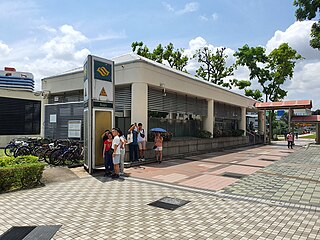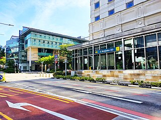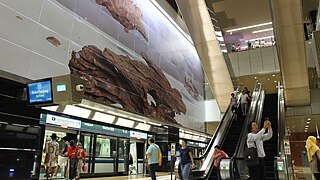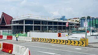
Little India MRT station is an underground Mass Rapid Transit (MRT) interchange station on the North East (NEL) and Downtown (DTL) lines. The station is located at the junction of Bukit Timah Road and Race Course Road, and serves the ethnic neighbourhood of Little India. Several landmarks surrounding the station include KK Women's and Children's Hospital, Tekka Market, and the Land Transport Authority headquarters.

Tampines MRT station is a Mass Rapid Transit (MRT) interchange station on the East West (EWL) and Downtown (DTL) lines in Tampines, Singapore. Located in the heart of the Tampines town centre next to Tampines Avenue 4, Tampines Central 4 and Tampines Central 5, it is in close proximity to the Tampines and Tampines Concourse bus interchanges. The station also serves the surrounding retail developments of Tampines Mall, Tampines One and Century Square.

Expo MRT station is a Mass Rapid Transit (MRT) interchange station on the East West line (EWL) and Downtown line (DTL) in the Tampines planning area, Singapore. The station lies between Changi City Point and the Singapore Expo, located along Changi South Avenue 1 at the junction of Expo Drive.

Newton MRT station is an underground Mass Rapid Transit (MRT) interchange station on the North South (NSL) and Downtown (DTL) lines. It is located in Newton, Singapore, at the junction of Scotts Road and Bukit Timah Road near Newton Circus. The station serves the offices and condominiums around Newton Circus including Goldbell Towers and Scotts Highpark, and it is within walking distance to the Newton Food Centre.

Promenade MRT station is an underground Mass Rapid Transit (MRT) interchange station on the Downtown (DTL) and Circle (CCL) lines in Downtown Core, Singapore. Located underneath Temasek Avenue and adjacent to Millenia Tower, the station serves several key attractions and locations such as Suntec City and the Marina Promenade, which the station is named after. The station is at the junction of the Dhoby Ghaut and Marina Bay branches of the CCL.

Bugis MRT station is an underground Mass Rapid Transit (MRT) interchange station on the East–West (EWL) and Downtown (DTL) lines. Situated in Bugis, Singapore, the station is underneath the junction of Rochor Road and Victoria Street. Various developments surrounding the station include Bugis Junction, Raffles Hospital and the National Library. The station is also close to Kampung Glam.

Downtown MRT station is an underground Mass Rapid Transit (MRT) station on the Downtown line (DTL). Located in Downtown Core, Singapore, underneath Central Boulevard, the station serves various commercial developments including the Marina Bay Financial Centre, Asia Square and SGX Centre. The station is operated by SBS Transit.

Telok Ayer MRT station is an underground Mass Rapid Transit (MRT) station on the Downtown line (DTL). Situated in Outram, Singapore, the station serves various offices and commercial developments around the junction of Cross Street and Telok Ayer Street. The station is operated by SBS Transit.

The Downtown Line (DTL) is a medium-capacity Mass Rapid Transit (MRT) line in Singapore. It runs from Bukit Panjang station in the north-west of the country towards Expo station in the east via a loop around the city-centre. Coloured blue on the rail map, the line serves 34 stations, all of which are underground. The DTL is the fifth MRT line on the network to be opened and the third line to be entirely underground. It is the second MRT line to be operated by ComfortDelGro's SBS Transit after the North East Line. It also serves as an alternative to the East–West Line where it runs roughly geographically parallel from Bugis to Expo station.

Stevens MRT station is an underground Mass Rapid Transit (MRT) interchange station on the Downtown (DTL) and Thomson–East Coast (TEL) lines. Situated at the junction of Stevens Road and Bukit Timah Road, it serves the nearby Singapore Chinese Girls' School and St. Joseph's Institution, as well as the Raffles Town Club and the surrounding private estates.

Tan Kah Kee MRT station is an underground Mass Rapid Transit (MRT) station on the Downtown Line (DTL) in Bukit Timah, Singapore. Located directly underneath the campus of Hwa Chong Institution (HCI), this station was named after the founder of the institution Tan Kah Kee. In addition to HCI, other educational institutions within the vicinity of this station include Nanyang Girls' High School, Raffles Girls' Primary School and National Junior College.

King Albert Park MRT station is an underground Mass Rapid Transit (MRT) station on the Downtown line (DTL) in Bukit Timah, Singapore. Located at the western end of Bukit Timah Road at the junction of Blackmore Drive, this station serves the private residential estates along the Bukit Timah corridor. Sites surrounding the station include Methodist Girls' School, Ngee Ann Polytechnic, and the preserved Bukit Timah Railway Station.

Hillview MRT station is an underground Mass Rapid Transit (MRT) station on the Downtown Line, situated on the boundaries of Hillview and Nature Reserve planning subzones of Bukit Batok and Bukit Panjang respectively, Singapore.

Bukit Panjang MRT/LRT station is a Mass Rapid Transit (MRT) and Light Rail Transit (LRT) interchange station on the Downtown line (DTL) and the Bukit Panjang LRT line (BPLRT) in Singapore. Located in the namesake estate of Bukit Panjang, the station is at the junction of Upper Bukit Timah Road and Petir Road. The station serves the commercial buildings of Bukit Panjang Plaza, Hillion Mall, and Junction 10. It forms a part of the Bukit Panjang Integrated Transport Hub (BPITH), which also contains a bus interchange.

Bencoolen MRT station is an underground Mass Rapid Transit (MRT) station on the Downtown Line (DTL) in Singapore. Located under Bencoolen Street, the station serves primarily the Nanyang Academy of Fine Arts (NAFA), Singapore Management University and surrounding developments. At 43 metres (141 ft) below street level, Bencoolen is the deepest station in Singapore.

Mattar MRT station is an underground Mass Rapid Transit (MRT) station on the Downtown line (DTL) in Geylang, Singapore. The station is located underneath Mattar Road near the junction of Merpati Road. Surrounding landmarks of the station include Canossa Convent, Masjid Sallim Mattar, Church of St Stephen, and Circuit Road Food Centre. The station is operated by SBS Transit.

Bedok North MRT station is an underground Mass Rapid Transit station on the Downtown line in the northern part of Bedok, Singapore, located along Bedok North Road, near the Pan Island Expressway flyover and the Bedok Town Park. It serves nearby HDB estates, the nearby Damai Primary School and will serve a future integrated hospital in the area.

Jalan Besar MRT station is an underground Mass Rapid Transit station on the Downtown Line in Rochor, Singapore. The station is located under Jalan Besar, at the junction with Weld Road, hence its name.

Sungei Bedok MRT station is a future underground Mass Rapid Transit interchange and terminal station on the Downtown line and Thomson–East Coast line in Bedok planning area, Singapore. The station is being built east of where Upper East Coast Road becomes Bedok Road, and will serve residents of the Eastwood estate. Nearby facilities include the Bedok Food Centre, Eastwood Centre and the Laguna National Golf & Country Club.
Sungei Kadut MRT station is a future Mass Rapid Transit interchange station on the North South (NSL) and Downtown (DTL) lines, located in Sungei Kadut, Singapore. First announced as a provisional station on the NSL Woodlands Extension in the 1990s, plans for its construction was eventually confirmed in the Land Transport Master Plan (LTMP) 2040 by the Land Transport Authority (LTA).


