Related Research Articles

Union County is one of the 36 counties in the U.S. state of Oregon. As of the 2020 census, the population was 26,196. Its county seat is La Grande.

Baker County is one of the 36 counties in the U.S. state of Oregon. As of the 2020 census, the population was 16,668. The county seat and largest city is Baker City. The county was organized on September 22, 1862, when a portion of Wasco County was partitioned off. The new county's area was reduced in 1864 when Union County was partitioned off, and again in 1887 when Malheur County was partitioned off. The county's lines were last adjusted in 1901 when a parcel was added to the county.

Granite is a city in Grant County, in the U.S. state of Oregon. The city had a population of 38 in 2010, up from 24 in 2000. In 2010, it was the fourth-smallest incorporated city by population in Oregon. The smaller cities were Shaniko, Lonerock (21), and nearby Greenhorn (0).

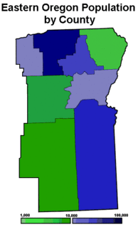
Eastern Oregon is the eastern part of the U.S. state of Oregon. It is not an officially recognized geographic entity; thus, the boundaries of the region vary according to context. It is sometimes understood to include only the eight easternmost counties in the state; in other contexts, it includes the entire area east of the Cascade Range. Cities in the basic eight-county definition include Baker City, Burns, Hermiston, Pendleton, John Day, La Grande, and Ontario. Umatilla County is home to the largest population base in Eastern Oregon; accounting for 42% of the region's residents. Hermiston, located in Umatilla County, is the largest city in the region, accounting for 10% of Eastern Oregon's residents. Major industries include transportation/warehousing, timber, agriculture and tourism. The main transportation corridors are I-84, U.S. Route 395, U.S. Route 97, U.S. Route 26, U.S. Route 30, and U.S. Route 20.

The Grand Canyon of the Yellowstone is the first large canyon on the Yellowstone River downstream from Yellowstone Falls in Yellowstone National Park in Wyoming. The canyon is approximately 24 miles (39 km) long, between 800 and 1,200 ft deep and from .25 to .75 mi wide.

The Episcopal Diocese of Washington is a diocese of the Episcopal Church covering Washington, D.C. and nearby counties of Maryland in the United States. With a membership of over 38,000, the diocese is led by the Bishop of Washington, Mariann Budde. It is home to Washington National Cathedral, which is the seat of both the diocesan bishop and the Presiding Bishop of the Episcopal Church.

The Malheur National Forest is a National Forest in the U.S. state of Oregon. It contains more than 1.4 million acres (5,700 km2) in the Blue Mountains of eastern Oregon. The forest consists of high desert grasslands, sage, juniper, pine, fir, and other tree species. Elevations vary from about 4,000 feet (1,200 m) to the 9,038-foot (2,755 m) peak of Strawberry Mountain. The Strawberry Mountains extend east to west through the center of the forest. U.S. Route 395 runs south to north through the forest, while U.S. Route 26 runs east to west.

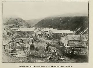
The Cook–Folsom–Peterson Expedition of 1869 was the first organized expedition to explore the region that became Yellowstone National Park. The privately financed expedition was carried out by David E. Folsom, Charles W. Cook and William Peterson of Diamond City, Montana, a gold camp in the Confederate Gulch area of the Big Belt Mountains east of Helena, Montana. The journals kept by Cook and Folsom, as well as their personal accounts to friends were of significant inspirational value to spur the organization of the Washburn-Langford-Doane Expedition which visited Yellowstone in 1870.
Blue Mountain Hospital offers medical services in John Day, Oregon, United States. Part of the Blue Mountain Hospital District, it was built in 1949 in Prairie City and re-built in 1960 in John Day. The hospital district, a non-profit managed by a local board of directors, includes Blue Mountain Nursing Home, a 52-bed unit in Prairie City.
Joe Bush is a legendary ghost that allegedly haunts the Sumpter Valley Gold Dredge in Sumpter, Oregon, United States. According to legend, dredge workers on the No. 42 dredge at Sumpter Valley claim the ghost leaves wet, bare footprints on the dredge's decks, causes lights to flicker, and doors to open and close unexpectedly. The ghost of Joe Bush also makes an appearance in the book series Skeleton Creek.
Galena is an unincorporated community in Grant County, Oregon, United States, about 20 miles (32 km) from Austin Junction in the Blue Mountains. It is on the Middle Fork John Day River in the Malheur national forest. The former gold mining camp is considered a ghost town.

Susanville is an unincorporated community in Grant County, Oregon, United States, in the Blue Mountains about two miles up Elk Creek from Galena. The place was started as a gold mining camp in 1862 or 1864 and is now considered a ghost town.
Hamilton is an unincorporated community in Grant County, Oregon, United States. It is located on Oregon Route 402 east of Monument and west of Long Creek. As of 1993, the community had no businesses and only three houses.
Dixie is an unincorporated historic community in Grant County, Oregon, United States. It was a station on the Sumpter Valley Railway near Dixie Summit. The station was named for Dixie Creek, a tributary of the John Day River near Prairie City. The creek was named for the many gold miners from the U.S. South who worked claims on the creek.
Black Rock is an unincorporated community and former logging camp in Polk County, Oregon, United States. It is located about three miles west of Falls City, in the Central Oregon Coast Range on the Little Luckiamute River.
Minneconjou Creek is a stream in the U.S. state of South Dakota.

Whites Creek is an Ozark stream in Douglas County, Missouri. It is a tributary of Hunter Creek.
The Ah Hee Diggings, also known as the Chinese Walls, are an area of some 60 acres (24 ha) of hand-stacked rock walls in Oregon, U.S., built by Chinese miners who worked for the Ah Hee Placer Mining Company along Granite Creek from 1867 to 1891.
References
- ↑ Bailey, Barbara Ruth (1982). Main Street: Northeastern Oregon. Oregon Historical Society. pp. 55, 56. ISBN 0-87595-073-6.
Coordinates: 44°54′51″N118°02′09″W / 44.91417°N 118.03583°W
