
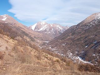
The Susa Valley is a valley in the Metropolitan City of Turin, Piedmont region of northern Italy, located between the Graian Alps in the north and the Cottian Alps in the south. It is one of the longest valleys of the Italian Alps. It extends over 50 kilometres (31 mi) in an east-west direction from the French border to the outskirts of Turin. The valley takes its name from the city of Susa which lies in the valley. The Dora Riparia river, a tributary of the Po, flows through the valley.

The Zuckerhütl is a mountain in Tyrol, Austria. At 3,505 metres, it is the highest peak of the Stubai Alps and lies at the southern end of the Stubaital Valley.

Prisojnik or Prisank is a mountain of the Julian Alps in Slovenia. Its summit is 2,547m above sea level. It is located above the Vršič Pass, from where most climbs of the mountain start.
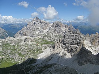
The Dreischusterspitze is a mountain of the Dolomites in South Tyrol, Italy. It is the highest peak of the Sexten Dolomites and the most northerly 3,000m peak of the range. From the north it resembles a majestic pyramid, while from the east and west it resembles a jagged ridge. The mountain is located above the village of Sexten. It was first climbed in 1869 by Paul Grohmann, Franz Innerkofler and Peter Salcher.
The Val Chisone is one of the Occitan valleys of western Piedmont, situated in the Cottian Alps in the Metropolitan City of Turin in north-west Italy.
Monte di Tremezzo is a mountain of the Lugano Prealps in Lombardy, Italy. It is the highest summit of a ridge just south of Porlezza commune, lying between Lake Lugano and Lake Como. Due to its modest height it is a relatively easy mountain to climb, but due to its great prominence it provides a good view across the lakes, and over to the High Alps; mountains as far away as Finsteraarhorn, Dom and Monte Leone can be seen on a clear day.

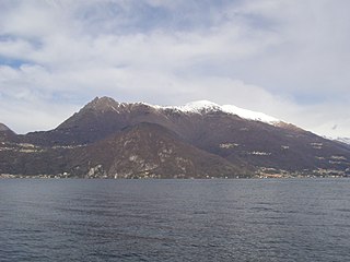
Monte Legnone is a mountain of the Bergamo Alps in Lombardy, northern Italy. It is located between the valleys of Valsassina and Valtellina near Lake Como.It has a height of 2609 mt.

Punta Scais is a mountain of Lombardy, Italy. It is located in the Bergamo Alps.

Punta Sommeiller or Pointe Sommeiller is a mountain of the Province of Turin, Italy and of Savoie, France. It lies in the Cottian Alps range. It has an elevation of 3,333 metres (10,935 ft) above sea level.
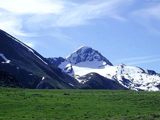
Punta Tersiva (3,512m) is a mountain of the Graian Alps in Aosta Valley, north-western Italy. It is described as an "elegant, pyramid shaped mountain".

The Croce Rossa or Croix Rousse is a mountain of the Graian Alps, on the border between Piedmont, Italy and Savoie, France.

Becca di Luseney (3,502m) is a mountain of the Pennine Alps in Aosta Valley, northwest Italy. It has a pyramidal look on all four sides, and its north face is covered with a glacier. A huge rockfall from its southwest face came down in 1952, completely destroying the village of Chamen and other settlements in the Valpelline valley. The mountain was first climbed in 1866.

Punta Lavina (3,308m) is a mountain of the Graian Alps located on the border of Aosta Valley and Piedmont, Italy. It is located between the Aostan Cogne Valley in the north and the Piedmontese Soana Valley in the South. The mountain has an elegant pyramidal shape which is easily recognisable from both Canavese and Turin. It lies entirely within the Gran Paradiso National Park.

Trogkofel is a mountain of the Carnic Alps lying on the border of Friuli, Italy and Carinthia, Austria. It is located on the main ridge of the Carnics between the Aip Valley to the south and the Gail Valley in the north, and is the second highest mountain on the eastern ridge after Gailtaler Polinik. The mountain is known as Crete Rosse, meaning Red Rocky Mountain in Friuli.

Pizzo Diei is a mountain of the Lepontine Alps in Piedmont, northern Italy. It is located in the Alpe Veglia Nature Park in the commune of Varzo, and has a slightly lower sister peak, the pyramidal shaped Monte Cistella. The mountain is a popular ski mountaineering peak and its summit offers fine views of the Monte Rosa Massif.

Sorapiss, also referred to as Sorapis or Punta Sorapiss, is a mountain in the Dolomites within the Veneto region of northern Italy. Situated in the comune of Cortina d'Ampezzo, it has an elevation of 3,205 metres (10,515 ft). In its vicinity is a mountain pass of the same name, as well as Sorapiss Lake, at the foot of the mountain. The mountain range is part of the "Natural Park of the Ampezzo Dolomites".

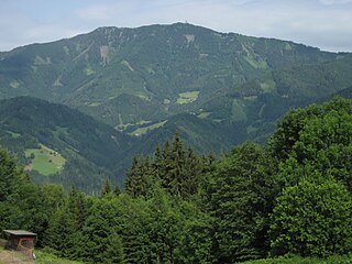
Stuhleck is a mountain in Steiermark, Austria. It is the highest mountain of the Fischbach Alps and of the Prealps east of the Mur.
Rennfeld is a mountain in the Fischbach Alps, part of the Prealps east of the Mur. It is the westernmost peak of the range.

The Gran Queyron or Grand Queyron is a 3,060 metres high mountain of the Cottian Alps.

The Punta Leynir is a 3,238 metres high mountain belonging to the Italian side of Graian Alps.

