
Trajan's Bridge is a Roman bridge in the civil parish of Santa Maria Maior, in the municipality of Chaves in the Portuguese northern subregion of Terras de Trás-os-Montes.
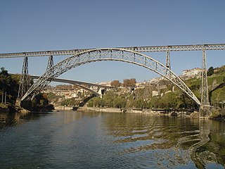
The Maria Pia Bridge is a railway bridge built in 1877, and attributed to Gustave Eiffel, situated over the Portuguese northern municipalities of Porto and Vila Nova de Gaia.

The Roman ruins of Villa Cardillio is an archaeological site located in central Portugal. Situated in the rural civil parish of Santa Maria, it is located approximately 3 km from the centre of the municipal seat of Torres Novas. Receiving its name from a mosaic pavement onsite, the specific translation of piece is still unclear, but assumed that the site was owned by a couple. The ruins were first excavated in 1962, yielding hundreds of coins and well as ceramics, bronze works, Assyrian and Egyptian glass works. Also revealed were some jewellery and a statue of Eros.

The Dom Luís I Bridge, or Luís I Bridge, is a double-deck metal arch bridge that spans the River Douro between the cities of Porto and Vila Nova de Gaia in Portugal. At its construction, its 172 metres (564 ft) span was the longest of its type in the world. It has been confused with the nearby Maria Pia Bridge, a railway bridge that was built 9 years earlier, which is similar in aspect to the Luís I bridge.
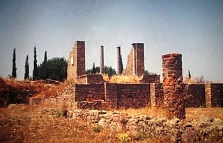
Miróbriga is an ancient Roman town located near the village and civil parish of Santiago do Cacém, in the municipality of the same name in the south-west of Portugal. Archeology revealed that the town occupied the site of an ancient Iron Age settlement that existed since the 9th century B.C.
The Ponte da Palhaça is a bridge crossing the Ribeira da Tojeira in the civil parish of Palhaça, municipality of Oliveira do Bairro in the Portuguese district of Aveiro.
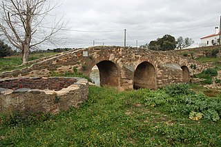
The Ponte da Ribeira de Cobres is a bridge in the civil parish, in the municipality of Almodôvar in the Portuguese district of Beja.

The Ponte Velha de Mértola, also referred to as the Ponte Branca or Torre do Rio, is a structure located along the Guadiana River, in the civil parish of Mértola, municipality of Mértola, in the Portuguese district of Beja. Although named a bridge, the structure is the remains of a wharf and fortified port, linked to the defensive curtain of the walled city.
The Ponte Romana do Rio Brenhas, sometimes known simply as the Ponta Romana de Moura or Ponte de Moura, is a bridge built during the Roman occupation of the Iberian peninsula, that crosses the River Brenhas in the civil parish of Moura e Santo Amador in the municipality of Moura in the Portuguese district of Beja.

The Bridge of Prado is a bridge constructed over the Cávado River, in the civil parish of Vila de Prado, municipality of Vila Verde, in Norte Region, Portugal northern Portugal. Although originally a Roman bridge, it was re-constructed during the 16th century when the original had been destroyed following flooding and consistent use. There are few vestiges of the Roman bridge.

The Ponte da Ribeira de Meimoa is a medieval bridge that crosses the Ribeira de Meimoa, in the civil parish of Meimoa, municipality of Penamacor in Portuguese district of Castelo Branco.

The Bridge of Cava da Velha is a Roman bridge, situated in the civil parish of Castro Laboreiro e Lamas de Mouro, in the municipality of Melgaço in northern Portuguese district of Viana do Castelo.

The Ponte da Barbeita is a Gothic bridge that cross the Rio Mouro in the civil parish, municipality of Monção, in the Portuguese district of Viana do Castelo.
Ponte Velha de São Pedro da Torre is a bridge in the civil parish of São Pedro da Torre, municipality of Valença in the Portuguese district of Viana do Castelo.
The Old Bridge of Santo Adrião is a two-arch bridge over the Rio Tedo in the civil parish of Vila Seca e Santo Adrião, municipality of Armamar, the Portuguese district of Viseu.

The Roman ruins of Ammaia are located in Portugal within the Nature Park of the Serra de São Mamede, a mountainous expanse of forest in the civil parish of São Salvador da Aramenha, municipality of Marvão, along the border with Spain.

The Roman Villa of Frielas is located in the parish of Frielas in the municipality of Loures in the Lisbon District of Portugal. It fell under the territory of the Roman settlement of Olisipo, which covered a large area from Lisbon to the south to Torres Vedras in the north. It is believed to have been re-used in the medieval period during the Islamic occupation of Portugal. Excavations began in 1997 and are continuing, over an area of about 3500 square metres. Since 2012 the villa has been classified as a Site of Public Interest.
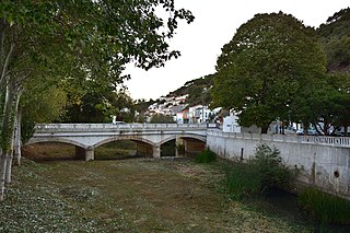
The Ponte de Aljezur, is a structure located over the Ribeira de Aljezur, in the civil parish of Aljezur, municipality of Aljezur, in the Portuguese district of Faro.
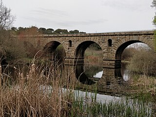
The Roman Bridge of Vila Formosa crosses the Seda stream, close to the village of Seda, in the municipality of Alter do Chão, in the Portalegre District of Portugal. It dates back to the first century CE.


