Rosebud | |
|---|---|
 Rosebud and Centerville-Rosebud Rd area | |
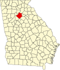
 Rosebud Location within the state of Georgia | |
| Coordinates: 33°47′55″N83°58′0″W / 33.79861°N 83.96667°W | |
| Country | United States |
| State | Georgia |
| County | Gwinnett |
| Elevation | 902 ft (275 m) |
| Time zone | UTC-5 (Eastern (EST)) |
| • Summer (DST) | UTC-4 (EDT) |
| GNIS feature ID | 332922 [1] |
Rosebud is an unincorporated community located in Gwinnett County, Georgia, United States.