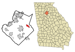
Dacula, Georgia | |
---|---|
Motto(s): "Honoring Our Past, Building Our Future " [1] | |
Coordinates: 33°58′53″N83°53′43″W / 33.98139°N 83.89528°W | |
Country | United States |
State | Georgia |
County | Gwinnett |
Government | |
• Mayor | Trey King |
Area | |
• Total | 5.45 sq mi (14.11 km2) |
• Land | 5.42 sq mi (14.03 km2) |
• Water | 0.03 sq mi (0.08 km2) |
Elevation | 1,122 ft (342 m) |
Population (2020) | |
• Total | 6,882 |
• Density | 1,270.68/sq mi (490.65/km2) |
Time zone | UTC-5 (Eastern (EST)) |
• Summer (DST) | UTC-4 (EDT) |
ZIP code | 30019 |
Area code | 770 |
FIPS code | 13-21184 [4] |
GNIS feature ID | 2404173 [3] |
Website | daculaga |
Dacula ( /dəˈkjuːlə/ də-KEW-lə) is a city in Gwinnett County, Georgia, United States, located approximately 37 miles (60 km) northeast of Atlanta. The population as of the 2010 census was 4,442, [5] and the U.S. Census Bureau estimated the population to be 6,255 as of 2018. [6] In 2020, its population was 6,882. The Dacula area is home to some of the oldest buildings in northeast Georgia, such as the Elisha Winn House, which originally acted as the courthouse for Gwinnett County.
The Dacula area was originally within the Muscogee (Creek) Nation. Most of the land within the city's limits was ceded to the State of Georgia in the 1790 Treaty of New York after the Oconee Wars [7] The vicinity of Dacula was one of the first areas in northeast Georgia to be occupied by white European settlers (around the time of the War of 1812). The area remained mostly uncolonized until the late 20th century , in part, due to the remaining presence of the Cherokee Nation in portions of Gwinnett County. After settlers lobbied for the ethnic cleansing of the Nation, the Trail of Tears (through the Indian Removal Act) made it easier for Dacula and the unannexed portions of Gwinnett to be settled.
Dacula itself began in the late 1800s under the name of Chinquapin Grove (Chinquapin was spelled several different ways), where Dacula Elementary now stands. Chinquapin comes from the indigenous Powhatan word for dwarf chestnut tree (Allegheny Chinkapin). The tree is no longer found in the area due to chestnut blight. An 1865 United States Coast Survey Map shows the town of Chinquepin Grove. An 1883 George Cram Map of Georgia shows the town of Chincapin Grove. The town was renamed named "Hoke", [8] in 1891 after a Seaboard Air Line Railroad executive, but that name was changed due to the Post Office Department's protest. [9] By 1895, maps of Georgia no longer showed the town of Chinquapin Grove and instead show the town of Dacula. [10]
Dacula's name is said to be formed from letters in Decatur and Atlanta by a postmaster. [11] The two cities to the west that were already prospering at the time of Dacula's founding. The New-Herald issue dated June 16, 1899 stated that Dacula would soon decide whether or not it wished to be incorporated; however, the town was not incorporated until 1905, because residents feared that incorporation would destroy business and industry. [10]
Religion has and continues to be a driving force in Dacula. One of the first churches built in the town was a Methodist Church, founded by Rev. R. P. Jackson. A News-Herald issue dated January 25, 1912 describes the brick building was no larger than 40x60 ft. [10]
The town was once home to a train station on a CSX line through northeast Georgia, although the station closed in the mid-1950s.
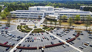
The City of Dacula is one of the final municipalities to develop in Gwinnett, County. In 2022, Gwinnett County broke ground on the Rowen Project, which seeks to bring together researchers, entrepreneurs, and other innovators, alongside more than 50 research and educational institutions across Georgia to expand the state's research triangle. [13] Since the project's approval, the Dacula area has seen an increase in both suburban residential and strip mall commercial changes, including the Harbins 316 development, which massively expanded food and amenity access to a portion of Gwinnett County that previously had to drive 30–40 minutes to a grocery store. As the town becomes home to an increasing number of national chains, residents are increasingly proud of their local gathering places and traditions. The town unveiled a new playground and workout area in Maple Creek Park in 2024, and continues its renowned Memorial Day Parade. [14] [15]
Dacula is located in eastern Gwinnett County, with U.S. Route 29 Business/Georgia State Route 8 (Winder Highway) the main road through the center of town. Business 29/SR 8 leads west 6 miles (10 km) to Lawrenceville, the county seat, and east 11 miles (18 km) to Winder. U.S. Route 29 (University Parkway) is a four-lane highway that bypasses Dacula to the south, with access from Harbins Road. University Parkway leads east 34 miles (55 km) to Athens and west 12 miles (19 km) to Interstate 85, which leads an additional 25 miles (40 km) southwest to Atlanta.
According to the United States Census Bureau, Dacula has a total area of 5.0 square miles (12.9 km2), of which 0.031 square miles (0.08 km2), or 0.59%, is water. [5]
The Dacula 30019 ZIP code goes well beyond the city limits, resulting in mail delivery as far north as the unincorporated community of Hamilton Mill, south of Interstate 85.
Census | Pop. | Note | %± |
---|---|---|---|
1900 | 120 | — | |
1910 | 169 | 40.8% | |
1920 | 244 | 44.4% | |
1930 | 304 | 24.6% | |
1940 | 315 | 3.6% | |
1950 | 369 | 17.1% | |
1960 | 440 | 19.2% | |
1970 | 782 | 77.7% | |
1980 | 1,577 | 101.7% | |
1990 | 2,217 | 40.6% | |
2000 | 3,848 | 73.6% | |
2010 | 4,442 | 15.4% | |
2020 | 6,882 | 54.9% | |
U.S. Decennial Census [16] |
Race | Num. | Perc. |
---|---|---|
White (non-Hispanic) | 2,942 | 42.75% |
Black or African American (non-Hispanic) | 1,922 | 27.93% |
Native American | 11 | 0.16% |
Asian | 296 | 4.3% |
Pacific Islander | 1 | 0.01% |
Other/Mixed | 323 | 4.69% |
Hispanic or Latino | 1,387 | 20.15% |
As of the 2020 United States census, there were 6,882 people, 1,902 households, and 1,529 families residing in the city.
Previous Mayors:
The current mayor and council members are: [18]
The county operates Gwinnett County Public Schools. [20] The following GCPS schools have Dacula mail addresses:
Gwinnett County Public Library operates the Dacula and Hamilton Mill Branch in the nearby unincorporated area of Hamilton Mill. [21]
The town of Dacula is served by two newspapers: the Gwinnett Daily Post (based in nearby Lawrenceville) and the Hamilton Mill Neighborhood News.
The following parks are located in the town of Dacula: [22]
Gwinnett County is located in the north central portion of the U.S. state of Georgia. It forms part of the Atlanta metropolitan area, being located about 9 miles (14 km) northeast of Atlanta city limits. In 2020, the population was 957,062, making it the second-most populous county in Georgia. Its county seat is Lawrenceville. The county is named for Button Gwinnett, one of the signatories of the Declaration of Independence.
Auburn is a city in Barrow and Gwinnett counties in the U.S. state of Georgia. As of the 2020 census, the city had a population of 7,495.
Braselton is a town in Barrow, Gwinnett, Hall, and Jackson counties in the U.S. state of Georgia, approximately 43 miles (69 km) northeast of Atlanta. As of the 2020 census, the town had a population of 13,403, and in 2023 the estimated population was 15,538.
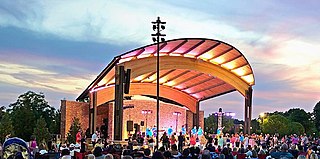
Winder is a city and the county seat of Barrow County, Georgia, United States. It is located east of Atlanta and is part of the Atlanta metropolitan area. The population was 18,338 at the 2020 census.
Canton is a city in and the county seat of Cherokee County, Georgia, United States. As of the 2010 census, the city had a population of 22,958, up from 7,709 in 2000.
Doraville is a city in DeKalb County, Georgia, United States northeast of Atlanta. As of the 2020 census, the city had a population of 10,623.
Tucker is a city located in DeKalb County, Georgia, United States, located near Atlanta and was originally settled in the 1820s, and later developed as a railroad community in 1892. According to the 2016 United States Census Bureau annual estimate of resident population, it has a population of 35,322. In a November 2015 referendum, by a 3:1 margin (73.94%), voters approved incorporating Tucker into a city. In March 2016, Tucker residents elected the city's first mayor and city council.
Duluth is a city in Gwinnett County, Georgia, United States. Located north of Interstate 85, it is approximately 22 miles (35 km) northeast of Atlanta.
Lawrenceville is a city in and the county seat of Gwinnett County, Georgia, United States. It is a suburb of Atlanta, located approximately 30 miles (50 km) northeast of downtown. It was incorporated on December 15, 1821. As of the 2020 census, the population of Lawrenceville was 30,629.
Lilburn is a city in Gwinnett County, Georgia, United States. The population was 14,502 at the 2020 census. The estimated population was 12,810 in 2019. It is a part of the Atlanta metropolitan area.
Loganville is a city in Walton and Gwinnett counties, Georgia, United States. The population was 14,127 in 2020. Loganville is located about 36 mi (58 km) east of Atlanta and is part of the Atlanta metropolitan area.
Norcross is a city located in Gwinnett County, Georgia, United States. According to the 2010 census, the population was 9,116, while in 2020, the population increased to 17,209. Norcross is part of the Atlanta-Sandy Springs-Marietta metropolitan statistical area.
Snellville is a city in Gwinnett County, Georgia, United States, east of Atlanta. Its population was 20,573 at the 2020 census. It is a developed suburb of Atlanta and a part of the Atlanta metropolitan area, and is located roughly 33 miles east of downtown Atlanta via US 78 and Interstate 285.
Suwanee is a city in Gwinnett County and a part of the Atlanta metropolitan area in the U.S. state of Georgia. As of the 2010 census, the population was 15,355; this had grown to an estimated 20,907 as of 2019. In 2020, its population was 20,786.
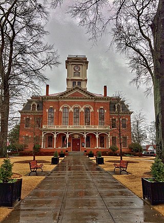
Monroe is a city and the county seat of Walton County, Georgia, United States. It is located both one hour east of Atlanta via US 78 and GA 138 to I-20 and east of Hartsfield–Jackson International Airport and is one of the exurban cities in the Atlanta metropolitan area. The population was 14,928 at the 2020 U.S. census.
The Gwinnett County Public Schools is a school district operating in Gwinnett County, Georgia, United States. GCPS is the largest school system in Georgia, with over 140 school buildings and an estimated enrollment of over 182,000 students for the 2023–2024 school year. GCPS is estimated to be the 14th largest school district in the U.S. The district has its headquarters near Suwanee.
Johns Creek is a city in Fulton County, Georgia, United States. According to the 2020 census, the population was 82,453. The city is a northeastern suburb of Atlanta.
Peachtree Corners is a city in Gwinnett County, Georgia, United States. It is part of the Atlanta metropolitan area, and is the largest city in Gwinnett County with a population of 42,243 as of the 2020 U.S. census.
Georgia's 7th congressional district is a congressional district in the U.S. state of Georgia. It is currently represented by Democrat Lucy McBath.
Mountain View High School is a public high school outside of Lawrenceville, Georgia, United States. It is a part of Gwinnett County Public Schools. It opened for classes on August 10, 2009.