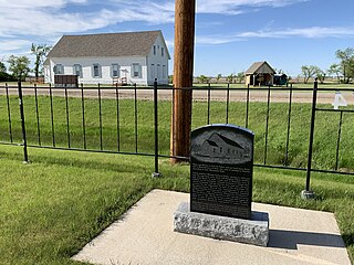
Emerald Park is an unincorporated community in Saskatchewan, Canada within the Rural Municipality (RM) of Edenwold No. 158. It is 9 km (5.6 mi) east of Regina and is adjacent to the Town of White City.

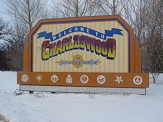
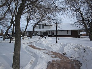
Charleswood is a residential community and neighbourhood in Winnipeg, Manitoba, Canada. It is located in the South-West of the city and is bordered by the neighbourhoods Tuxedo to the East, Fort Whyte to the South, and the Rural Municipality of Headingley on the West. It's boundaries are Roblin and the Assiniboine River to the north, Shaftesbury Boulevard on the East, Wilkes Avenue to the South and the Perimeter Highway to the West.

Winnipegosis is an unincorporated urban community in the Rural Municipality of Mossey River, Manitoba, Canada. It lies at the mouth of the Mossey River on Lake Winnipegosis in west-central Manitoba.
Emerson is an unincorporated community recognized as a local urban district in south central Manitoba, Canada, located within the Municipality of Emerson – Franklin. It has a population of 678 as of the 2016 Canada census.
The Rural Municipality of Lakeview was a rural municipality (RM) in the Canadian province of Manitoba.

West St. Paul is a rural municipality (RM) in Manitoba, Canada. It lies adjacent to the north side of Winnipeg, and directly west of the Red River. It is part of the Winnipeg Metro Region, and had a population of 5,368 at the 2016 census.

East St. Paul is a rural municipality (RM) in Manitoba, Canada. It is located north-east of and adjacent to the city of Winnipeg, and is part of the Winnipeg Metropolitan Area. The municipality was formed on 3 November 1915 when the municipality of St. Paul (1888-1914) was subdivided into West St. Paul and East St. Paul, with the Red River acting as the dividing line.

Arborg is a town located along the Icelandic River in Manitoba. The community is located 103 kilometres north of Winnipeg, at the junction of Manitoba Highways 7 and 68, in the Interlake Region of Manitoba, Canada. The town is surrounded by the Municipality of Bifrost - Riverton and has a population of 1,279 as of the 2021 Canadian census.

Argyle is a small hamlet located in the Canadian province of Manitoba. Argyle is in Manitoba's Interlake Region. It is part of the Rural Municipality of Rockwood. It is approximately 30 km from Manitoba's capital, Winnipeg. Nearby are the towns of Stonewall, Balmoral, Teulon, Grosse Isle, Gunton, Rosser, Stony Mountain and Selkirk. The major industry is agriculture, where mixed farming prevails. Many residents work in Winnipeg or surrounding towns.

Lorette is a local urban district in the Rural Municipality of Taché, located 25 km southeast of Winnipeg, in the province of Manitoba, Canada.
Kenton is an unincorporated community recognized as a local urban district in Manitoba, Canada. It is located in the Rural Municipality of Woodworth, about an hour's drive west of Brandon. The first permanent settlement of the area began in 1881, following the westward expansion of the borders of the province of Manitoba. The settlement was named for its first postmaster, A.W. Kent. Kenton became an unincorporated village district in 1947. In 1986, the community had a population of 158. Water supply for the community is from the nearby half-mile long Kenton Reservoir on Bars Creek, a tributary of the Oak River. The 600 acre foot reservoir was constructed in 1969 by the Prairie Farm Rehabilitation Administration and also provides an opportunity for sport fishing. Kenton is the location of the municipal council chamber for the RM of Woodworth.

Kerrobert is a town in west central Saskatchewan. It has a population of 970 (2021)

Roseland Christian School was a private, coeducational elementary school on the far south side of Chicago, Illinois. It was founded in Roseland as a school for the children of Dutch immigrants in the area. Later it mainly served the African American community that lives in Roseland.
Eriksdale is an unincorporated community located in the Interlake Region of central Manitoba, Canada, near the eastern shore of Lake Manitoba. The community is located on the crossroads of Highway 6 and Highway 68, approximately 118 km (73 mi) north of Winnipeg. It is now a part of the Rural Municipality of West Interlake.

Whitehead is a rural municipality (RM) in the province of Manitoba in Western Canada. It is west of Brandon and the principle communities within its boundaries are Kemnay and Alexander.

Victoria Beach is a rural municipality (RM) in the Eastman Region of Manitoba, Canada, located on the southeastern shores of Lake Winnipeg, approximately 100 kilometres (62 mi) north of Winnipeg.
Plumas is an unincorporated community recognized as a local urban district located in the Municipality of WestLake – Gladstone, in the Canadian province of Manitoba. Plumas is roughly 70 km northwest of Portage la Prairie, Manitoba, and about 150 km northwest of the provincial capital, Winnipeg.
Alexander, Manitoba, is a local urban district in the Rural Municipality of Whitehead, situated on Highway 1, west of Brandon.

Randolph, originally known as Chortitz, is a small community in the Rural Municipality of Hanover, Manitoba, Canada. The community has an estimated population of 70 and is located 1.6 kilometres north of Highway 52 on Provincial Road 206 about 11 kilometres west of Steinbach. Randolph is located within a half kilometre of the longitudinal centre of Canada.
Aubigny is a small, unincorporated community in the Rural Municipality of Morris, Manitoba, Canada. It is located approximately 31 kilometres south of Winnipeg along the Red River, at the junction of Provincial Road (PR) 205 and St. Mary's Road.


