| Rosolini | |
|---|---|
| Comune | |
| Comune di Rosolini | |
 | |
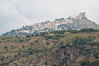
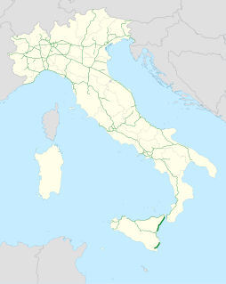
 Rosolini Location of Rosolini in Italy | |
| Coordinates: 36°49′N14°57′E / 36.817°N 14.950°E Coordinates: 36°49′N14°57′E / 36.817°N 14.950°E | |
| Country | Italy |
| Region | Sicily |
| Province | Syracuse (SR) |
| Government | |
| • Mayor | Giuseppe Incatasciato |
| Area | |
| • Total | 76.47 km2 (29.53 sq mi) |
| Elevation | 154 m (505 ft) |
| Population (30 November 2017) [1] | |
| • Total | 21,207 |
| • Density | 280/km2 (720/sq mi) |
| Demonym(s) | Rosolinesi |
| Time zone | CET (UTC+1) |
| • Summer (DST) | CEST (UTC+2) |
| Postal code | 96019 |
| Dialing code | 0931 |
| Website | Official website |
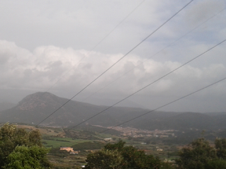
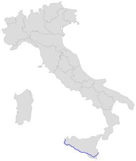
Rosolini (Sicilian : Rusalini) is a comune (municipality) in the Province of Syracuse, Sicily, southern Italy. It is about 200 kilometres (120 mi) southeast of Palermo and about 40 kilometres (25 mi) southwest of Syracuse. Rosolini was a town in feudal times, and was a settlement in the late Imperial Roman and Byzantine Ages. In the 15th century, Rosolini was a fief of the Platamones. It was the Moncadas, in the year of 1713, which founded the newer town of Rosolini which we see today.
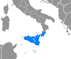
Sicilian, also known as Siculo or Calabro-Sicilian, is a Romance language spoken on the island of Sicily and its satellite islands. It is also spoken in southern Calabria, specifically in the Province of Reggio Calabria, whose dialect is viewed as being part of the continuum of the Sicilian language. Central Calabria, the southern parts of Apulia and Campania, on the Italian peninsula, are viewed by some as being part of a broader Far Southern Italian language group.

The comune is a basic administrative division in Italy, roughly equivalent to a township or municipality.
The Province of Syracuse is a province in the autonomous island region of Sicily in Italy. Following the suppression of the Sicilian provinces, it was replaced in 2015 by the Free municipal consortium of Syracuse. Its capital is the city of Syracuse, a town which was established by Greek colonists arriving from Corinth in the 8th century BC. It has an area of 2,109 square kilometres (814 sq mi) and a total population of 403,985 (2016). Syracuse has 8% of the Sicilian population and 8.2% of Sicily's area.
Rosolini borders the following municipalities: Ispica, Modica, Noto, Ragusa.

Ispica is a city and comune in the south of Sicily, Italy. It is 30 kilometres (19 mi) from Ragusa, 50 kilometres (31 mi) from Syracuse, and 90 kilometres (56 mi) away from La Valletta, on the coast of Malta. The first mention in a document of Ispica occurred in 1093, in a list of churches and ecclesiastic departments for administrative purposes, but the territory has been colonized since the Bronze Age.

Modica[ˈmɔːdika] is a city and comune of 54.456 inhabitants in the Province of Ragusa, Sicily, southern Italy. The city is situated in the Hyblaean Mountains.

Noto is a city and comune in the Province of Syracuse, Sicily, Italy. It is 32 kilometres (20 mi) southwest of the city of Syracuse at the foot of the Iblean Mountains. It lends its name to the surrounding area Val di Noto. In 2002 Noto and its church were declared a UNESCO World Heritage Site.