
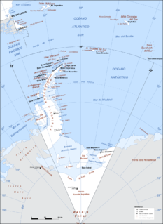
The French Southern and Antarctic Lands is an overseas territory of France. It consists of:
- Kerguelen Islands, a group of volcanic islands in the southern Indian Ocean, southeast of Africa, approximately equidistant between Africa, Antarctica and Australia;
- St. Paul and Amsterdam islands, a group to the north of Kerguelen;
- Crozet Islands, a group in the southern Indian Ocean, south of Madagascar;
- Adélie Land, the French claim on the continent of Antarctica;
- the Scattered Islands, a dispersed group of islands around the coast of Madagascar.

The Balleny Islands are a series of uninhabited islands in the Southern Ocean extending from 66°15' to 67°35'S and 162°30' to 165°00'E. The group extends for about 160 km (99 mi) in a northwest-southeast direction. The islands are heavily glaciated and of volcanic origin. Glaciers project from their slopes into the sea. The islands were formed by the so-called Balleny hotspot.

Ross Island is an island formed by four volcanoes in the Ross Sea near the continent of Antarctica, off the coast of Victoria Land in McMurdo Sound. Ross Island lies within the boundaries of Ross Dependency, an area of Antarctica claimed by New Zealand.

The South Orkney Islands are a group of islands in the Southern Ocean, about 604 kilometres (375 mi) north-east of the tip of the Antarctic Peninsula and 844 kilometres (524 mi) south-west of South Georgia Island. They have a total area of about 620 square kilometres (240 sq mi). The islands are claimed both by Britain, and by Argentina as part of Argentine Antarctica. Under the 1959 Antarctic Treaty, sovereignty claims are held in abeyance.
This is a list of extreme points in Antarctica.
Argentine Antarctica is a sector of Antarctica claimed by Argentina as part of its national territory consisting of the Antarctic Peninsula and a triangular section extending to the South Pole, delimited by the 25° West and 74° West meridians and the 60° South parallel. This region overlaps with British and Chilean claims in Antarctica; however, all claims are suspended by the Antarctic Treaty System, of which Argentina is a founding signatory and permanent consulting member, with the Antarctic Treaty Secretariat being based in Buenos Aires.

Anvers Island or Antwerp Island or Antwerpen Island or Isla Amberes is a high, mountainous island 61 km long, the largest in the Palmer Archipelago of Antarctica. It was discovered by John Biscoe in 1832 and named in 1898 by the Belgian Antarctic Expedition under Adrien de Gerlache after the province of Antwerp in Belgium. It lies south-west of Brabant Island at the south-western end of the group. The south-western coastline of the island forms part of the Southwest Anvers Island and Palmer Basin Antarctic Specially Managed Area. Cormorant Island, an Important Bird Area, lies 1 km off the south coast.

Palmer Archipelago, also known as Antarctic Archipelago, Archipiélago Palmer, Antarktiske Arkipel or Palmer Inseln, is a group of islands off the northwestern coast of the Antarctic Peninsula. It extends from Tower Island in the north to Anvers Island in the south. It is separated by the Gerlache and Bismarck straits from the Antarctic Peninsula and Wilhelm Archipelago, respectively.

Franklin Island is an island 13 kilometres (7 nmi) long, lying in the Ross Sea about 130 kilometres (80 mi) east of Cape Hickey, Victoria Land. It was discovered on January 27, 1841 by James Clark Ross, and named for Sir John Franklin, the noted Arctic explorer, who as Governor of Van Diemen's Land (Tasmania) had royally entertained the expedition on its way south at Hobart in 1840.

Sulzberger Bay is a bay between Fisher Island and Vollmer Island, along the coast of King Edward VII Land. Discovered by the Byrd Antarctic Expedition on December 5, 1929, and named by Byrd for Arthur H. Sulzberger, publisher of The New York Times, a supporter of the Byrd expeditions in 1928–1930 and 1933–1935.
The Helo Cliffs are a set of prominent cliffs at about 3,525 metres (11,565 ft) on the north rim of the summit caldera of Mount Erebus, on Ross Island, Antarctica. The name derives from a nearby U.S. Coast Guard HH-52A helicopter which crashed on the east slope of Mount Erebus while en route to Cape Bird from McMurdo Station on January 9, 1971. The helicopter lost power in flight and was damaged when it landed. The four crew and passengers were not injured. The helicopter was abandoned because of its location.
Isolation Point is a small volcanic peak projecting through the ice sheet covering the southeastern extremity of White Island, in the Ross Archipelago, Antarctica. It was so named because of its remote position by the New Zealand Geological Survey Antarctic Expedition, 1958–59.
Aurora Glacier is a large glacier draining that part of Ross Island between Mount Erebus and Mount Terra Nova, and flowing south into McMurdo Ice Shelf. It was named by A.J. Heine in 1963 after the Aurora, the ship of the Ross Sea Party of the British expedition under Ernest Shackleton, 1914–17.
Erebus Glacier is a glacier draining the lower southern slopes of Mount Erebus, Ross Island, Antarctica. It flows west to Erebus Bay where it forms the floating Erebus Glacier Tongue. It was named in association with Mount Erebus by the British National Antarctic Expedition, 1901–04, under Robert Falcon Scott.
Cape Bird is a cape which marks the north extremity of Ross Island. Discovered in 1841 by a British expedition under Ross, and named by him for Lieutenant Edward J. Bird of the ship Erebus.
Tramway Ridge is a ridge that rises to about 3450 m above sea level in the north-west part of the summit caldera of Mount Erebus on Ross Island, Antarctica. The ridge is formed by the levees (banks) on the side of a young lava flow. The appearance of the feature is suggestive of a set of railway or tram lines.
Fang Glacier is a glacier on the west side of Fang Ridge, separating the old and new craters of Mount Erebus on Ross Island. It was charted by Frank Debenham of the British Antarctic Expedition, 1910–13, and named by him in association with Fang Ridge.
Millennium Peak is a peak rising to about 1,800 metres (6,000 ft) on the northeast slope of Mount Erebus, Ross Island, Antarctica, 4 nautical miles (7 km) east-northeast of the Erebus summit. It was so named by the Advisory Committee on Antarctic Names in the millennium year 2000.
The Marshall Archipelago is an extensive group of large ice-covered islands within the Sulzberger Ice Shelf off Antarctica. Several of the islands were discovered and plotted by the Byrd Antarctic Expeditions and by the United States Antarctic Service (1939–41), all led by Admiral Richard E. Byrd. The full extent of the archipelago was mapped by the United States Geological Survey from surveys and U.S. Navy air photos (1959–65). The name was proposed by Admiral Byrd for General of the Army George C. Marshall, who made financial contributions as a private individual and also, on the same basis, provided advisory assistance to the Byrd expedition of 1933–35.

The North-west White Island Antarctic Specially Protected Area comprises a 142 km2 area of coastal shelf ice on the north-west side of White Island in the Ross Archipelago of Antarctica.The site has been designated an Antarctic Specially Protected Area because it supports an unusual small breeding population of Weddell seals, which is not only the most southerly known, but which has also been physically isolated from other populations by the advance of the McMurdo and Ross ice shelves. The first seals in the area were recorded in 1958, since when the population has grown to 25–30. The seals use the open waters of McMurdo Sound but do not have the breathing capacity to reach the open ocean by swimming beneath the intervening 20 km of permanent shelf ice.


