Roswell, Idaho | |
|---|---|
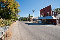 State Highway 18 through Roswell | |
 Roswell, Idaho Location within the state of Idaho  Roswell, Idaho Roswell, Idaho (the United States) | |
| Coordinates: 43°44′57″N116°57′43″W / 43.74917°N 116.96194°W | |
| Country | United States |
| State | Idaho |
| County | Canyon |
| Elevation | 2,264 ft (690 m) |
| Time zone | UTC-7 (Mountain (MST)) |
| • Summer (DST) | UTC-6 (MDT) |
| ZIP codes | 83660 |
| Area codes | 208, 986 |
| GNIS feature ID | 400062 [1] |
Roswell is an unincorporated community in Canyon County in the U.S. state of Idaho. [1]
Roswell is located 2 mi (3.2 km) south of Parma. [2] Founded in 1889, it was named by and for an early settler and school teacher who dreamed of founding a town in that spot. [1]
Roswell Grade School was added to the National Register of Historic Places in 1982. [3]


