Rothenklempenow | |
|---|---|
 Rothenklempenow | |
 Flag  Coat of arms | |
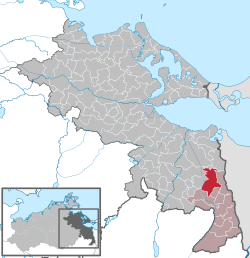
Location of Rothenklempenow within Vorpommern-Greifswald district | |
 Location of Rothenklempenow | |
 Rothenklempenow  Rothenklempenow | |
| Coordinates: 53°31′N14°12′E / 53.517°N 14.200°E | |
| Country | Germany |
| State | Mecklenburg-Vorpommern |
| District | Vorpommern-Greifswald |
| Municipal assoc. | Löcknitz-Penkun |
| Government | |
| • Mayor | Rainer Schulze |
| Area | |
• Total | 58.09 km2 (22.43 sq mi) |
| Elevation | 22 m (72 ft) |
| Population (2023-12-31) [1] | |
• Total | 572 |
| • Density | 9.85/km2 (25.5/sq mi) |
| Time zone | UTC+01:00 (CET) |
| • Summer (DST) | UTC+02:00 (CEST) |
| Postal codes | 17321, 17322 |
| Dialling codes | 039744, 039754 |
| Vehicle registration | VG |
| Website | www.amt-loecknitz-penkun.de |
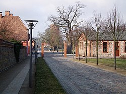
Rothenklempenow is a municipality in the Vorpommern-Greifswald district, in Mecklenburg-Vorpommern, Germany.