Pudagla

Last updated
Pudagla
DEU Pudagla COA.svg
Location of Pudagla within Vorpommern-Greifswald district
Pudagla in VG.svg
Germany adm location map.svg
Red pog.svg
Pudagla
Mecklenburg-Vorpommern location map.svg
Red pog.svg
Pudagla
Coordinates: 53°58′N14°04′E / 53.967°N 14.067°E / 53.967; 14.067 Coordinates: 53°58′N14°04′E / 53.967°N 14.067°E / 53.967; 14.067
Country Germany
State Mecklenburg-Vorpommern
District Vorpommern-Greifswald
Municipal assoc. Usedom-Süd
Government
   Mayor Fred Fischer
Area
  Total13.26 km2 (5.12 sq mi)
Elevation
1 m (3 ft)
Population
 (2020-12-31) [1]
  Total499
  Density38/km2 (97/sq mi)
Time zone UTC+01:00 (CET)
  Summer (DST) UTC+02:00 (CEST)
Postal codes
17429
Dialling codes 038378
Vehicle registration VG
Coat of Arms of the House of Pomerania, Pudagla manor house Pudagla-Greifenwappen.JPG
Coat of Arms of the House of Pomerania, Pudagla manor house

Pudagla is a municipality in the Vorpommern-Greifswald district, in Mecklenburg-Vorpommern, Germany.

Contents

Geography and Transport

Pudagla is located between the Achterwasser lagoon about 1500 metres to the west, the Schmollensee lake directly to the southeast and the coast of the Baltic Sea approximately 5 kilometres to the northeast. The village is situated at the foot of Glaubensberg Hill (38,8 m above sea level) and since the new layout of the Bundesstraße 111 in January 2008, directly on the transport route. This runs right through the Usedom Island Nature Park. Approximately 15 kilometres to the southwest is the town of Usedom and about six kilometres to the east are the Kaiserbäder resorts Bansin, Heringsdorf and Ahlbeck. The abandoned village of Camik and the settlement of Stoben Sheep Farm are also part of the village.

History

Windmill of type post mill near Pudagla, dating from 1779 Bockwindmuhle pudagla P9010079.JPG
Windmill of type post mill near Pudagla, dating from 1779

The first documented mention of Pudagla was in the year 1270 as "Pudgla", also written as "Putglow". This is a transliteration of the slavic pad glowe (at the hill) and is related to present-day Glaubensberg south of the village at Schmollensee. The name of this hill is derived from "glowa“ - (plattdeutsch "Glaube"). [2]

Duke Barnim I of Pomerania gifted the village Pudagla with its tithes and all rights including to the river Pritolniza, known today as Groote Beek to Usedom Abbey on 14 October 1273. [3]

From 1307/09 until the Protestant Reformation, it was the site of Pudagla or Usedom Abbey, which moved there from Usedom (town) (Grobe Abbey). After the abbey's secularization into a ducal domain, it at times served as an administrative center. Historical buildings are the former monastery church, some further ruins of the abbey, and a palace.

Pudagla Manor House, once a royal residence of Pomeranian dukes, undergoing renovations in Summer 2014. Schloss Pudagla Manor Rekonstruktion Dach August 2014.JPG
Pudagla Manor House, once a royal residence of Pomeranian dukes, undergoing renovations in Summer 2014.

Related Research Articles

Mecklenburg-Vorpommern State in Germany

Mecklenburg-Vorpommern, also known by its anglicized name Mecklenburg–Western Pomerania, is a state in the north-east of Germany. Of the country's sixteen states, Mecklenburg-Vorpommern ranks 14th in population, It covers 23,176 km2 (8,948 sq mi) making it the sixth largest German state in area, and 16th in population density. Schwerin is the state capital and Rostock is the largest city. Other major cities include Neubrandenburg, Stralsund, Greifswald, Wismar and Güstrow.

Greifswald City in Mecklenburg-Vorpommern, Germany

Greifswald, officially the University and Hanseatic City of Greifswald is a city in northeastern Germany.

Mellenthin Municipality in Mecklenburg-Vorpommern, Germany

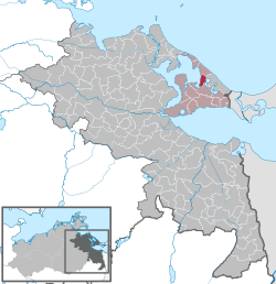
Mellenthin is a municipality in the Vorpommern-Greifswald district, in Mecklenburg-Vorpommern, Germany.

Usedom (town) Town in Mecklenburg-Vorpommern, Germany

Usedom is a town on Usedom Island, in the Vorpommern-Greifswald district in Mecklenburg-Vorpommern, Germany. It is the seat of the Amt Usedom-Süd, to which 14 other communities also belong.

Jarmen Town in Mecklenburg-Vorpommern, Germany

Jarmen is a town in the Vorpommern-Greifswald district, in Mecklenburg-Western Pomerania, Germany. It is situated on the southern bank of the river Peene, 20 km south of Greifswald, in the historic region of Pomerania.

Strasburg, Germany Town in Mecklenburg-Vorpommern, Germany

Strasburg is a town in the Vorpommern-Greifswald district of Mecklenburg-Vorpommern, Germany. It is situated in the historic Uckermark region, about 16 kilometres west of Pasewalk, and 33 kilometres east of Neubrandenburg.

Garz (Usedom) Municipality in Mecklenburg-Vorpommern, Germany

Garz is a small municipality on the island of Usedom in the Vorpommern-Greifswald landkreis in the state of Mecklenburg-Vorpommern, Germany.

Bandelin Municipality in Mecklenburg-Vorpommern, Germany

Bandelin is a municipality in the Vorpommern-Greifswald district, in Mecklenburg-Vorpommern, Germany, consisting of the villages Kuntzow, Schmoldow, Vargatz, and Bandelin.

Ückeritz Municipality in Mecklenburg-Vorpommern, Germany

Ückeritz is a municipality in the Vorpommern-Greifswald district, in Mecklenburg-Vorpommern, Germany.

Züssow Municipality in Mecklenburg-Vorpommern, Germany

Züssow is a municipality in the Vorpommern-Greifswald district, in Mecklenburg-Vorpommern, Germany.

Stolpe auf Usedom Municipality in Mecklenburg-Vorpommern, Germany

Stolpe auf Usedom is a municipality in the Vorpommern-Greifswald district, in Mecklenburg-Vorpommern, Germany.

Loddin Municipality in Mecklenburg-Vorpommern, Germany

Loddin is a municipality on Usedom Island, in the Vorpommern-Greifswald district, in Mecklenburg-Vorpommern, Germany.

Koserow Municipality in Mecklenburg-Vorpommern, Germany

Koserow is a municipality on Usedom Island, in the Vorpommern-Greifswald district, in Mecklenburg-Vorpommern, Germany.

Groß Kiesow Municipality in Mecklenburg-Vorpommern, Germany

Groß Kiesow is a municipality in the Vorpommern-Greifswald district, in Mecklenburg-Vorpommern, Germany. It consists of

Jatznick Municipality in Mecklenburg-Vorpommern, Germany

Jatznick is a municipality in the Vorpommern-Greifswald district, in Mecklenburg-Vorpommern in north-eastern Germany.

Benz (Usedom) Municipality in Mecklenburg-Vorpommern, Germany

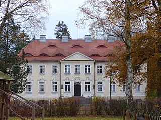
Benz is a municipality on the island of Usedom in the Vorpommern-Greifswald district, in Mecklenburg-Vorpommern, Germany. In an area that has been occupied since the Stone Age, the first documentation of the village dates to 1229 and during historical times, possession of it has changed several times, including by Sweden and Prussia.

Peenemünde Municipality in Mecklenburg-Vorpommern, Germany

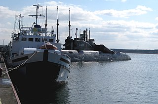
Peenemünde is a municipality on the Baltic Sea island of Usedom in the Vorpommern-Greifswald district in Mecklenburg-Vorpommern, Germany. It is part of the Amt of Usedom-Nord. The community is known for the Peenemünde Army Research Center, where the world's first functional large-scale liquid-propellant rocket, the V-2, was developed.

Vorpommern-Greifswald is a district in the east of Mecklenburg-Vorpommern, Germany. It is bounded by the districts of Mecklenburgische Seenplatte and Vorpommern-Rügen, the Baltic Sea, Poland and the state of Brandenburg. The district seat is the University and Hanseatic City of Greifswald. A lake called Berliner See is found in the district.

Groote Beek River in Germany

Groote Beek is a river on the island of Usedom, Mecklenburg-Vorpommern, Germany connecting the Schmollensee lake to the Achterwasser lagoon, which is connected to the Baltic Sea. The waterway begins at the Schmollensee to the east of the village Pudagla and runs approximately 2.1 kilometres in a north-westerly direction through wetlands to the Achterwasser.

Ahlbeck (near Ueckermünde) Municipality in Mecklenburg-Vorpommern, Germany

Ahlbeck is a municipality in the Vorpommern-Greifswald district, in Mecklenburg-Vorpommern, Germany.

References

  1. "Statistisches Amt M-V – Bevölkerungsstand der Kreise, Ämter und Gemeinden 2020". Statistisches Amt Mecklenburg-Vorpommern (in German). July 2021.
  2. Manfred Niemeyer: Ostvorpommern I. Quellen- und Literatursammlung zu den Ortsnamen. Bd. 1: Usedom. (= Greifswalder Beiträge zur Ortsnamenkunde. vol. 1), Ernst-Moritz-Arndt-Universität Greifswald, Institut für Slawistik, Greifswald 2001, ISBN 3-86006-149-6. p. 10 ff
  3. PUB 979. In: Rodgero Prümers: Pommeranian Documents vol II sect. 1. 1254–1278. von der Nahmer, Stettin 1881, S. 282.