
Catonsville is a census-designated place (CDP) in Baltimore County, Maryland, United States. The population was 41,567 at the 2010 census. The community lies to the west of Baltimore along the city's border. Catonsville contains the majority of the University of Maryland, Baltimore County (UMBC), a major public research university with close to 14,000 students.

The Maryland Transit Administration (MTA) is a state-operated mass transit administration in Maryland, and is part of the Maryland Department of Transportation. The MTA operates a comprehensive transit system throughout the Baltimore-Washington Metropolitan Area. There are 80 bus lines serving Baltimore's public transportation needs, along with other services that include the Light Rail, Metro Subway, and MARC Train. With nearly half the population of Baltimore residents lacking access to a car, the MTA is an important part of the regional transit picture. The system has many connections to other transit agencies of Central Maryland, Washington, D.C., Northern Virginia, and south-central Pennsylvania : WMATA, Charm City Circulator, Regional Transportation Agency of Central Maryland, Annapolis Transit, Rabbit Transit, Ride-On, and TransIT.

Route 14 is a bus route operated by the Maryland Transit Administration between Baltimore and Annapolis, Maryland. At most times, the line operates from the Patapsco Light Rail Stop in southern Baltimore with short turns at Jumper's Hole in Pasadena. The bus route, one of the longest local routes operated by MTA, is the successor to the Baltimore and Annapolis Railroad interurban, and mainly operates along the parallel Ritchie Highway, serving Brooklyn Park, Glen Burnie, Pasadena, and Severna Park. When the Light Rail is not running, Route 14 runs all the way to downtown Baltimore, mostly along Hanover Street.

LocalLink 75 is a bus route operated by the Maryland Transit Administration in Baltimore and its suburbs. The line currently runs from the Patapsco Light Rail Stop to Parkway Center in Anne Arundel County, via BWI Airport and Arundel Mills. Weekend trips and some weekday trips on this line terminate at Arundel Mills. The line operates between BWI Airport and downtown Baltimore during hours when the light rail is not operating.
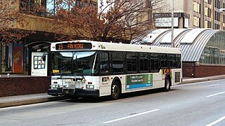
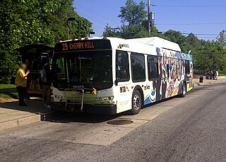
Route 23 is a bus route operated by the Maryland Transit Administration in Baltimore and its suburbs. The line currently runs from the Wal-Mart parking lot in Catonsville, Maryland east through downtown Baltimore to the Fox Ridge community in Essex, serving the corridors of Edmondson Avenue on the west side and Eastern Avenue on the east, and the communities of Edmondson Village, Allendale, Rosemont, Patterson Park, and Eastpoint, and is one of the most heavily used bus routes operated by the MTA.
Milford Mill Road, Slade Avenue, and Smith Avenue are a long road mostly in Baltimore County, Maryland that runs through Milford Mill and Pikesville in the suburbs of Baltimore. The road starts out at the light rail stop in historic Mt. Washington Village in Baltimore city as Smith Avenue, and continues through Pikesville up to Seven Mile Lane before its name changes to Slade Avenue, and the road widens to four lanes. The road is known as Slade Avenue until Reisterstown Road, and from there, its name becomes Milford Mill Road until it dead-ends one block south of Rolling Road in an area known as Windsor Mill. It is one of the most heavily used routes in the northwest suburbs of Baltimore, as it is used for cross-county travel by motorists between the Pikesville and Randallstown areas.

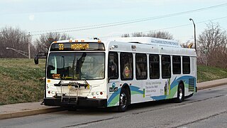
Route 35 is a bus route operated by the Maryland Transit Administration in Baltimore and its suburbs. The line currently runs from White Marsh Mall to UMBC through the city of Baltimore, with selected peak hour trips to Landsdowne. The line serves the Essex campus of the Community College of Baltimore County, the corridors of Philadelphia Road, Pulaski Highway, Monument Street, and Wilkens Avenue, the communities of Rosedale, East Baltimore, Southwest Baltimore, Elm Ridge, and Arbutus, and several Metro stations.

The Maryland Transit Administration was originally known as the Baltimore Metropolitan Transit Authority, then the Maryland Mass Transit Administration before it changed to its current name in October 2001. The MTA took over the operations of the old Baltimore Transit Company on April 30, 1970.

Patapsco station is a Baltimore Light Rail station in Halethorpe, Maryland. The stop is located along Patapsco Avenue from which its name is derived. The station serves as a hub for several MTA bus routes. Patapsco was the final stop along the line for a period from September 1992 until April 1993, when the line was extended to Linthicum.

Route 51 is a bus route operated by the Maryland Transit Administration in Baltimore and its suburbs. The line currently runs from the Rogers Avenue Metro Subway Station to the Patapsco Light Rail Stop, serving the communities of Arlington, Ashburton, Mondawmin, Rosemont, Baltimore, Cherry Hill, and Mt. Winans, and the suburb of Baltimore Highlands.
Route 29 is a bus route operated by the Maryland Transit Administration in Baltimore. The line currently operates weekdays and Saturdays in a circular fashion, linking the Cherry Hill Light Rail Stop to the Cherry Hill community. Two other MTA bus lines, Routes 27 and 51, also serve the Cherry Hill area.

Route 44 is a bus route operated by the Maryland Transit Administration in Baltimore and its suburbs. The line currently runs from Rosedale Industrial Park near Pulaski Highway just outside the Baltimore city limits on the east side of the city across the northern portion of the city to Security Square Mall, with selected peak hour trips to the Social Security Administration. Some early morning trips before 7 AM lay over at the Centers for Medicare and Medicaid Services (CMS) headquarters. The line operates mostly along Frankford Avenue, Echodale Avenue, East Belvedere Avenue, Northern Parkway, Rogers Avenue, and Gwynn Oak Avenue, serving the communities of Gardenville, Hamilton, Belvedere Park, Homeland, Roland Park, Pimlico, and Arlington, and the western suburb of Woodlawn.

Route 58 is a bus route operated by the Maryland Transit Administration in Baltimore and its suburbs. The line's western terminus is the Reisterstown Plaza Metro Subway Station, and its eastern terminus is White Marsh Mall, though some peak hour trips make short turns in Overlea. Route 58 serves the communities of Glen, Cheswolde, Fallstaff, a large section of Northern Parkway, and a portion of Belair Road in Baltimore County.
LocalLink 28 is a bus route operated by the Maryland Transit Administration in Baltimore. The line currently runs from the Rogers Avenue Metro Subway Station in Northwest Baltimore to a loop in Moravia in Northeast Baltimore. Service is provided about once every 10–15 minutes during rush hour, every 20 minutes midday, every 30 minutes on Saturdays, and hourly on Sundays. The line operates primarily along the cross-town corridor of Coldspring Lane and Moravia Road, transversing Arlington, Park Heights, Roland Park, Homeland, and Montebello. The line passes several universities, including Loyola College, Notre Dame, and Morgan State University.

LocalLink 89 is a bus route operated by the Maryland Transit Administration in Baltimore and its suburbs, mostly along Reisterstown Road. The line currently runs from the Reisterstown Plaza Metro Subway Station to the Owings Mills Town Center. The line replaced original Route 59 under BaltimoreLink, and was a split-off from Route M-9, and resembles the pre-1997 route of Route M-9. It is the successor to several other bus routes and streetcars.

LocalLink 87 is a bus route operated by the Maryland Transit Administration in the suburbs of Baltimore. The route currently runs from the Owings Mills Town Center to Glyndon via Reisterstown Road and the Owings Mills Metro Subway Station. The line, which was a split-off from the final version of the now defunct Route M-9, and resembles the former Route M-16 that operated from 1987 to 1998. The route was previously named No. 56 before BaltimoreLink, when it was replaced in its entirety by Route 87.

Express BusLink 150 is a bus route operated by the Maryland Transit Administration in Baltimore, Ellicott City, and Columbia, Maryland. The line currently operates between the Village of Harper's Choice in Columbia and Harbor East, mostly via US-29 and US-40, serving The Mall in Columbia and Catonsville.
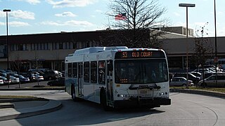
LocalLink 83 is a bus route in Baltimore and its suburbs. The line currently runs from the Old Court Metro Subway Station in Pikesville, Maryland to the Mondawmin Metro Subway Station in Northwest Baltimore along Old Court Road and Reisterstown Road, serving the communities of Park Heights and the Reisterstown Road Plaza. The line is the successor to Bus Route 7, which still operates south of Mondawmin. Route 7 operated along Reisterstown Road outside the Metro's hours of operation until 2001.
UMBC Transit is the official bus system of the University of Maryland, Baltimore County. Along with the Maryland Transit Administration (MTA), the UMBC community has public transit access to nearby areas such as Catonsville, Arbutus, Maryland, and Baltimore City.
