Route 35 (MTA Maryland)

Last updated
Route 35
MTA Maryland 10004 35.jpg
Overview
System Maryland Transit Administration
GarageEastern
Bush
Statusactive
Began service1970
Ended serviceJune 2017
PredecessorsNo. 6 Streetcar, Bus Route 31
Route
LocaleBaltimore City
Communities served Arbutus
Rosedale
Landmarks served St. Agnes Hospital
Johns Hopkins Hospital
Franklin Square Hospital
CCBC
UMBC
Essex campus
White Marsh Town Center
Other routes 1, 3, 4, 5, 7, 8, 10, 11, 13, 15, 19, 20, 21, 22, 23, 24, 27, 30, 36, qb40, 44, qb46, qb47, qb48, 51, 55, 58, 61, 64, 77, 91, 99, 120, 150, 160
Service
LevelDaily
FrequencyEvery 20 minutes
Every 15 minutes (peak)
Weekend frequencyEvery 30 minutes
Operates4:30 am to 12:30 am [1]
Map

Route 35 is a bus route operated by the Maryland Transit Administration in Baltimore and its suburbs. The line currently runs from White Marsh Mall to UMBC through the city of Baltimore, with selected peak hour trips to Landsdowne. The line serves the Essex campus of the Community College of Baltimore County, the corridors of Philadelphia Road, Pulaski Highway, Monument Street, and Wilkens Avenue, the communities of Rosedale, East Baltimore, Southwest Baltimore, Elm Ridge, and Arbutus (Landsdowne trips only), and several Metro stations.

The bus route is the successor to the 3 Wilkens Avenue and 6 Monument Street streetcar lines.

History

Route 35 starting operating with that designation on May 1, 1970 between Oliver Beach and downtown Baltimore, serving the Philadelphia Road/Pulaski Highway corridor. [2] In 1971, the Oliver Beach section was extended to serve Bowleys Quarters. [3]

Prior to this date, various other buses and streetcar routes served both sides of the present route. The no. 35 designation was also used for several other routes in the past. The most notable was a streetcar line that operated from Lorraine to downtown between 1920 and 1929 along a route similar to the present Route 15, which from 1929 to 1954 ran only from Lorraine to Walbrook. In 1954, this line was converted to a bus, and it 1966, it was merged into Route 15. [4] [5] The other two bus routes that briefly ran and used the no. 35 designation were a shuttle that operated between the UMBC and Catonsville Community College campuses in 1966 (a service currently provided by Route 77), [6] and the bus that ran along Coldspring Lane from 1968 to 1969 (where Route 33 now runs). [7]

The No. 9 Halethorpe Streetcar served the Wilkens Avenue corridor starting in 1900. In 1926, this service was merged into the No. 3 Streetcar Line, which had operated to Reservoir Hill. [8] (Currently, Bus Route 5 provides the closest service to this). In 1948, Bus Route 12 replaced Wilkens Avenue service. This remained in place when Route 12 was merged into Bus Route 3, which had a northern terminus at Baynesville. [9] Bus Route 3 continued to operate from Baynesville to Halethorpe until 1987, when it was split. The no. 3 designation was given to the north end, which remains to this day. The south end was designated Route 31. Route 31 served the Wilkens Avenue corridor until 2005.

On the east side, Monument Street had been served by the No. 4 Streetcar since 1894. The no. 4 Streetcar operated between Windsor Hills and Orangeville (Kresson Street). In 1935, the No. 6 Curtis Bay Streetcar took over the Monument Street operation. This was converted into a bus operation in 1948. [10]

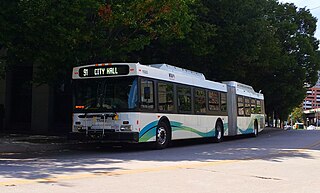
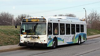
In 1970, Bus Route 35 started operating between Franklin Square Hospital Center and downtown along the Philadelphia Road corridor in Baltimore County. [11] In the city, the line operated along Pulaski Highway and Madison and Monument Streets, serving Johns Hopkins Hospital before reached its terminus at University of Maryland Transit Center. The line provided minimum amounts of service, especially outside of rush hour. During off-peak hours, service operated only as often as a single bus allowed, which at some times, was only once every 2–3 hours. All trips on this line until the mid-90s were considered to be express service, making limited stops on parts of the route, and requiring payment of an additional fare.

In 1977, Bus Route 6 was split into four new lines, with one or more serving each corridor the entire route had previously served. A new Route 62 was formed, which operated between Hollander Ridge and the Inner Harbor. [12] For the next 23 years, bus routes 35 and 62 operated along much of the same route in Baltimore City. Route 35 served the county portion of the corridor, and did not have the deviations Route 62 had in the city, but had several within the county.

Over the years, certain special branches and deviations were added to selected trips on the line to serve various places, including the Essex Community College campus, Chesaco Park, Marshfield Business Park, Oliver Beach, (this service has been provided by Route 24 since 1988), and King Avenue (in 1994, all trips were extended to King Avenue).

In the fall of 1992, MTA announced that weekend service on Route 35 would be eliminated in January 1993 due to low ridership. [13] After public outcry resulting from these cuts, MTA arranged for a private contractor to provide weekend service along Philadelphia Road. This service was eventually cut. But in 2000, weekend service on Route 35 was restored.

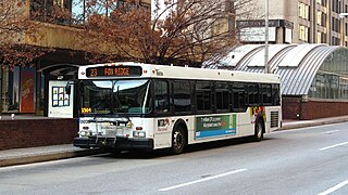
In 1997, Route 35 started to make its first comeback from its cuts earlier in the decade when all trips on the line were extended to White Marsh. [14] There was no actual addition in the level of service provided when the route was extended. In fact, midday frequency was reduced as the single bus that operated had a longer route. But this became the most frequent service to White Marsh Mall, an area previously served by a minimal amount of bus service.

In 2000, Route 35 saw yet its biggest expansion. The line was combined with Route 62. By using the operating budget of the two lines together to operate a single route, MTA was able to provide hourly service to White Marsh at all times, with other trips making short turns at the city line, and operating via Armistead Gardens, a deviation on Route 62.

In 2005, as part of the Greater Baltimore Bus Initiative, a comprehensive overhaul plan for the Baltimore region, Route 35 was combined with Route 31, and extended west to UMBC. At this time, all trips were extended to White Marsh, with short turns no longer being made at the city line. In order to reduce confusion, the new combined line, during its first three months of operation, was identified as Route 31/35 before it once again assumed the Route 35 designation on February 5, 2006.

As a result of the overhaul, deviations from the main corridor of Route 35 were eliminated. While some were provided by other lines, others were no longer served by any MTA buses.

In June 2011, Adjust service to match demand on the route.

In June 2017, Route 35 has been discontinued as the new transit system has launched.

Related Research Articles

Route 3 (MTA Maryland)

Route 3 is a bus route operated by the Maryland Transit Administration in Baltimore and its suburbs. The line currently runs from the Inner Harbor with most trips operating to Cromwell Bridge Road Park and Ride in Baynesville along the corridors of Loch Raven Boulevard and St. Paul Street, with selected trips to Sheppard Pratt Hospital in Towson, mostly via Joppa Road, and some trips making short turns at Loch Raven and Taylor. It is the successor to the 17 St. Paul Street streetcar line that ran from 1893 to 1938 and the Route T bus that ran from 1939 to 1947.

Route 91 (MTA Maryland)

Route 91 is a bus route operated by the Maryland Transit Administration in Baltimore. The line currently runs from Sinai Hospital to City Hall, serving the communities of Pimlico, Arlington, Walbrook, and Bolton Hill, Coppin State College and the corridors of Garrison Boulevard and Eutaw Place. The line has the second-highest farebox recovery rate of all MTA bus lines.

Route 75 (MTA Maryland LocalLink)

LocalLink 75 is a bus route operated by the Maryland Transit Administration in Baltimore and its suburbs. The line currently runs from the Patapsco Light Rail Stop to Parkway Center in Anne Arundel County, via BWI Airport and Arundel Mills. Weekend trips and some weekday trips on this line terminate at Arundel Mills. The line operates between BWI Airport and downtown Baltimore during hours when the light rail is not operating.

Route 23 (MTA Maryland)

Route 23 is a bus route operated by the Maryland Transit Administration in Baltimore and its suburbs. The line currently runs from the Wal-Mart parking lot in Catonsville, Maryland east through downtown Baltimore to the Fox Ridge community in Essex, serving the corridors of Edmondson Avenue on the west side and Eastern Avenue on the east, and the communities of Edmondson Village, Allendale, Rosemont, Patterson Park, and Eastpoint, and is one of the most heavily used bus routes operated by the MTA.

CityLink Red (MTA Maryland)

CityLink Red is a citylink bus route operated by the Maryland Transit Administration in Baltimore and its suburbs. The line currently runs from the University of Maryland Transit Center to the Lutherville Light Rail Stop along the corridors of York Road and Greenmount Avenue, and is one of the most heavily used MTA bus lines. The CityLink Red bus replaced Route 8 bus route due to BaltimoreLink, and is the successor to the 8 Towson and 7 Govanstown streetcar lines.

Route 95 (MTA Maryland LocalLink)

LocalLink 95 is a bus route operated by the Maryland Transit Administration in Baltimore. The line currently runs from the intersection of Roland Avenue and Lake Avenue in Roland Park south to the Inner Harbor via Roland Avenue, University Parkway, Charles Street and St. Paul Street.

Route 54 (MTA Maryland LocalLink)

Route 54 is a bus route operated by the Maryland Transit Administration in Baltimore and its suburbs. The route was formerly known as Route 19 prior to 2017. The line currently runs from the State Center Metro Subway Station to the intersection of Harford Road and Northern Parkway. From there it splits into two branches. About one half of buses continue operating along Harford Road to the Carney Park-and-Ride just north of the I-695 interchange, and the other half to the intersection of Goucher Boulevard and Taylor Avenue in Towson via Northern, McLean Boulevard, Hillsway, and Taylor. The line serves the communities of Montebello, Hamilton, and Parkville.

Route 10 (MTA Maryland)

Route 10 is a bus route operated by the Maryland Transit Administration in Baltimore and its suburbs. The line currently runs from the Wal-Mart parking lot in Catonsville to Bullneck Road/Turner's Station Dundalk mostly along the corridors of Frederick Road on the west side and Eastern Avenue on the east side, serving the communities of Yale Heights, Pigtown, downtown Baltimore, Fells Point, and Highlandtown.

Route 36 (MTA Maryland)

Route 36 is a bus route operated by the Maryland Transit Administration in Baltimore and its suburbs. The line currently runs from the intersection of York Road and Northern Parkway to the Riverview, with some trips making short turns at Washington Boulevard and Monroe Street. The line serves the corridors of The Alameda, Kirk Avenue, Guilford Avenue, and Washington Boulevard.

Route 64 (MTA Maryland)

Route 64 was a bus route operated by the Maryland Transit Administration in Baltimore and its suburbs. The line ran from the intersection of North Avenue and St. Paul Street to Curtis Bay, with selected trips to Energy Parkway and Riviera Beach. The line also served Federal Hill, Port Covington, and Brooklyn.

Route 77 (MTA Maryland)

Route 77 is a bus route operated by the Maryland Transit Administration in the suburbs of Baltimore. The line currently runs from the Old Court Metro Subway Station in Pikesville, Maryland to the Patapsco Light Rail Stop, and serves Randallstown, Windsor Mill, Woodlawn, Catonsville, Arbutus, Halethorpe, and Lansdowne, and the campuses of UMBC and CCBC Catonsville.

Route 29 (MTA Maryland LocalLink)

LocalLink 29 is a bus route operated by the Maryland Transit Administration in Baltimore. The line currently runs from the Mondawmin Metro Subway Station in Northwest Baltimore to Brooklyn Homes in South Baltimore through the communities of Rosemont and the corridors of Hilton Street, Caton Avenue, and Patapsco Avenue. During peak hours, selected trips operate via Violetville Industrial Park.

Route 29 (MTA Maryland)

Route 29 is a bus route operated by the Maryland Transit Administration in Baltimore. The line currently operates weekdays and Saturdays in a circular fashion, linking the Cherry Hill Light Rail Stop to the Cherry Hill community. Two other MTA bus lines, Routes 27 and 51, also serve the Cherry Hill area.

Route 44 (MTA Maryland)

Route 44 is a bus route operated by the Maryland Transit Administration in Baltimore and its suburbs. The line currently runs from Rosedale Industrial Park near Pulaski Highway just outside the Baltimore city limits on the east side of the city across the northern portion of the city to Security Square Mall, with selected peak hour trips to the Social Security Administration. Some early morning trips before 7 AM lay over at the Centers for Medicare and Medicaid Services (CMS) headquarters. The line operates mostly along Frankford Avenue, Echodale Avenue, East Belvedere Avenue, Northern Parkway, Rogers Avenue, and Gwynn Oak Avenue, serving the communities of Gardenville, Hamilton, Belvedere Park, Homeland, Roland Park, Pimlico, and Arlington, and the western suburb of Woodlawn.

Route 28 (MTA Maryland LocalLink)

LocalLink 28 is a bus route operated by the Maryland Transit Administration in Baltimore. The line currently runs from the Rogers Avenue Metro Subway Station in Northwest Baltimore to a loop in Moravia in Northeast Baltimore. Service is provided about once every 10–15 minutes during rush hour, every 20 minutes midday, every 30 minutes on Saturdays, and hourly on Sundays. The line operates primarily along the cross-town corridor of Coldspring Lane and Moravia Road, transversing Arlington, Park Heights, Roland Park, Homeland, and Montebello. The line passes several universities, including Loyola College, Notre Dame, and Morgan State University.

Route 89 (MTA Maryland LocalLink)

LocalLink 89 is a bus route operated by the Maryland Transit Administration in Baltimore and its suburbs, mostly along Reisterstown Road. The line currently runs from the Reisterstown Plaza Metro Subway Station to the Owings Mills Town Center. The line replaced original Route 59 under BaltimoreLink, and was a split-off from Route M-9, and resembles the pre-1997 route of Route M-9. It is the successor to several other bus routes and streetcars.

Route 87 (MTA Maryland LocalLink)

LocalLink 87 is a bus route operated by the Maryland Transit Administration in the suburbs of Baltimore. The route currently runs from the Owings Mills Town Center to Glyndon via Reisterstown Road and the Owings Mills Metro Subway Station. The line, which was a split-off from the final version of the now defunct Route M-9, and resembles the former Route M-16 that operated from 1987 to 1998. The route was previously named No. 56 before BaltimoreLink, when it was replaced in its entirety by Route 87.

Route 62 (MTA Maryland LocalLink)

LocalLink 62 is a bus route in the suburbs of Baltimore. The line currently runs from the Essex campus of the Community College of Baltimore County to Turner's Station in Dundalk. The current route serves the Rosedale, Middle River, and Essex areas and the CCBC Essex and Dundalk campuses. The line was previously known as Route 4 prior to the launch of BalitmoreLink. LocalLink Route 62 replaced the entirety of Route 4 on June 18, 2017.

CityLink Lime (MTA Maryland)

CityLink Lime is a CityLink bus route operated by the Maryland Transit Administration in Baltimore and its suburbs. The line currently runs from the Mondawmin Metro Subway Station along Liberty Heights Avenue and Liberty Road to a loop known as in Milford Mill with buses marked as "Milford Mill". The loop is composed of a square block, consisting of Liberty Road, Rolling Road, Church Lane, and Milford Mill Road. The spot of the layover depends on the time of day.

Route 57 (MTA Maryland)

Route 57 is a bus route operated by the Maryland Transit Administration in Baltimore and its suburbs. The line currently runs from the Rogers Avenue Metro Subway Station in Northwest Baltimore to Security Square Mall, with selected trips to the Social Security Administration headquarters in Woodlawn. The line serves the corridor of Gwynn Oak Avenue and the communities of Howard Park, Gwynn Oak, and Windsor Mill.

References

  1. http://mta.maryland.gov/sites/default/files/35_SCHEDULE_JUN2011_web.pdf [ bare URL PDF ]
  2. Routes of Baltimore Transit – 1900 to Today Archived 2011-07-17 at the Wayback Machine . Btco.net. Retrieved on 2011-04-21.
  3. [ dead link ]
  4. A History of the 35 Lorraine Line Archived 2008-05-27 at the Wayback Machine . Btco.net (1966-01-30). Retrieved on 2011-04-21.
  5. Routes of Baltimore Transit – 1900 to Today Archived 2011-07-17 at the Wayback Machine . Btco.net. Retrieved on 2011-04-21.
  6. Obscure Routes and Operations in Baltimore Transit Archived 2008-05-27 at the Wayback Machine . Btco.net. Retrieved on 2011-04-21.
  7. History of the Cold Spring Crosstowns Archived 2002-04-13 at the Wayback Machine . Btco.net. Retrieved on 2011-04-21.
  8. Routes of Baltimore Transit – 1900 to Today Archived 2011-07-17 at the Wayback Machine . Btco.net. Retrieved on 2011-04-21.
  9. Routes of Baltimore Transit – 1900 to Today Archived 2002-06-01 at the Wayback Machine . Btco.net. Retrieved on 2011-04-21.
  10. Routes of Baltimore Transit – 1900 to Today Archived 2011-07-17 at the Wayback Machine . Btco.net. Retrieved on 2011-04-21.
  11. Routes of Baltimore Transit – 1900 to Today Archived 2011-07-17 at the Wayback Machine . Btco.net. Retrieved on 2011-04-21.
  12. Routes of Baltimore Transit – 1900 to Today Archived 2011-07-17 at the Wayback Machine . Btco.net. Retrieved on 2011-04-21.
  13. MTA January 1993 schedule changes
  14. MTA September 1997 schedule changes
  15. Highlights of proposed bus route changes. latimes.com (2005-06-09). Retrieved on 2011-04-21.